![]() You don't need to be an 'investor' to invest in Singletrack: 6 days left: 95% of target - Find out more
You don't need to be an 'investor' to invest in Singletrack: 6 days left: 95% of target - Find out more
Off to the Picos soon what is the STW recommendation for a mapping App. Like the uk OS with easy route search and good mapping. Obvs will have a paper map too.
We won’t be doing anything crazy as will have the fam in tow.
Thanks in advance.
I used Wikiloc - I could pre download maps and nav offline. IIRC, they have IGN mapping?
What challenge of hills are you looking for?
Where are you staying?
Thanks Mat.
Kids are 12 & 13 ok for 10k depending on vert. Exposure is a bit of an issue for Mrsdts. Snowdon Rhyd ddu was a bit of an issue!
Edit. Location. Camping and touring. No fixed agenda.
We used backcountry navigator app which has Spain IGN 1:25000 maps (might be an android only app, not sure)
We’ve used Wikiloc in Spain, France, Portugal, Italy and the UK. Well worth the £10 annual subscription as you can filter by length, altitude gain, activity type, loops only etc.
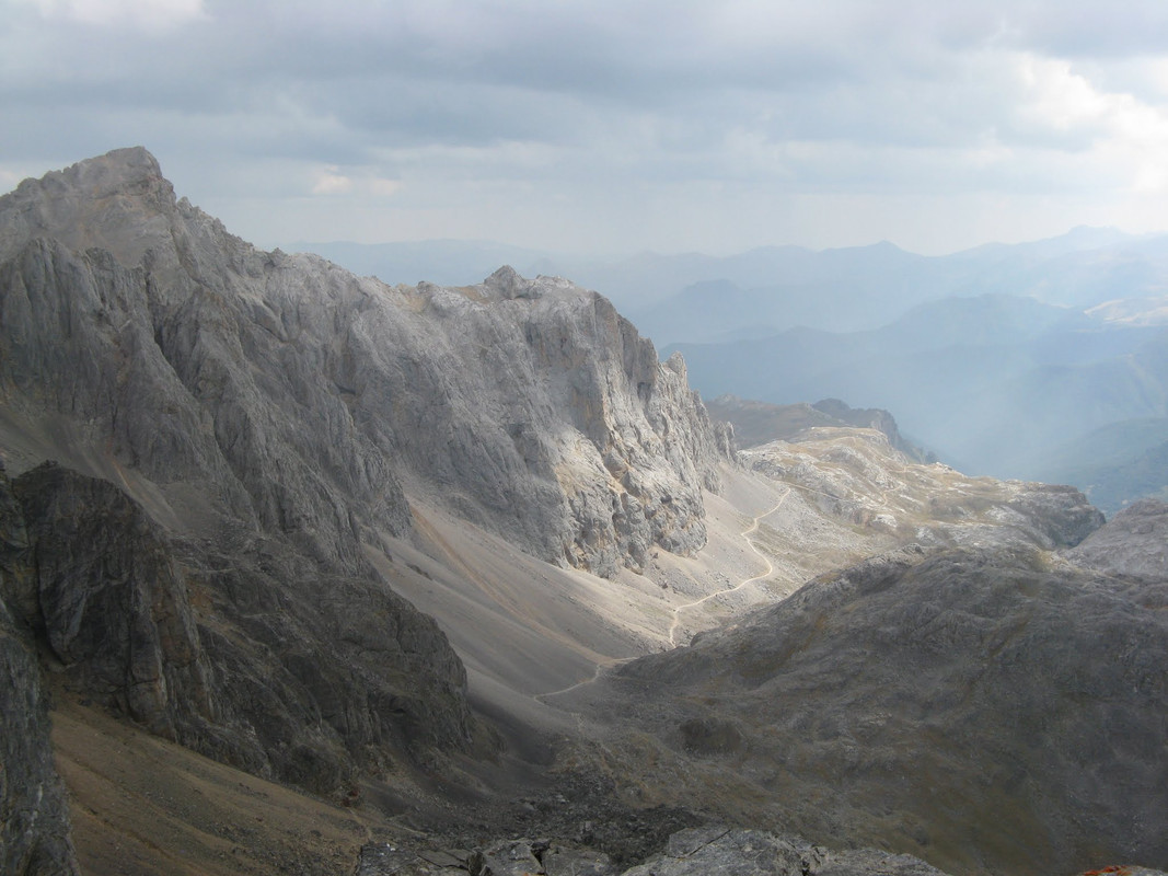
@matt_outandabout - where’s that pic please?
Peña Vieja ? We're cheap skates and use mapy.cz with free downloads to use off-line. Fine on paths and pretty good off-piste.
@Pauly - my guess is above Cabana Veronica, maybe Pico Tesorero summit?
My photo is just along the ridge from Torre de los Horcados Rojos
I use IGN mapas d'espagne android app. Not as good as its french counterpart in terms of footpaths and a bit thinner on detail in mountains, but decent 1:25,000 terrain mapping (just back from French Basque/Pyrenes Atlantique with a few mtb forays contrabordier). Can't remember what it costs me but I recall about half the OS map so basically I just let it renew.
@TheDTs - Coriscao is an easy summit (similar to Lakeland walking) that provides amazing views of the mountains in Matt's photo from the South. The views from the summit are beautiful.
You park at Col San Glorio on the N621 SE of Potes then it's a straight forward ridge walk.
Thanks ElShamilo, Potes is on our rough plan. That looks like a great walk.
We have a few campsites loosely arranged, they don't seem to take bookings. I would like to drive the track from Espinama to Sotres, and I would like to do a Cares gorge walk that I did with mrsdts when we went there before kids, 14 years ago!
Also going to head further West to the coast and loop back along the North coast to Santander. We have 2 weeks and luckily the weather is looking reasonable and not too scorchio.. Still expecting some rain and cloud though, mountain weather being what it is.
Can't blooming wait to get on the Pont Aven, and have a G&T!
where’s that pic please?
Summit of Torre de los Horcados Rojos.
It's cable car up then lovely valley walk, with one last steep pull up scree and rock, with a couple of rocky moves but not what I call scrambling and no big drops. The very summit has one airy move (not scrambling, but you will use hands if nervous). Spectacular view for the ease of access. Go early, we had a wall of folk wandering up in the baking midday heat and copping an afternoon downpour - while we were on first cable car of the day, and off the hill by 1pm.
You *must* do the Cares Gorge walk - rated as one of the best day walks in the world. Jaw dropping. But again, get there early for a parking spot.
There's many local walks, and some easier summits from high villages. Some sign posted locally, many on the maps. Munro sized days.
Also, while next to the road and not glamorous, we did like the hot springs at La Hermida. You don't need the image of my pasty body in there.
We also did a day down to Riano - spectacular road and scenery, although Riano is a bit modern 'ski town' feel.
Also going to head further West to the coast and loop back along the North coast to Santander.
We stayed another week in the Basque country between Donastia San Sebastian and Bilbao. It was superb - great beaches, lovely hills, amazing food, toured some skate parks, went to the Guggenheim etc
We climbed Mugarra - a great day out with 3m Griffon culture colony on the hill!
Also a (thorny) couple of days biking.
https://flic.kr/p/2ny9QtQ
And of course, Basque cheesecake. 😋
https://flic.kr/p/2nycjLw
The cable car allows bikes on the first 2 runs of the day.
Fabulous but make sure you pump your tyres up, take spare tubes and ensure your tubeless fluid is topped up.
If you can carry a spare wheel that'll help. Those rocks are truely viscous.
Got a great photo if I can find it and work out how to show it
https://imgur.com/gallery/S117wun