![]() You don't need to be an 'investor' to invest in Singletrack: 6 days left: 95% of target - Find out more
You don't need to be an 'investor' to invest in Singletrack: 6 days left: 95% of target - Find out more
No good if you're already a subscriber to OS, but it's 50% off for 24 hours:
Perfect thanks!
For those with existing memberships (like me). I set the subscription to not renew and then use the newly purchased code a couple of days after it has expired. Has worked for the last 2 years with a code bought at a discounted price. Not the biggest loss at that price if it doesn't pay off.
Just a warning that the OS Maps app is getting a price increase to £6.99 a month as of December.
I've cancelled my subscription but I might try and renew if I can get it at the old price.
Nice one, been meaning to get another anual membership. £14.50 is a bargain.
I think I originally went with OutdoorActive because it gave me topo maps for UK, USA and the bits of Europe I bike in. It also sync's my planned routes (including from Trailforks) seamlessly onto the Garmin device - does OSMaps offer these facilities as my OA renewal is coming up?
Nice.
My Black Friday sub from last year expires today!
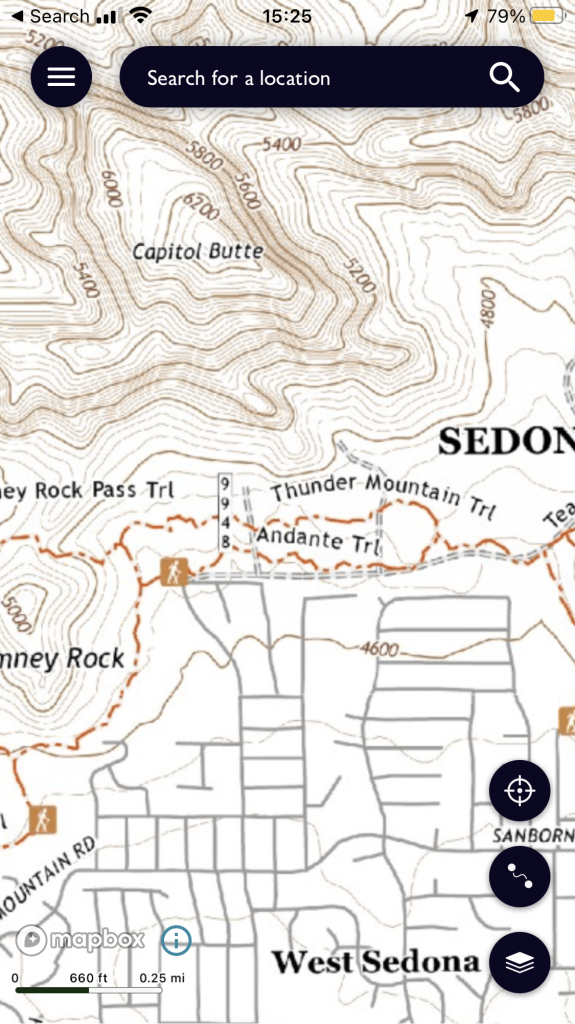
For the navigation noobs among us, can some explain some of the cool things you can do with online OS maps?
I'm intrigued but have no idea what I'd do with it.
Will it add any value to the Garmin that I just ordered? I've never used one of those yet either.
Brilliant PSA, thank you Hannah.
Never tried it before, it would seem churlish not to at that price, so done. Along with some reduced waterproof 1:25000 maps I've been wanting.
I needed some maps for a trip in April so now I've got them all! Thanks
My subscription runs out tomorrow, so this will do nicely!
I have been using the web and the app for the last year, its been pretty good so far!
Subs go up on Dec 1st so caution if you cancel and renew because after that you won’t get the existing subscriber renewal of £28.99 but the new subscriber renewal of £34.99
It works well for plotting stuff in the UK - although I find the snap-to-path utterly useless for offroad stuff as it doesn't always recognise a path/trail/fireroad/access road, however it works fine if you don't select snap-to-path in the Settings.
It is good having the ability to zoom in and see the detail, but I attended a chat last night about various routing/plotting apps and there are several that all do the same thing, just present themselves in slightly different ways, so there is plenty choice to be had out there.
You plot the route and can save it to your device (route and mapping) or you can export the .gpx - the app doesn't add .gpx to the exported file so make sure you add that.
It will send it via Gmail, to Google Drive or to Nearby Devices. I upload to my Drive then download it to my phone. Open the file on the phone and it offers Garmin Connect to open it and it is added a a Course. You then use Garmin Connect app to browse the course and sync it to the Garmin device(s) you want it on - very easy.
Purchased.
This video helped swing it...
Interestingly they haven't sent me a code but it shows as a renewal on my orders that will kick in when the current one runs out. I did get an email invoice confirmation.
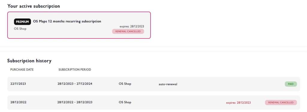
Interestingly they haven’t sent me a code but it shows as a renewal on my orders that will kick in when the current one runs out.
That's a properly organised offer, isn't it. Good work OS store people.