![]() You don't need to be an 'investor' to invest in Singletrack: 6 days left: 95% of target - Find out more
You don't need to be an 'investor' to invest in Singletrack: 6 days left: 95% of target - Find out more
On my wish list is a GPS unit which can be used on the bike but also handheld when hiking, preferably compatible with OS maps. Yes I could buy two job specific units but it doesn’t make sense. Want the navigation more than training statistics. Any suggestions?
Garmin Oregon / Montana
I use a Garmin Edge Explore with maps from Talkytoaster for MTB and hill walking. You can link it to various meters, also Strava and Komoot etc, but I don’t - just navigation using gpx files from my laptop mapping.
I use my phone and OS maps but I have it in a pocket and just pop it out at major trail junctions/when I need a sense check. I carry a power bank if out for longer (and a map!).
Am watching with interest though for better ideas (particularly waterproof ones).
What advantage do they have over just using your phone? I have full OS mapping on mine.
Genuine question
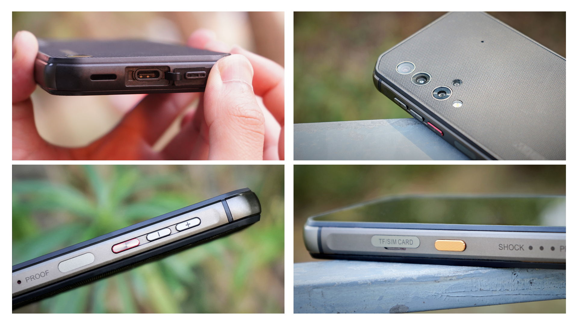
Blackview 5900 phone here (big battery, also me and water proof) with maverick pro GPS navigation app on it, includes OS maps. I usually record on maverick but use maverick for maps/navigation.
What advantage do they have over just using your phone?
The classic issue with using a phone is battery use with GPS enabled, plus the notional safety consideration that if your phone does run out of power, you lose both electronic navigation and the ability to call mountain rescue all in one hit.
And for bike use, phones less robust and less water resistant than dedicated GPS units - obviously a case can mitigate some of that. Plus phone touch screens can be dubious in the wet, whereas a button GPS - eg: Wahoo - doesn't care.
But those are the obvious arguments against sole phone use. I'm not saying they're 100% valid btw, just that they are potential issues. I use a Wahoo Roam on the bike and a Satmap off it, unless I'm on some casual jaunt and just need a quick location fix, in which case the phone.
Fwiw, OS mapping units hard to use on the bike while moving. Depends a bit on whether you're on or off road and how much clutter there is in that particular map square. All imho/ymmv etc.
The classic issue with using a phone is battery use with GPS enabled, plus the notional safety consideration that if your phone does run out of power, you lose both electronic navigation and the ability to call mountain rescue all in one hit.
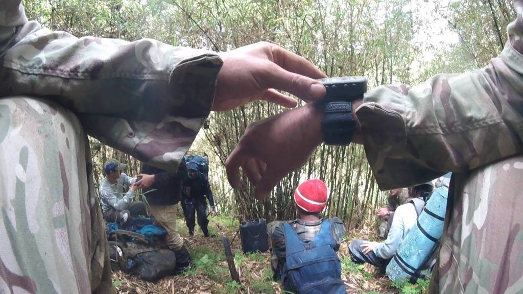
The day after I found myself with no battery in my phone, long after sunset, in the rain, and no idea how to get through the jungle between me and my car (in Suffolk) I bought an Edge garmin, the one with about 24 hours of battery life.
Also really useful that you can get a remote control button thing - so navigating in a busy town full of cars and junctions I can wake up the display without having to take my hands off the bars.
Re: Phones
I use a Blackview BV9900 Pro
Virtually indestructible, water/shock proof, really good battery - if needed for more than a day, then I'd be carrying a powerbank anyway. Has a nifty thermal imaging camera too
MY phone easily does a day of navigation on one charge
Ta for the points tho =- and I accept that a back up is really needed. I felt very vulnerable on my big ride with so much reliant on my phone
I can see the point of using a phone, but it would have to be a second phone.
Garmin fenix 5x. Plot the route on it for point to point nav, then the phone (OSmaps) for cross checking/backup.
Used it for hiking in Portugal.
Bikepacked in the balkans.
Cycletoured from Southampton to Prestwick.
It can be mounted to the bar on your bike. Tiny battery lasts 24hrs in navigation and strava mode, but takes an hour to charge full from a charge bank, or I've bodged a mount so it can stay fully charged from my dynamo.
The only main downside is the memory for the route. It will give you turn for turn navigation up to 50 nav points but then it's just follow the red line. Also, if the route is huge, it takes a little while to load so best to break the route down to manageable sections.
thats the conclusion I came to Scotroutes. a back up of some form is a darn good idea so phone x2 or GPS and a phone
<p>Thank you all, Plenty to consider, I did try the phone and OS maps with a Quadlock mount, power bank and will revisit this. I am fairly old school (read old) and take a paper map and compass as back up anyway. <br /><br /></p><p>The Garmin Montana looks great but maybe overkill for my level of adventure. a final point on phones, you don’t need the latest model and a pre owned iPhone or similar can be picked up for way less money add a £5 per month Lebara sim and you don’t need to worry too much about it.</p>
1 x phone + powerbank
1 x GPS watch
1 x backup AA GPS handheld
I've been wondering the same thing. I want some kind of navigation device. Not really bothered about training info. Hate using my phone outside in crappy weather with gloves on etc. Want something I can just strap on and leave on. Don't do Strava but starting to see the potential in Komoot and Trailforks.
I want it mostly so I can look up and download a route when heading to a strange area without all the current faff and confusion.
Watch or head unit?
And what's the best value Garmin with STW members discount?
If you are worried about battery life on a phone when using OSMaps, it still works when the phone is in aeroplane mode - just make sure you've downloaded the maps for the area first.. I've done an 8 hour hike on about 15% battery.
I’ve been using satmap for both biking and hiking for years but the company is now defunct. have a 10 and a more modern internet enabled 20
*if you just want a rolling os50 that sits on the bars or in your pocket or on a strap you might get a cheap satmap 10 or 12 with mapcard - say £40 if you’re lucky), but to download/upload routes etc you need a pc and a cable, *don’t believe it works with iPad, poss with Mac, deffo windows)), rechargeable battery pack available but no spares, not sure if mapcards will get cheaper (as people change) or more expensive as they do seem to keep working and bar mounts etc will dry up.
Currently trying an garmin etrex35, (*schoolboy error of compromise and getting something small and light for the mrs - screen too small imho), does integrate with iPad (expensive apple usb 3 dual port camera cable), can get cheap maps off eBay, currently prefer satmap (route display much better imho, better battery system, better setup options) )but I am more used to it and when satmap breaks and I can’t get a cheapie off eBay etc I suspect I’ll get an Oregon(bigger screen Garmin)as the map cards etc seem interchangeable.
Hi
Garmin Edge 800 - I picked up one on eBay for about £60 with GB OS Map 50K.
Been using for over 2 years now for biking and hiking combined with a small power bank and your sorted.
As per fatmountain. Add Waterproof see through phone cover/ dry bag.
OS sell a good submersible one.
My backup is an Etrix, reasonable value for a back up device after some slow os issues on my phone in some remote places.
Also handy for multiple day gpx track saving as per another post on here.
Feels really clunky and slow but pretty handy in bad weather and robust.
I could not use while actually riding, Need to stop as a small display and the keys are hard to use when vibrating on the bike. Good for following gpx on a route, but not as clear as a phone! But a good back up and more useful when walking.
My Garmin Edge 200 still going strong for the gpx following when riding!!! Not sure how it old it is now!
Phones are so convenient to use though and quick to when in the right circumstances and human nature tends to mean its an option I use alot as well!
You tend to get lost or need info when it's raining....terrible conditions for a phone screen, you only do this once!
My go to as a primary and/or back up GPS is that little bad boy - Garmin Foretrex 201, it's been superseded by a newer models in the Garmin lineup, but that bugger has been infalible in all environments.
Runs off 2 x AA batteries, fantastic check nav tool.
I use my Wahoo Elemnt bolt for routes on bike.
Hiking I use my phone with All trails and always take a battery pack but do wonder sometimes what I would do if phone stopped working.
Anyone looking for a mount for their phone, I've got this. Not tried it in anger yet as hadn't got the right SFN/bolt configuration previously and had it mounted on my bars, where it moved too much. Will report back after todays ride
[url= https://live.staticflickr.com/65535/53108461711_db1afb66bc_k.jp g" target="_blank">https://live.staticflickr.com/65535/53108461711_db1afb66bc_k.jp g"/> [/img][/url][url= https://www.flickr.com/gp/85252658@N05/iq84812i5j ]20230811_104553[/url] by [url= https://www.flickr.com/photos/85252658@N05/ ]davetheblade[/url], on Flickr
[url= https://live.staticflickr.com/65535/53108880675_33085f9891_k.jp g" target="_blank">https://live.staticflickr.com/65535/53108880675_33085f9891_k.jp g"/> [/img][/url][url= https://www.flickr.com/gp/85252658@N05/WYdkkh8590 ]20230811_104601[/url] by [url= https://www.flickr.com/photos/85252658@N05/ ]davetheblade[/url], on Flickr