![]() You don't need to be an 'investor' to invest in Singletrack: 6 days left: 95% of target - Find out more
You don't need to be an 'investor' to invest in Singletrack: 6 days left: 95% of target - Find out more
Bit of a raw subject for some I understand. But after hearing on the news that there's loads the environment agency etc. could have done over York way, i wonder how it could be prevented in Calderdale, i understand the principle of flood plains but surely there just isn't the space along the valley? I suppose the river could be deeper but what else?
Lots could be done... But everything has consequences. If you keep the water in the river up top then more goes down, getting one place flood free could spell disaster for the next town down. It will be a very emotive issue and probably it needs to be a very open and transparent process on what happens next. Also what is the 1 in 100 year flood you are protecting against how big, what was the worst just seems to be bettered every few years.
Making homes flood recoverable is one sensible option, power down from the ceiling rather than the floor, different flooring etc.
No Torry donors with grouse moors upstream ?
http://www.theguardian.com/commentisfree/2015/dec/29/deluge-farmers-flood-grouse-moor-drain-land
This flood was not only foretold – it was publicly subsidised
Its all academic really.
Did it strike you at any point over the last few weeks that there's any serious will within government or the environment agency to seriously address the issue? To dedicate the resources required, and change things on the ground? Or do you think that we're going to just get more of the quietly cutting funds to flood defences, and carrying on with the 'fingers crossed and hope for the best' approach?
[img] 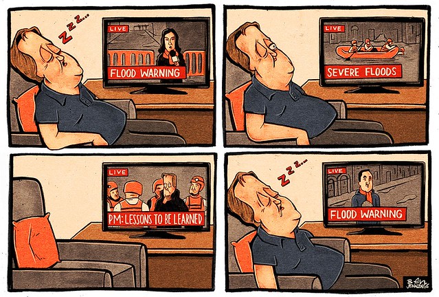 [/img]
Cheapest way would be to keep it on the uplands for longer. Be that through newly wooded areas acting as a sponge and absorbing the run-off and allowing it back into the water table slowly to local flow restrictions on the backs and streams on the moorland. (Pickering has had success with this). Getting the landowners to play ball though will be the tough part.
Oh and stop building on flood plains, see the land name that's a clue that is.
I agree with Mike, Preventing Floods in one area increases the risk to others in other areas, i think that is evident in the floods we saw in December.
I agree with Mike, Preventing Floods in one area increases the risk to others in other areas, i think that is evident in the floods we saw in December.
You clearly haven't read Kimber's link then.
If there's enough rain then anything will flood, after the floods in Carlisle a few years ago the EA worked out what were likely flood levels based on historical records then added half a metre to the height of the barriers. The floods in December were another half metre higher again.
Usually it isn't the water itself that causes the initial problem but debris such as trees that get stuck under bridges causing the water to back up and overflow the banks.
There's not much room in the Calder Valley for upstream defences, things like dry bunds that delay and limit the flow of excess water downstream so you have to look at resiliant infrastructure: top-down electricals as mentioned; ground floors only being used for utility space and so on. Deepening and/or widening river channels just moves the problem downstream where it's actually likely to be worse as more streams and rivers will have joined. The authorities wer able to do this at Lynmouth after the disaster there in the 1950s as it was on the coast so nothing downstream. In fact Lynmouth and the more recent Boscastle are better topographical comparisons for the Calder Valley than say York or Carlisle.
There have been lots of articles written & posted over the last couple of days espousing wildly differing views. It's sadly enviable I think that this will mostly become a sterile political football, to score points rather than directing much needed energy to the actual problem.
Certainly there needs to be a properly organised "debrief" over the whole event. What worked, what didn't. The Govt. has some questions to answer regarding it's spending on defences, and large landowners need to be questioned regarding their practices up on the moors above us, but equally there has to be the realisation from some folk about the nature of the resilience of their homes and business. Lastly we live in steep sided valleys at the bottom of which used to be a marsh, The water now has a easy route to the valley floor, and once there now has a equally fast route the now along very managed roads rivers and canals, and we've had 175-200% of our monthly rainfall for November and December with over 25 days of measurable rain each month, and January looks to be continuing that trend. We've had a lot of rain, and we're currently making it easy to flood
Did it strike you at any point over the last few weeks that there's any serious will within government or the environment agency to seriously address the issue?
It occurred to me (to the massively cynical side of my brain, presumably far over on the left), after riding through Calderdale and seeing people dumping everything they own out on the street, to be replaced (hopefully sooner than later) by new stuff, that flooding might actually be seen as good for the economy and so have a certain appeal to the likes of Cameron and Osborne. Too much conspiracy theory?
Reminded me of Rich Hall's quip that under capitalism the hero is the man dying of cancer and going through a messy divorce.
Be that through newly wooded areas acting as a sponge and absorbing the run-off and allowing it back into the water table slowly to local flow
Looking at photos of the valley sides in the 60-70's and now, the thing that strikes one almost straight away is the amount of trees there are in the modern photos. I don't think the valleys were as badly flooded in those previous decades, were they?
I don't want to get tied up in a thread about this at the minute TBH, the houses and shops need cleaning out, and I've got some clearance to do of my own. There's much to look forward to (not least my new carpets are coming today!) such as some cafe's re-opening, brants trousers, and more washing to do for blazing saddles. Please keep this pleasant.
^^^ This, there are more trees, and less sheep in the uplands than at any time in the last 100 years. However, there are vastly more people in the country (especially in flood prone areas) with hugely increased expectations of flood protection. The amount of rainfall we have had is also unprecedented. Remember this was the wettest December EVER recorded for most of the UK.
Remember that although a sponge does hold more than a slate, once it is saturated it won't hold a single a cc more than that same slate.
As above the words it's never flooded here, I've never seen it so bad so high etc.
Did you hear the interview on Radio 4 a few weeks back where they had a flood expert and the head of the NFU. The flood expect was saying all the things like planting more trees in the uplands and slowing rivers down with small dams and basically all the things that seem to make sense. Main idea is to stop water rushing downstream to the pinch points and then flooding. The head of the NFU was the most pig headed and stuck in the mud person I have ever heard. He totally ignored all the questions and said that none of it could be done as it might remove some grazing land. His argument was that one of the reason that people go to places like the Lake District was to see all the sheep on the mountains and hills. He might as well have stuck his fingers in his ears and shouted NO NO NO. Complete idiot and god knows how he got his position.
Too much conspiracy theory?
Maybe from a homeowners point of view it'll help the economy. But from a business point of view its an absolute disaster. I know of two small businesses personally who are just calling it a day. They know they'll never get insurance again so they're walking away. They've lost their livelihoods.
I'm presently doing a lot of work for a large company who've been decimated. 3 warehouses completely flooded. All their stock is manufactured in the China. Its pretty much all destroyed. The lead times to get it replaced and shipped is 5 - 6 months. They've got trade shows coming up, but no stock. So what are they going to do? Will they still be an ongoing concern in 6 months? This is a business built up over 30 years, and employing a lot of people!
Its worth noting that this area has never ever previously flooded. They're insured. Will they be insurable next year?
This is the reality on the ground! This is going to knock on economically for a long time. Just look at the flooding in Leeds and York. These are major economies. How many companies are going to be in this position. This is just the beginning. Again - does it strike you that anyone in government actually cares? That they realise how serious this is to still fragile northern economy?
Maybe if you say 'Northern Powerhouse' enough times, someone might believe it. Their response to the flooding up here shows what shallow vacuous sloganeering, utterly devoid of any substance that this is
Did it strike you at any point over the last few weeks that there's any serious will within government or the environment agency to seriously address the issue?
Certainly there needs to be a properly organised "debrief" over the whole event. What worked, what didn't. The Govt. has some questions to answer regarding it's spending on defences
After every large event an independent investigation will be held. I've contributed to them in the past and I can assure you that no stones are left unturned and no-one is beyond criticism. The HR Wallingford (leading independent company) investigation into the 13/14 operation of the Leigh Flood Storage Area can be found here:
[url= http://www.eastpeckham-pc.gov.uk/East-Peckham-Parish-Council/UserFiles/Files/Our%20Community/2015/MCR5376-RT001-R04-00.pdf ]PDF Link[/url]
There are always lessons to be learnt and you can be reassured that all of the questions you wish to be asked will be. In addition, as a member of the public, when the investigation is launched you will be able to contribute to the process and ensure your views are represented. All findings will be further audited independently.
I can't speak for everyone within the Environment Agency but I could not disagree with the first statement more.
Brant, I did actually read it, I looked upon it as a point scoring one upmanship excercise where by the Local Activist group fore saw these floods because the not so local Billionaire land owner charges thousands for toffs to come and shoot his grouse.
There is no doubt that poor land management above the town has helped water escape off the moors at a greater rate, Baring in mind that a Months worth of rain fell in 24 Hours and the fact that 16" inches of rain fell in the previous 2 Months Oct / Nov then the land was already at saturation point, that water has to go somewhere and through history these places have always flooded. It's better though that we blame those with wealth as its all their fault.
I was actually lead to believe that the flood defense for the Foss failed on the Confluence of the river Ouse which contributed to the swell.
The point about the dry bunds/retention systems is that they only come in to effect when the water levels get high enough so the land is only flooded rarely. So long as the locations chosen don't have bits of land that would get isolated as the waters rise then stock isn't going to be at risk (sheep and cattle are reasonable swimmers anyway - the farmers on Mull used to swim their cattle to Oban for example). A flood payment scheme payable for each flood event would be cheap.
There's a PDF on the Environment Agency site that goes through this and many other options for flood defence/protection.
Well it's a complex can of worms you've opened.
In essence, you can't engineer your way out of all flooding. Deeper rivers and higher walls would be a very short-sighted and ineffective solutions. The discussion around dredging a couple of years ago was a case in point. Dredging creates a small increase in river capacity in a very small area (at risk of pushing flooding downstream), whilst the agricultural practice that creates all the washed off sediment continues unchanged and the land continues to have a reduced holding capacity. As mentioned above (Monbiot's arguments are good on this), river catchments need to be more effective at holding and slowing water, and this needs to be achieved with better land management on a very large scale. However, this requires a combination of huge changes in agricultural practice and for environmental legislation to actually have teeth. But, as the majority of the land owning class is Tory, this isn't likely to change any time soon. Combine this with the government's poor grasp of environmental issues and their even poorer desire to implement change, and it's a recipe for these kind of events. The amount of money they recently pledged is a complete joke, billions need to be invested for the long term, and a major shift in attitudes needs to occur.
Also, I have to put in a word for the EA, who every time this happens come in for a huge amount of unwarranted stick. The EA would desperately like to do more but they are at the complete mercy of government cuts and budget constraints. Their flood prevention spending is very strictly regulated by pre-set controls on cost-benefit. So even where they have money to spend, it has to be used in areas were most people and property are at risk, which means smaller rural areas like Cumbria sadly suffer. Also, they have faced significant budget and staff cuts across the board, and have had to deal with major flooding events on top of dealing with day to day work. The media hasn't yet picked up on the fact that upcoming EA budget contraints will mean they will not have enough to cover maintenance of all their flood assets. Never mind building higher walls, they won't even have enough to look after what they have. This could all be changed from within government, and many in the EA are at their wits end with the position they find themselves in.
EDIT - FWIW I don't work for the EA but I know a few people who do, and I also work in the water industry.
FYI sheep are very poor swimmers.
Cattle yes, but sheep have a woolly jumper that will absorb 10s of kilos of water and cause it to tire extremely quickly. One farmer lost about 100 sheep in the Lakes flooding while another had 41 cattle found alive and well downstream. 1 over 20 miles away!!
There is no doubt that poor land management above the town has helped water escape off the moors at a greater rate, Baring in mind that a Months worth of rain fell in 24 Hours and the fact that 16" inches of rain fell in the previous 2 Months Oct / Nov then the land was already at saturation point, that water has to go somewhere and through history these places have always flooded. It's better though that we blame those with wealth as its all their fault.
Having actually been in town at peak flood height, and seen the effect that even a temporary gap in the rain made to river levels, it really isn't a big leap to suggest that controlling land absorption and run off is key to this.
By the time the water is in the rivers in the valley bottom, either you're screwed, or the folk down the road with the shorter walls are screwed.
http://www.gaugemap.co.uk/#!Map/Summary/1972/2090/2015-12-26/2015-12-27
cutting funds to flood defences, and carrying on with the 'fingers crossed and hope for the best' approach?
Surely, it's "we just don't give a damn about the poor" rather than fingers crossed.
Reasonable point regarding sheep fleece though I have had to rescue sheep (Swaledales & Dalesbred) that had become stranded on an island in a reservoir near the farm and they were able to swim to shore (about 100m). It could have been summer so they wouldn't have full winter fleeces.
A bit of a side issue though, the point I was making is that dry bunds don't necessarily preclude normal use of the land that would be inundated.
I think it is a wider debate that flood defences.
For me this also borders how we value land, green spaces, wild space and what the purpose of it all is. It is not just a simple 'flood defences' issue.
I wonder if an underlying issue is that so many 'flood defence schemes' are picked up by big companies - whereas lots of the answers seem to lie in smaller, local schemes, delivered by farmers, landowners and small businesses, but led by government and the economics as well as social issues. We reward for food production, perhaps we need to revisit the whole EU food production/UK grant schemes to farmers, and it should be on a balanced and pragmatic approach...
It's worth noting that it's not just the ability of the upland catchment to absorb water, but the rate at which it then flows downstream, even when saturated. A more complex upstream environment with more trees/wetland/biomass along with small dams/obstacles (i.e. forest streams not 'cleaned' of branches etc.), will mean that water will take much longer to get downstream even when saturated, and give the river a chance to cope better with all the input. It would also raise the level at which the ground does become saturated, and make the catchment area more resilient to extreme rainfall events. This could quite easily make the difference between a high river and a catastrophically high one. It would also give current defences a better chance of coping.
He totally ignored all the questions and said that none of it could be done as it might remove some grazing land.
Remember Farmers get EU subsidy's on farmable land not hedgerows, trees, etc.
as part of my small involvment with an mtb advocacy group, i attend a few land-management meetings. Try suggesting that we could let a few trees grow on the moors and people get very angry, very quickly.
(i'm not even talking about proactive, large-scale planting here, just letting the self-seeded saplings grow)
Farmers also get subsidies for environmental reasons: my brother gets a grant not to clear gorse from part of his farm because it supports a flower which in turn is needed by a rare (for Cumbria) butterfly.
There is no doubt that poor land management above the town has helped water escape off the moors at a greater rate, Baring in mind that a Months worth of rain fell in 24 Hours and the fact that 16" inches of rain fell in the previous 2 Months Oct / Nov then the land was already at saturation point, that water has to go somewhere and through history these places have always flooded. It's better though that we blame those with wealth as its all their fault.I was actually lead to believe that the flood defense for the Foss failed on the Confluence of the river Ouse which contributed to the swell.
It may be just how I'm reading this but you seem to be linking the Calderdale floods with the failure of the Foss Barrier.
Yep there are a lot of schemes for land management. There is also a lack of understanding about what's going on with farming and land use.
In many ways this sort of stuff long terms requires people to leave their politics at the door.
It's a complicated issue...
It is a complicated issue!
I don't profess to be a professor of it but there does seem to be some themes coming out of the stuff I have read:
Management of watercourses - seems to have reduced because of legislation as to whose responsibility it is
Building on flood plains / inadvertently diverting watercourse with buildings
I read an article last week that said the mills upstream used to attenuate the flow and allow for more storage capacity in Yorkshire - as they ponds are falling into disrepair this effect is much reduced
I don't think there will be a silver bullet- probable all of the comments above need to be considered and a complex plan incorporating many strategies put into place.
The other thing that springs to mind is how far is it reasonable to go with the measures? We have never experienced the level of rainfall that we have had last month or so in Yorkshire - should this be the level of rainfall planned (and costed) for?
I am not an engineer etc.............
My parents live at Cragg Vale & when I drove past Baitings dam on boxing day, it looked like a spectacular amount of water was coming over the spillway, then I guess running down the valley to Sowerby Bridge & contributing to the flooding in the Calder valley & beyond. No doubt this was happening all over the area.
So i can see how better management of the uplands could help keep water above the reservoir catchments for longer. But (without trying to sound like an ar$e) when a long period of dry weather & possible drought comes round, surely there would be a requirement to get what little water there is in the uplands into the resevoirs to be used?
There is certainly an issue with peoples expectations on flood prevention. Undoubtedly things need to be reviewed and thought through properly in a joined up manner, but you can't protect everywhere against unprecedented levels of rain.
Flooding is horrendous, and it seems to be becoming more regular, but none of the places affected have "never" flooded before. I've talked on other threads of people in Yalding in Kent, within living memory, abandoning the ground floor of their properties in the winter.
Does there also need to be a realisation that what used to be 1 in 100 year events are now regular and that given the 'new normal' aka climate change historical flooding models used for planning will need to be revised?
I noticed whilst reading reports on the Boxing Day floods that where I used to live in the Colne Valley didn't have any serious flood damage. The Colne is next door to Calderdale, just to the south in Kirklees, and is basically comparable in terms of geography, geology, average rainfall, etc. There was a bit of overflow from river to canal in places, and that's it I think. I remember when I was a kid Marsden and Slaithwaite, the villages at the top of that valley, used to flood regularly when it rained heavily, and there are documented major floods historically, so it's not like it can't get properly soggy up there.
One thing that is different about the Colne Valley though is that the majority of the catchment at the top is owned by the National Trust, and they have [url= http://www.nationaltrust.org.uk/marsden-moor-estate/features/gully-blocking-on-the-marsden-moor-estate ]specific strategies in place to retain water on the tops[/url]. They just finished a really big project on this last summer, and there are loads of little dams all over the peat up there now. I'd be interested to know if the amount of rain was comparable on Boxing Day, and if the NT's work in managing the peat moors might have slowed the run off enough to avoid disaster further down the valley. Just a thought really, but worth bearing in mind I think - hopefully the relevant people talk to each other about this stuff, I dunno...
There is certainly an issue with peoples expectations on flood prevention.
This. Yes, things can be done better (they nearly always can) however there will always be extreme events that either cannot be predicted, or that have solutions for which would be unpalatable as a society. Sadly it comes down to what is socially acceptable in terms of cost, resources and time. It is virtually impossible to prevent any flooding occurring if you look at realistic solutions. All you can really do is try and protect high value locations, attenuate as mush as possible, and otherwise look at flood resiliant construction (i.e. accepting it will flood, but designing in quicker recovery).
In a similar way it would be easy to say 'lets make all new buildings completely fireproof,' however no one would fund them, no one would buy them and no one would want to live in them.
as part of my small involvment with an mtb advocacy group, i attend a few land-management meetings. Try suggesting that we could let a few trees grow on the moors and people get very angry, very quickly.
You should see the full scale frothing that has erupted over Stakis wanting to plant managed forest behind my town, apparently it'll "destroy the land that walkers come from miles around to use" (despite having never seen a walker up there in my puff barring a local with a dog on the old cattle road).
And then there's the small scale hydro...
If you stopped 100 people in the street and asked either:
1) Should we do more flood prevention?
OR
2) Should we do more flood prevention which is going to cost you £100 more on your council tax bill?
I'd wager the answer would be rather different! However, most times this question is asked as in case 1) (in the media etc)
[url= http://markavery.info/2016/01/05/wuthering-moors-52/ ]Anyone up for some guerilla ditch blocking?[/url]
I noticed whilst reading reports on the Boxing Day floods that where I used to live in the Colne Valley didn't have any serious flood damage.
Same thing occurred to me Mint Imperial. The Holme Valley also got off lightly but I'd compare Colne Valley more with Calderdale geographically anyway. Fascinating stuff about the different attitudes to upland management in the two areas. Hopefully someone in the know will be able to apply some proper hydrology work to this to substantiate the effect or otherwise of the approaches to management.
This
"Having actually been in town at peak flood height, and seen the effect that even a temporary gap in the rain made to river levels, it really isn't a big leap to suggest that controlling land absorption and run off is key to this.
By the time the water is in the rivers in the valley bottom, either you're screwed, or the folk down the road with the shorter walls are screwed."
I was there too and spent most of the last 10 days volunteering out of the Town Hall for the clear up. A key for me is in harnessing the fabulous explosion of community and awareness that occurred this last week.
Every tree we plant, every tributary we slow and dam, every millpond we re-use will allow the speed at which water enters the system and reduce the peak of the flood.
By concentrating on the bits of land where landowners will let us take action first, we can have an immediate impact. For the first time in my life I'd be interested in planting trees on a Sunday, or looking for small streams to dam in the Pickering model.
We can then look at the Walshaw Estate and others later on. I like the idea of a council tax levy so that the real social cost of draining land to improve grouse shooting is properly reflected in what people pay to shoot.
^ there being some of the problem with a change.
It is small scale, local, individual landowner and household reliant.
Government is swayed by big business, big business is swayed by big contracts and lots of lumi jackets and machinery with signs and nice offices.
One landowner at at a time, one community at a time, is a difficult, slow process.
A flood alleviation scheme for the Upper Calder Valley and other Pennine valleys and upland areas in Britain.
https://www.linkedin.com/pulse/flood-alleviation-scheme-upper-calder-valley-other-pennine-bradshaw
My home for almost 20 years now has been a small holding 350 metres above sea level in the South Pennines above Hebden Bridge in the former West Riding of Yorkshire, here I have developed my business as a consulting geotechnical and structural engineer. In this time I have witnessed a number of minor, serious and on Boxing Day 2015 a very serious flooding event which has resulted in very extensive damage to the community within which I live and where my children go to school and attend college. This latest flood comes after two serious floods in June 2012 which occurred only two weeks apart. These events place huge strain on the infrastructure, businesses and housing stock of the lower lying valley areas, although upland areas have also been affected with a flash hillside flood in 2012, in this most recent flood event some hillsides have been affected by landslides or are under the threat of imminent failure.
The community has rallied round and the help from volunteers from these valleys and from afar has been tremendous, with all sections of the community getting involved with the clean up. We must not however forget that this is three major floods in three and a half years, clearly this is not effective use of the time of hardworking people or resources, and whilst Yorkshire folk are known for their resilience a solution must now be found.
The source of the River Calder is 400 metres above sea level at Heald Moor above Portsmouth near Todmorden, and the Upper Calder Valley which contains the former mill towns of Todmorden, Hebden Bridge and Mytholmroyd is typified by fast flowing streams flowing steeply to the valley floor where they join the Calder, from upstream to downstream these are Midgelden Brook, Jumble Hole Clough, Colden Water, Hebden Water , Cragg Brook and Luddenden Brook. Aside from Centre Vale Park in Todmorden, the cricket club at Eastwood, land opposite the Stubbing Wharf pub and Calder Homes Park in Hebden Bridge there is very little land area in the valley bottom suitable for flood attenuation by land storage. Other areas of large riverside land at Brearley Fields between Mytholmroyd and Luddendenfoot are too far downstream from the towns of Hebden Bridge and Mytholmroyd to prevent flooding in those towns.
The mill towns established themselves around the fast flowing streams when water power was king, before the development of steam, these are some of the earliest towns to industrialise in the world. The engineers of the day designed weirs and millraces to channel water to mill ponds to be used during dry periods to power the mills. These valleys had flooded for centuries and the valley floor was boggy and waterlogged for long periods but before the valleys were developed this was not an issue. The construction of the mill ponds did however attenuate the flows during heavy rain, allowing the lower lying areas to be developed as the tendency to flood was reduced. These mill ponds have either fallen into disrepair or have purposely been decommissioned to avoid the requirement for inspections under the then Reservoir Safety Act 1975 which required an inspection every 10 years by a Panel (Civil) Engineer appointed by the Secretary of State. Similar legislation applies today under the Flood and Water Management Act 2010.
The town of Pickering in North Yorkshire is a very good example of where flood attenuation has protected the town from the most recent Boxing Day floods. Here according to the Independent newspaper (> http://www.independent.co.uk/news/uk/home-news/uk-flooding-how-a-yorkshire-flood-blackspot-worked-with-nature-to-stay-dry-a6794286.html
) they have built 167 leaky dams of logs and branches, added 187 obstructions to smaller drains made from bales of heather, planted 29 hectares of woodland and finally constructed a bund to store up to 120,000 cubic metres of water. Whether the bales of heather are suitable for the fast flowing waters of the Upper Calder Valley is a matter of detail but something along those lines is a worthy consideration. As for leaky dams, the mill ponds of the Upper Valley could be dredged and their dams reinstated, and may even be used at the same time for power generation with a little forethought. Tree planting and reinstatement of moorland peat bogs hitherto drained for the purposes of game shooting are also worthy considerations.
Turning to the bund idea used at Pickering, this could be achieved possibly at Calder Homes Park, although with the Rochdale canal on one side and the Calder on the other which both burst their banks on Boxing Day it did little in its current capacity to prevent flooding in Hebden Bridge and downstream in Mytholmroyd. The land opposite the Stubbing Wharf on the north side of the A646 at Mytholm has been derelict for years and various planning applications to construct a supermarket have been mooted. There are clearly ownership issues here but this is a large area of land which I estimate from Google Earth to be around 55000 square metres (including the playing field), which if allowed to flood to a 2 metre depth would provide 110000 cubic metres for flood storage, at very little cost aside obviously the land purchase and the culverts required below the A646. There are advantages here over Calder Homes Park as this land is upstream of the town of Hebden Bridge.
So far then we have the following measures all worthy of consideration:
Reinstate former mill ponds in the Midgelden Brook, Jumble Hole Clough, Colden Water, Hebden Water , Cragg Brook and Luddenden Brook valleys adopting the leaky dam approach with dams emptied after cessation of rainfall and falling river levels.
Consider damming smaller tributaries with “softer” approaches subject to testing.
Tree planting on the higher catchment areas. Much has been done already but there is a time lag element here as immature trees do not have the water demand that established forestry provides.
Reinstatement of peat bogs.
Consider the use of Calder Homes Park / Eastwood cricket ground for storage with additional engineering to increase capacity.
Consider the use of the land at Mytholm for storage with additional engineering to increase capacity.
Consider the increased use of the playing fields at Brearley by additional engineering to increase capacity for protection of the lower reaches beyond, Sowerby Bridge and Elland for example which have recently suffered. I estimate the land area here to be 80000 square metres, raising the bunds by 1.0 metre would provide an additional 80000 cubic metres of flood storage at very little cost.
Finally consider the use of deep tanks for storage at key tributaries, Jumble Hole Clough and Hebden Water for example. These are clearly costly but are a highly effective solution for additional or "bolt on" capacity to a system primarily designed using the less costly approaches previously noted. Such a tank exists adjacent to St Michael’s Church at Mytholmroyd (below the lock up garages in George Street) , its purpose is as a stormwater interceptor designed to capture raw sewage from the sewers during storms, which is then pumped back into the sewers once the storm has passed. This prevents spillage to the Calder and improves the water quality. The same type of tank can be installed purely for storm water attenuation from surface water drains. The Mytholmroyd tank was 14 metres internal diameter and about 17 metres deep so had a capacity of some 2500 cubic metres. Additional capacity is attainable by increasing depth or diameter each depending on site constraints such as available land area and ground conditions. This is a long way from the 120,000 cubic metres at Pickering however I am suggesting these are placed at key tributaries to attenuate their flows to the Calder alongside the measures noted above particularly the mill pond storage and the downstream Mytholm / Calder Homes Park with improved capacity. They are ideal for placement in series with one linking to the other spaced along the valley at intervals. With the limited space available in the Calder Valley especially at its upper reaches these tanks offer the additional capacity such a system as a whole might need due to their small footprint. The construction at George Street in Mytholmroyd used secant bored piles used to form a circular bored pile wall, this is a fast approach for construction in the valley bottoms and avoids problems with water ingress and soil collapse. They can be made deeper once the rock is reached by conventional shaft rings.
The Pickering scheme was implemented at a cost of £2m according to the Independent. The cost of a scheme as I describe for the Upper Calder Valley I suggest is likely to be higher, however, the economic and human cost of this continued flooding must be immense and the long term benefits of such a scheme are ongoing and substantial. The downstream benefits at Sowerby Bridge, Elland and the lower reaches beyond are of course a bonus.
Not only should a scheme be considered for the Upper Calder Valley but also for other upland areas with narrow fast flowing streams falling to narrow constrained valley floors elsewhere throughout Britain that are liable to frequent and devastating flooding. Simply raising river walls is not the answer and is not sustainable, building additional deep tanks, or additional mill ponds, or where possible bunded areas on riverside flat land offers flexibility should rainfall intensity continue to increase. Flood attenuation and keeping water in the catchment is the only sustainable way for towns and villages in the uplands to continue to exist.
In the case of drained land upstream we're potentially not talking about "flood prevention" but about "stopping causing flooding". The entire goal of drainage is to get water off the land fast; tbf if large scale drainage [i]isn't[/i] contributing to flooding issues downstream then it's not doing its job.
There also needs to be a complete change in attitudes about flooding, one that encompasses a whole watershed and not just flooding hotspots. This would need an acceptance and understanding of the root causes of flooding in a given catchment and the implementation of a combination of locally appropriate measures, be that upland attenuation or levees around towns - essentially the correct mix to reduce risk and increase resilience. This would need attitudinal, political, and policy shifts, and none of that seems to be on the horizon.
Just be very careful about some of the facts appearing around the Pickering scheme. The rainfall (and hence event return period) experienced for Pickering is not the same as , for example at Hebden. I'm not saying at all that any of the conversations and arguments are invalid. It's just not as clear cut as is presented in some arguments.
In order to give people an idea of scale. I don't know the area, but picking a gauge on the Calder at Mytholmroyd, peak flow before 2014 is around 60cumecs. That would fill a 120,000 cubic metre storage reservoir in 30 minutes.
Flood storage reservoirs are not necessarily an easy option.
edit - obviously I understand you don't attenuate all of the flow, it's more of an illustration of the scale of the undertaking.
Thanks pictonroad thats fair. But the basic principle that every measure to retain rainfall in the hills taken slows a volume of water from entering the river system, reducing the peak flow is still broadly right.
Some of the measures might be less effective than Pickering.Some might be more so. But by investing at the top of the cachment we could impact on peak flow all the way down through Mirfield/York/Leeds etc.
@faustus what happened in Hebden Bridge was really unusual. Our Council has been decimated by cuts and the first 4 days we had 2 council staff working alongside maybe 500 volunteers in town. I'm hoping that it will be the community, not policy or taxation or government that looks to drive tree planting and leaky dams.
And as soon as I've typed this it feels ridiculous 🙂
Sure, I agree it's great for communities to take it in hand. But on a larger scale it needs to happen across whole catchments to make the best of it, and for policy to be thought of in that way. I have huge empathy for councils and the EA, as they have taken big cuts in budget and manpower and get left to take the flak. It's entirely in government hands to change policy (and spending) approach so that communities are more empowered to act in the way that is right for them. As brilliant as community/volunteer led initiatives are, flood prevention needs to encompass as much of the catchment as possible, and this will include land owners and farms that local communities may not be able to affect change upon. This is where changes in legislation and funding also need to be directed. As pictonroad says, the Pickering scheme isn't conclusive, and I would think that to protect larger areas, a lot more would have to be done in the catchment than they have done in order to be successful (i.e. changing land management practices on a much wider area), and that may be beyond the reach of communities to do.
Absolutely, I firmly believe in presenting the facts to the local communities, time and time again they have shown understanding and common sense that belies the screaming headlines.
Whilst you have scale of flooding in mind. On Christmas Day 2013 the Leigh Flood Storage Area on the River Medway went from empty to full in one day. At peak flow, water was flowing OUT of the structure at 150tonnes per second, the structure was still required to store 7million tonnes of water in one day.
Sobering figures.
[url=http://  ]Mark avery[/url]
Agree with all you say.
This makes for interesting reading especially the comments section.