![]() You don't need to be an 'investor' to invest in Singletrack: 6 days left: 95% of target - Find out more
You don't need to be an 'investor' to invest in Singletrack: 6 days left: 95% of target - Find out more
Some time ago they announced to move towards Open Street Maps, which I think are way better than Google Maps (for mountain biking for sure!).
If you go to see someone's ride (or your own) it shows it using the OSM: it looks really nice, all the paths and tracks are shown, all the landmarks, names of the parts of the woods (the latest OSM look even nicer than the legendary OS!).
Then you want to create a segment... Hang on! Back on the Google Maps!
Which means for off road use you still see "green screen" for woods and "white screen" for open off-road heath fields... I can't think about the purpose of that.
Glitch I'll wager.
They'll have been spending a lot of money on google maps so will be trying to switch to osm. Not sure what you mean by green and white screen, do you mean the resolution of aerial imagery is poor?
Not sure what you mean by green and white screen, do you mean the resolution of aerial imagery is poor?
Haha, what I mean is Google Maps dont show any tracks/paths, so zooming into the forest sections is like zooming onto a green sheet of paper 😉
Of course changing the view to "satellite" makes a change - you can see the tree tops nicely...
Give me google maps every time. OSM satellite view is poor at best in my area. I couldnt care less for standard or terrain view.
Hmm... I don't think it's easier finding the tracks here:
[img] 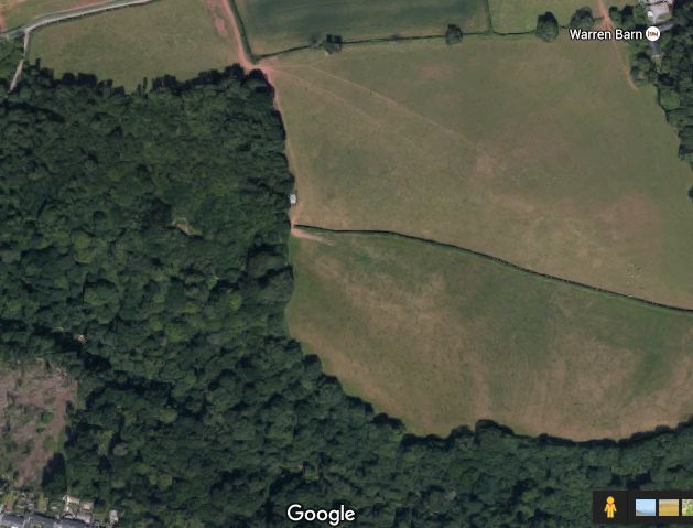 [/img]
or here
[img] 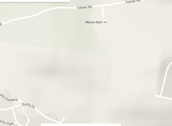 [/img]
than here:
[img] 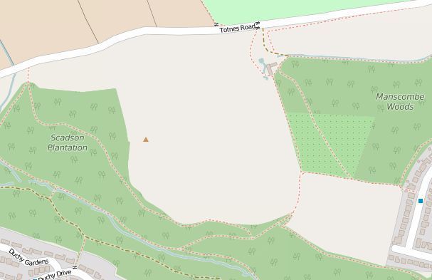 [/img]
😉
None of those are proper maps
OS is what you need for navigation and route planning
That last one looks like something you might get at Alton Towers to find your way to the Forbidden Valley
None of those are proper maps
OS is what you need for navigation and route planningThat last one looks like something you might get at Alton Towers to find your way to the Forbidden Valley
I'm not talking about navigation or route planning, but creating a segment on Strava 😉
To be honest OS map does not provide as much details as the "Alton Towers" on the pic above. And yes - I'm aware that OSM should be treated like Wikipedia 😉
I'm happy enough with the OSM maps but the satellite view is next to useless. Some areas have hi-res black and white cloud covered shots where everything is indistinguishable while others are in a very lossless low-res colour format where everything is indistinguishable.