![]() You don't need to be an 'investor' to invest in Singletrack: 6 days left: 95% of target - Find out more
You don't need to be an 'investor' to invest in Singletrack: 6 days left: 95% of target - Find out more
I have been inspire by Torridaffair holiday pics from people and of pics from some friends of a trip to the west coast of scotland with bikes to do my own holiday at the end of the summer over there. I have been across to the west coast a lot of times but never really with the bike.
So at the end of the summer, when my classic mini is finished being restored i plan to take the camping gear, the mini, a friend and two bikes on a bit of a road trip up the West coast for some epic scenery and rides, however I have no idea where to go bike wise? If anyone has any routes, with any maps or links to maps that would be greatly appreciated!
This....
[IMG]  [/IMG]
Plus this...
[IMG]  [/IMG]
Plus this...
[IMG] 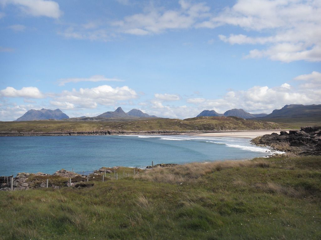 [/IMG]
Equals awesome holiday
[url= http://www.mtbtrails.info/Trail_main_page.aspx ]http://www.mtbtrails.info/Trail_main_page.aspx[/url]
have a look here
bruneep I bloomin love you!
Now secondly... with these sites like the one you sent me and the bikely you are able to download GPX or KML files of the route and are able to overlay these onto google earth etc. Now is it possible to do something similar onto a website or program that has OS maps on it? Hope that makes sense. Preferably something that is free and if it works on Mac thats even more of a bonus!
A bit further south than Torridon, but you might want to include it in a road trip
http://www.blog.scotroutes.com/2012/05/weekend-out-west.html
[img]  [/img]
anus - Member
Now secondly... with these sites like the one you sent me and the bikely you are able to download GPX or KML files of the route and are able to overlay these onto google earth etc. Now is it possible to do something similar onto a website or program that has OS maps on it?
http://wtp2.appspot.com/wheresthepath.htm
Anyone else help with some routes?
and druid, do you have any maps of those routes? they look incredible!
You'll find the GPX file for that Loch Morar route here: http://www.scotroutes.com/Routes/MTB/2012-05-05%20Loch%20Morar.gpx
oo er thats a whole lotta code?
Do you have a GPS of some sort - or would you rather I overlaid it onto an OS map?
We just rose Kenmore to Applecross the other week and that was a lovely bit of trail. We rode along the road from Applecross to Kenmore but missed out the bit of singletrack that takes you from the bay to the small beach about 3km up the road as it was a bit late in the day. Can thoroughly recommend the walled garden cafe for a scone at the end of the ride. Or the pub for seafood. Or the campsite restraunt for a quieter meal. Oh I want to go back already 😥
I do have a gps, i have downloaded a few gpx/kml files and overlaid them myself on that wheresthepath site, then im able to jpg the images from the os map.
If you are able to do that yourself in an easier way then feel free it would be appreciated, but dont go our your way to do it dude!
You'll find the GPX file for that Loch Morar route here: http://www.scotroutes.com/Routes/MTB/2012-05-05%20Loch%20Morar.gpx
cant download that file it just opens up in web page
<?xml version="1.0" encoding="utf-8"?><gpx creator="Garmin Desktop App" version="1.1" xsi:schemaLocation="http://www.topografix.com/GPX/1/1 http://www.topografix.com/GPX/1/1/gpx.xsd http://www.garmin.com/xmlschemas/WaypointExtension/v1 http://www8.garmin.com/xmlschemas/WaypointExtensionv1.xsd http://www.garmin.com/xmlschemas/TrackPointExtension/v1 http://www.garmin.com/xmlschemas/TrackPointExtensionv1.xsd http://www.garmin.com/xmlschemas/GpxExtensions/v3 http://www8.garmin.com/xmlschemas/GpxExtensionsv3.xsd http://www.garmin.com/xmlschemas/ActivityExtension/v1 http://www8.garmin.com/xmlschemas/ActivityExtensionv1.xsd http://www.garmin.com/xmlschemas/AdventuresExtensions/v1 http://www8.garmin.com/xmlschemas/AdventuresExtensionv1.xs d" xmlns="http://www.topografix.com/GPX/1/1" xmlns:xsi="http://www.w3.org/2001/XMLSchema-instance" xmlns:wptx1="http://www.garmin.com/xmlschemas/WaypointExtension/v1" xmlns:gpxtrx="http://www.garmin.com/xmlschemas/GpxExtensions/v3" xmlns:gpxtpx="http://www.garmin.com/xmlschemas/TrackPointExtension/v1" xmlns:gpxx="http://www.garmin.com/xmlschemas/GpxExtensions/v3" xmlns:trp="http://www.garmin.com/xmlschemas/TripExtensions/v1" xmlns:adv="http://www.garmin.com/xmlschemas/AdventuresExtensions/v1">
<metadata>
<link href="http://www.garmin.com">
<text>Garmin International</text>
</link>
<time>2012-07-30T20:30:43Z</time>
<bounds maxlat="56.972709568217397" maxlon="-5.62805931083858" minlat="56.954220263287425" minlon="-5.847522094845772" />
</metadata>
<rte>
<name>2012-05-05 Loch Morar</name>
<extensions>
<gpxx:RouteExtension>
<gpxx:IsAutoNamed>false</gpxx:IsAutoNamed>
<gpxx:DisplayColor>Magenta</gpxx:DisplayColor>
</gpxx:RouteExtension>
</extensions>
<rtept lat="56.955331368371844" lon="-5.847447076812387">
<ele>30.19921875</ele>
<time>2012-07-30T20:30:24Z</time>
<name>2012-05-05 Loch Morar</name>
<cmt>2012-05-05 Loch Morar</cmt>
<desc>2012-05-05 Loch Morar</desc>
<sym>Flag, Blue</sym>
<extensions>
<trp:ViaPoint>
<trp:DepartureTime>2012-05-05T09:12:57Z</trp:DepartureTime>
<trp:StopDuration>PT57S</trp:StopDuration>
<trp:CalculationMode>Direct</trp:CalculationMode>
</trp:ViaPoint>
<gpxx:RoutePointExtension>
<gpxx:Subclass>000000000000FFFFFFFFFFFFFFFFFFFFFFFF</gpxx:Subclass>
</gpxx:RoutePointExtension>
</extensions>
</rtept>
<rtept lat="56.954700881615281" lon="-5.846587596461177">
<ele>30.78515625</ele>
<time>2012-07-30T20:30:24Z</time>
<name>2012-05-05 Loch Morar1</name>
<cmt>2012-05-05 Loch Morar</cmt>
<desc>2012-05-05 Loch Morar</desc>
<sym>Flag, Blue</sym>
<extensions>
<trp:ViaPoint>
<trp:DepartureTime>2012-05-05T09:13:18Z</trp:DepartureTime>
<trp:ArrivalTime>2012-05-05T09:13:18Z</trp:ArrivalTime>
<trp:CalculationMode>Direct</trp:CalculationMode>
</trp:ViaPoint>
etc etc etc
could you mail it to me?
Right clink the link above and do a "Save Link As..." or whatever your browser has as an equivalent.
And here is a picture 🙂
[img] 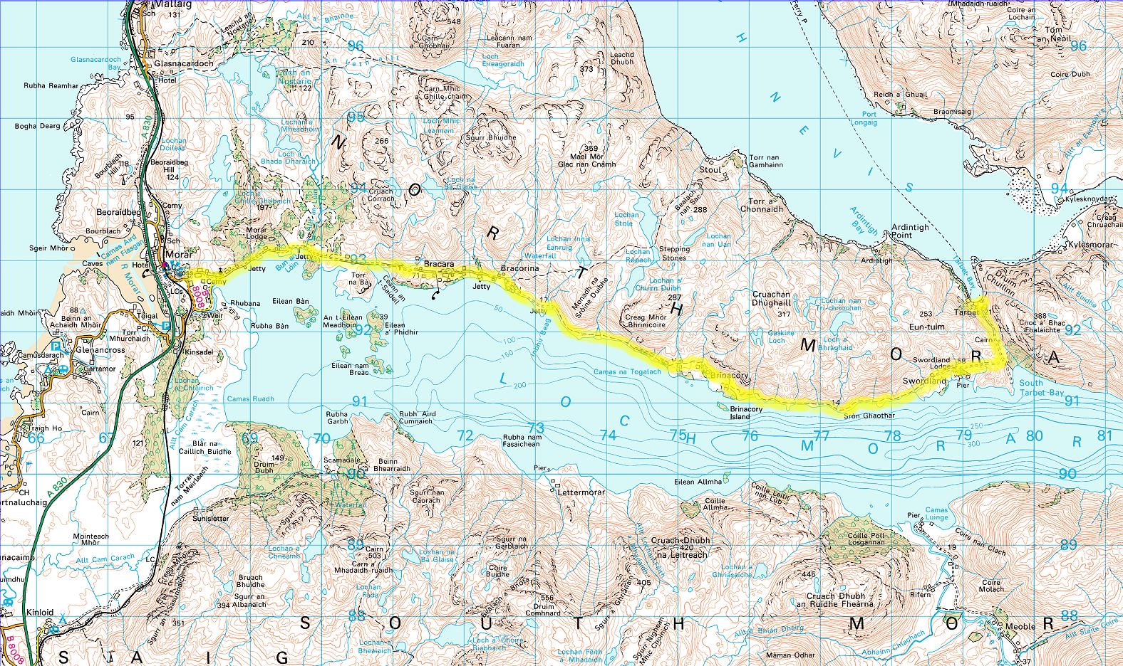 [/img]
can you upload gmx or kml files to a google maps account?
doh!
oh and druid thanks mate
Anyone else got any routes?
Couple of short routes:
Craig's Bothy from Lower Diabaig. Good evening's ride starting just north of Torridon, quite slabby and technical but beautiful views and a nice short evening ride vibe to it.
Suilven out and back. From Lochinver on the good quad bike track shown on the map (stays good all the way to Loch na Gainimh, entertaining but less good after that). There's also an interesting looking climb which starts up the slopes of Canisp from Loch na Gainimh, could be a fun up and down diversion for the sake of some extra views.
Alternatively the more scenic and more entertaining climb up past the Inverkirkaig falls. I've walked this twice now and both times thought it would be a lovely descent BUT its probably quite a popular walk so you'd want to be very careful coming back down, plus its quite short and doesn't get you very close to Suilven.
Riding into the Fisherfields from Poolewe or Dundonnel is good, both ways mostly rideable, epic scenery etc. If you want the best of the route though you want to do the climb from Carnmore up and over to Shenavall. Very wild mountain paths with amazing views of the mountains and a nice big steep descent down to Shenavall (also, a very boggy section to cross near the bottom, complete with multiple river crossings). I don't actually know how big a day this one would become, mighten't even be feasible as a day trip, you'd need to check some maps.
Oh aye - I forgot about the Carnmore one...
http://www.blog.scotroutes.com/p/west-highland-escape-with-lot-of.html
[url= http://farm5.staticflickr.com/4035/5165901893_054ac773f4_z.jp g" target="_blank">
[url= http://www.flickr.com/photos/druidh2000/5165901893/ ]Carnmore[/url] by [url= http://www.flickr.com/people/druidh2000/ ]druidh_dubh[/url], on Flickr
I hiked into Carnmore last week while I was without tubes. Would make a nice ride.... I told myself as I trudged out again. Amazing place and a comfy bothy.
I was wondering about the ride over to Shenavall - I thought you might be the man to know about it 13thfloormonk. Path back from Ruadh Stac Mor looked very ridable on that section.
Its almost 100% Kunstler, the climb up from Carnmore is steep and loose but would probably go (I had the camping gear on my back and was knackered...).
Lovely rolling path across a sort of plateau at the top of the climb, then a steep track descending round the back of Beinn Dearg Mor to Larichantivore (locked). Then you've got to cross Strath na Sealga, prepare to get wet!
Pour coffee, study map & find something interesting & ride it.
I was up a few weeks ago for some coastal stuff, the far north is a very rewarding area to ride in if you are prepared for a long drive.
[url= http://morayfatbike.blogspot.dk/2012/07/northwest-highlands-coastriding.html ]Sutherland trip[/url]
[img]  [/img]
Hope you have fun. Nice roads for the mini too 😈
Monk - that sounds about rihght for us!
Motorman - that is the plan, exactly. The reason i ask about routes first is that often you see a route on a map in scotland and it looks decent but often its totally unrideable! just dont want to go all that way and waste a day chugging our way across an unrideable track which is what happened last time riding across from Stracanaird (just north of Ullapool) along the coast to Achiltibuie.. goes off to check out your trip report!
oh and motorman, is your photo of oldshoremore beach?
He is sitting on the Faraid head looking back across Balnakiel beach to Durness.
When in Durness, ride up the hill track to the back of Ceann na beinne, then hike a bike to the top. Great views and then a superb descent if you carry on with Sangobeag in view on the west side of the hill. Follow the left ridge untill you hit the burn, then follow it down to the road. None of it is marked, just use your imagination (and lower your saddle)
Wot he said ^ 🙂