![]() You don't need to be an 'investor' to invest in Singletrack: 6 days left: 95% of target - Find out more
You don't need to be an 'investor' to invest in Singletrack: 6 days left: 95% of target - Find out more
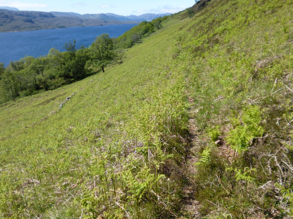
I’ll be up North next week and although I could cobble something together I thought I’d see if anyone might have some good suggestions! Thanks in advance !
Torridon would be the obvious suggestion. There are a few other options on here:
mtbtrails.info
Rode from Poolewe to Dundonnel a few years ago, that was a big day out in the hills and we had dropped a van at the finish.
If I were there again I might do an out and back into the Fisherfield Forest from Poolewe. Would be a big ride to get the best descent from that route though.
Poolewe in to Carnmore would be my pick of the area.
Loch Bad an Sgalaig to Loch na h-Oidche would be another.
Tollie path? Loop,starting and finishing Loch Maree. Singletrack, some Road, nice semi tech climb and then a full on technical descent to the Loch.
Someone has to try this! From poolewe south along the north side of loch maree to Kernsary then north to Fionn Loch. About a mile north of that point there is another track running north to altbea. I have done both bits of track as out and backs - very scenic and the northern track is a rough not often used bit of double track. It looks possible to connect the two if you go along the edge of the higher ground. However the connecting bit is marked on the map as Bad Bog!
Its on my list to do but Mrs TJ refused to try to cross bad bog on a rainy day - I wonder why 😉
Postman Path is a must do both ways 🙂
I hated the Postman Path! It was just a wee bit too narrow in places to get flow, and lots of carrying. Also it felt like the end of the Lord of the Rings - every time you thought you’d reached the end there was a little bit more left!
If you can get dropped off, consider Dundonnel to Poolewe on the HT550 route. The ride into Shenavall is good, cross the river, then up and over to Carnmore by what is probably the best descent of the whole route. It’s then up to you whether you go via Cowshit Bog to Poolewe or the Postman’s Path to Kinlochewe.
Tollie path? Loop
Unusually, I think this is better as an out and back.
As @AlasdairMc says, get dropped off at Dundonnel (well Corrie Hallie car park) and ride the HT550 route as far as Carnmore then the old route out via cowshit bog (about 100m of muddy track roughly here http://streetmap.co.uk/map.srf?X=190729&Y=879041&A=Y&Z=120 ) to Kernsary and Poolewe. Here's Ian Barrington's account of traversing Fisherfield - https://ianbarrington.com/2016/06/09/a-highland-tale-part-3/
The Postman's Path is a bit Marmite, some hate it, others like Rich and myself love it. Proper old school techy, nadgery mountain biking. Take the Carnmore path to Kernsary then cowshit bog and the stalker's track out towards Carnmore but turn right along the Strathan Buidhe to Letterewe House. Some very techy riding as far as the bridge at Glean Bianasdale, some is totally unrideable (unless you can bunny hop 1.5m upwards from a gravel surface!) but there's a lot of good riding
From the bridge the riding's easier, but not easy, to Kinlochewe.
Either get picked up at Kinlochewe or road back along Loch Maree to Slattadale then the Tollie path back to Poolewe.
@tjagain - that route (and quite a few others in the area) would benefit from a packraft.
Edit: it's worth searching for HT550 accounts of Fisherfield as the route takes the best, indeed the only practical, line through the area.
A loop I mean to do but is said to be good is the loop starting at the walker's car park near Loch a Bhraoin (between Dundonnell and Corrieshalloch) then taking the track alongside the loch to drop down to Loch an Nid and join up with the HT550 route where it drops in to Strath na Sealga then climb back over to Corrie Hallie. A long road section back to the car unless you've got two cars and can shuttle.
One track not mentioned is the direct line from the top of Corrie Hallie to Shenavall bothy. This was on the original HT route but it was felt to be very rough so the 4x4 track is now used. Given that the original HT route used the full Torridon descent that might be an indication of how tough that track is.
Thanks for the info, I was basically thinking of poaching parts of the HT550. As described above! One question though l, I’ve heard that fording the river can be a bit of a challenge at Shenavall. Anyone have experience of that at all?
Corrie Hallie to Poolewe is a classic. Don't even think hook of trying to ride the direct path to Shenavall.... Strath na Sealga river crossings are usually ok if there hasn't been too much rain for a day or so, be prepared to turn back though. If you can't sort the logistics for a point to point, Poolewe to Carnmore and back is great.
A good alternative to tjagain's route is out from Second Coast to Fionn Loch, short walk to pick up the (much rougher) track back to Aultbea.
Whitestone's route from Loch a Bhraoin to Corrie Hallie via Lochan Nid is really good, and best done in that direction.
I find that the Postie Path makes a good day out on foot...
It was alright when we did it the opposite way - Poolewe to Dundonnell - but only done it the once.
Dug out the blog post for you...
http://unduro.co.uk/riding/the-great-wilderness/
As I said before, I would consider riding that route but turning round just before the river and heading back to Poolewe. Avoiding the bog, river crossing and deceptively high bit from Shenavall bothy to Corrie Halle (which wouldn't be all that great either way).
Corrie Hallie to Poolewe direction gives you the sublime descent to Carnmore, whilst the unrideable section out of Strath na Sealga is taken in ascent. Done it a few times - it's my local ride!
Fording the Abhainn Strath na Sealga: the walkers' route is direct between Shenavall and Larachantivore but the HT550 route goes down to the outflow in to the loch where it's much wider but also much shallower. This point: http://streetmap.co.uk/map.srf?X=205347&Y=881620&A=Y&Z=120 not sure from @chakaping's blog if that's where he crossed.
The last couple of years it's been low enough to ride across. I walked it and there was a couple of metres where the water got to about halfway to my knees, most of the way it was ankle depth. When it gets deep it tends to be a combination of high rainfall raising the river level and strong wind blowing along the loch and causing the river water to back up (a bit like an incoming tide causing a river to back up). In 2015 Jenny Graham took 24hrs to get across the river! When I asked her, she said it took a couple of hours from the rain stopping to the river level beginning to drop.
The reason there's no bridge over the river is that it's the boundary between two estates so there's never been need for one - certainly I've not been able to find evidence for one.
Whitestone - many years ago there was a bridge across the river, a little way upstream from Larachantivore. It was had fallen into disrepair when I first saw it in 1982. These days the estate access Larachantivore by boat along Loch na Sealga. If the water level is not too high, it's usually possible to Ford it just downstream from the buildings.
I think they approach Carnmore by boat as well, there's a jetty down from the house, probably the other "end" is the track @tjagain mentions in his post. In fact a mate was going to walk in to Carnmore to go climbing on the crag and mentioned it in the pub in Poolewe and got offered a lift all the way!
Yes, Letterewe estate drive up the track via Kernsary to the west end of Fionn Loch, the use a boat to Carnmore.
That's on my Packraft "to do" list.
There's a packrafting video of heading up Loch na Sealga Colin, I'm pretty sure you'll have seen it.
Just remembered a quote about the river crossing from Rickie Cotter: "Deep? It's effin' deep when it's up to your tits!"
@felltop - do Letterewe still use ponies for stalking? From memory they are one of the few estates that still do/did. It's why the paths in to Fisherfield haven't been bulldozed in to 4x4 tracks.
Letterewe do still use ponies. Unfortunately they keep them on the Carnmore track, in the woods near Kernsary during the winter. One of the reasons why its become ing a mudbath. Gruinard Estate also use ponies.
Packrafting Lobh na Sealga would be superb, especially in a westerly breeze. Alternatively, I recently ran the path on the south side of the Loch. Parts of it are surprisingly rideable. I'm hoping to make a circuit out of what I call the "Trans Fisherfield" from home this spring using this route.
Ah, not cow shit bog but horse shit bog then 😉
Alternatively, I recently ran the path on the south side of the Loch. Parts of it are surprisingly rideable.
The map shows it ending about 2.5km from the outflow of the loch, what's the rest of the ground like?
Here's that video (hopefully I've chosen the right option to show/embed it), the river crossing I mention above is at about 8:40 onwards:
I've done the Loch Bhraoin loop but combined it with a ride of the famous Sgurr Ban slabs which have a mile of continuous bedrock down from 800m. Pretty steep and intimidating lower down with one massive drop that few would ride (push up the main slab ribbon to pick descent lines). Where the Coire Hallie path joins the stream I crossed over and had a play on the quartzite ribbons of slab (these link back to the escarpment above Coir a Ghiubhsachain which I want to explore with the bike next time!). The ride back up the Destitution Road is a total **** particularly if you've been to the Sgurr Ban summit and are humped (last 20mins of climb up this is an ankle breaking walk, leave the bike!).
@whitestone - enjoyed that film, especially as I went for a ride up to Loch na Sealga from Gruinard Bay this evening!, To answer you question about the path - the missing 2.5km do exist on the ground, but it's pretty faint, and largely unrideable. As for the rest of it, I'll have to go and find out!!
@chickenman Was that clockwise it anti? Sorry if that’s a doofus type question!
@frazchops - the Loch Bhraoin loop is done clockwise, basically a big long descent from there down to Loch an Nid and then down in to the Strath na Sealga.
I've known folk do Loch a'Bhraoin anticlockwise too. Be careful of water levels - the track alongside the loch is often submerged.