![]() You don't need to be an 'investor' to invest in Singletrack: 6 days left: 95% of target - Find out more
You don't need to be an 'investor' to invest in Singletrack: 6 days left: 95% of target - Find out more
Is there a goldilocks app for off road navigation these days? I recall View Ranger being a favourite here but it's successor being less popular?
My OS and Trailforks subscriptions are both up for renewal. I use for MTB, hiking and trail running. Both for plotting my own and finding existing routes.
OS Maps has excellent mapping but the route finder is painful.
Trailforks excellent for finding MTB trails in well documented areas but other than that not much use.
Strava heatmaps can be handy but other than that I didn't use any premium features when I trialled it.
Any others?
I use the OS app and while the mapping is of course excellent the app is really disappointing. There are lots of minor functionality issues that add up to it being significantly less user friendly than it could/should be.
For off road navigation get a garmin or whatever device.
For on the phone planning if you are a paid up Strava person then FATMAP is pretty good, OS mapping and covers Europe as well with proper maps. It does get upset occasionally and needs going in to manual or walking mode sometimes, but still pretty good and quick to use.
Plotaroute.com is my favoured route planner, (set for walking otherwise it diverts from the good stuff) Strava heat maps are great for seeing what’s been ridden but the route planner is probably the worst, try and plan a known good route and it diverts away from anything good.
If Uk visiting an area I don’t know, I find a segment on Strava that I want to ride (normally the steepest/longest downhill, then filter to top 10 this year/month/week and download a ride that matches my timeframe.
I use Komoot, it's OK, I guess, although its route planning tool can be an exercise in frustration
For manual route planning on OS based mapping I have (and still do) use Memory Map on PC and mobile. Create gpx and send to whatever bike computer or phone you use. OS maps you can buy outright or have a yearly subscription to access offline latest version mapping. You can print up to A3 (or bigger with an additional licence) if you want a custom paper map to carry.
I often use it in conjunction with the Hammerhead Web based route planner on PC (I use a Karoo 2 computer). The Hammerhead planning application snaps to map features and you can choose road/gravel/trail so it snaps to appropriate routes. It's not infallible as sometimes it can't tell a footpath from a bridleway, but using an OS map (or local knowledge) overcomes this without difficulty. Its generally pretty good and quicker than tracing routes manually.Both systems can import and export gpx files.
I always have the planned route on my phone in Memory map as well as the Karoo - if one dies the other is a backup. The Karoo backgeound mapping is less detailed than OS but is easier to follow on the fly. If more detail is needed, get the phone out for a quick look.
Works well for me
Don't forget if you have Strava Premium you get Fatmap for free which contains full UK OS mapping and the equivalent European maps.
You can download areas for offline use, and the route planner isn't bad.
Whats also handy is when you save your strava ride if you open it in fatmap it overlays it onto the OS map.
I stuck woth Outdooractive and works fine for me. Nothing clever, i just use it to plot exploratory routes using mostly OS layers. The autoplot works faurly well with occasional manual override needed and it syncs with the garmin unit automatically (no faffing with gpx).
I found GPX Studio pretty useful for cutting and splicing together bits of GPXes into routes:
I use OSMaps and flip between the OS mapping and the Satallite view (plus some 3D/Google Earth viewing) as basically the ROW bridleways and paths marked on the OS mapping are hit-and-miss as to whether they still actually exist here in the Rhondda - sometimes they are gone and sometimes the path/route has moved elsewhere - so I use the Satellite view to try and figure it out.
Also many of the bridleways are unusable as such so you wouldn't want to plan a cycle route reliant on them unless you had experienced them before.
Some of the routes that are listed on OS Maps are also dodgy as they are old and the routes they followed have 'dissappeared' from lack of use/landowners rrstricting access/wind farms trashing them/logging activities blocking and hiding the entraces/etc.
Komoot
 Ideally I’m looking at 2 screens one with an os map the other with the Strava heat map. But are terrible to plot in
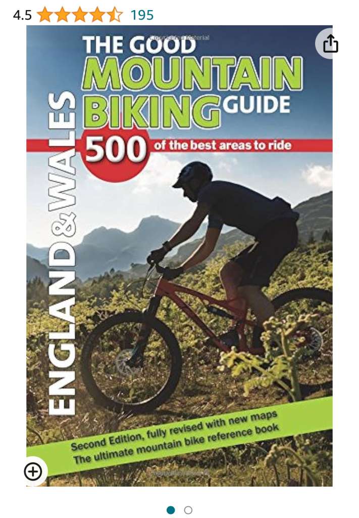
This book is worth having as it provides just so much information.
OS maps for me. Yes it has some idiosyncratic bits and the app is a bit meh in places but it is great mapping, you can download map sections and it's reasonable on battery.
I'd prefer a Garmin on the trail but I don't want to spend £300. 😉
I use Komoot, which is occasionally a bit optimistic with trails in respect of rideability and occasionally even existence.
Can be cross-checked for free against Bing OS maps and Google Earth