![]() You don't need to be an 'investor' to invest in Singletrack: 6 days left: 95% of target - Find out more
You don't need to be an 'investor' to invest in Singletrack: 6 days left: 95% of target - Find out more
We've spotted this route on Bikepacking.com and wondered if anybody had anything to add or remove?
https://bikepacking.com/routes/north-yorkshire-moors-ramble/
The Dark Horse and Darkest Horse at Kilburn and the nice little start of the Jerry Noddle at Dalby seem obvoius enough and no doubt there are descents at Guisborough as you pass through.
We aren't especially preciouis about doing 200 miles either so feel free to say if you think a section is only in there to add extra miles.
We would be travelling from West Yorkshire so it might make more sense to start at the Thirsk end but a seaside finish sounds nice.
Cheer Jason
Hi , im local-ish to the route being on the east coast, Its on my to do list, go check out keep smiling adventures on YouTube , he's done it but sadly wasn't impressed , but i spose it depends on what ur looking for ?
I will do it sometime hopefully next year
enjoy
Cheers Stumpy, I'll give that a watch.
The little loop at the NW end looks like it could be a bit pointless so we will probably lop that off. We will also stay high at Sutton Bank and enjoy a trail or two at Kilburn.
We've done the Ardmoors before, I wonder if one of those descents could be included?
Having driven through the NYM since I was a child, it might be nice to cycle over them.
Can you think of any good sections this misses out?
I think we can do it without tents/bivvys but carrying Expeds/sleeping bags with help from my wife and a bunkbarn and bell tent on route.
There was a descent in Silton too I believe which looks nearby.
I should add, we will be on Mountain bikes with XC tyres.
I'm far from an expert but used to ride the Moors a fair bit with the Retrobike crew. From what I remember there are some glaring omissions as we always used to faff around Goathland, take in The Hole of Horcum on the way and generally stay that side of the Whitby/Pickering road. Used to also sometimes start at Cropton (+ camp) as there's some nice riding around that area. Up around Danby too, it seems to take you the wrong side? There are a few classic loops based nearby but most favour the north side.
The one of the lads that led us is actually a guide based near Dalby and a few others were local to various points on the moor so knew where they were going.
Thanks, anymore info on those omissions anybody?
There are lots of other possibilities and variations but as an off road tour of the moors it looks reasonably well thought through. Changing one bit misses another.
E.g. if you missed Guisborough you avoid a hill or two and gain the cycle path and the bridleway from Commondale and then through Danby Park woods but lose the bit along the paved Quaker's Causeway.
Stay high from Danby Beacon to take the dirt road heating East above Lealholm and from there to Glaisdale but turn you miss Fryup Dale.
From Boggle Hole you can follow the Moor to Sea route to Langdale End which is lovely along the Cinder Track and forest but the you miss the high moor at Fylingdale.
The little loop in the NW corner takes you down into Swainby where there is a village shop, the Rusty Bike cafe and a couple of good pubs. If you need a refuel worth doing but otherwise probably not.
The YHA at Boggle Hole is a good place to stay. Note that you can't get along the beach to Boggle hole at high tide. If the tide is in then you need to come back up to the Cinder Track from Robin Hoods bay and go along that and back down.
Starting from Thirsk would work fine or start from Rosedale, in the centre of the figure of 8, stop near Sutton Bank one night (Paradise Farm perhaps) and Boggle Hole one night. For the middle night stay in Rosedale. There is a big campsite and you could leave the camping gear in the car so avoid carrying it.
Looks a good route to base a few days adventure round. Lots of good cafes too. Dale Head farm in Rosedale is one of my favourites.
The Rusty Bike is great and well worth a diversion. The cafe at Lordstones is on one of the must ride bits of the route that contours the ridge along the edge of the moors. There's also the cafe at Great Fryup bike place. All the bridleways round there ride better than the actual route. I'd try to work in the bridleway over from Rosedale to Fryup via waterfalls gill (paved packhorse route into proper rocky tech and on to fast flowy singletrack.)
I know the NW corner best and could go on ..
Thanks John and please do, add anything you think we need to ride 🙂
Any recommendations for accommodation in Thirsk or Rosedale? We would be a group of 4-5 using this as a base rather than bikepacking and would like a decent pub nearby!
Rosedale to Fryup via waterfalls gill - is that marked as the George Gap Causeway Path on the map?
Spoons in Thirsk is usual value for money and on the square. Only been in the bar not stayed.
https://www.jdwetherspoon.com/pubs/the-three-tuns-thirsk/
Rosedale the campsite is slightly corporate and fussy about vans but facilities are good. They also have pods and I think a couple of cottages. The small tents field at the top is lovely.
https://www.rosedaleabbeycaravanpark.co.uk/
We spotted a camp site above Rosedale called Bell End Farm too.
I know where the Bell End one is. No idea what it's like. About a mile uphill from the village (shop, cafes and pub).
The name is all good though 🙂
The goats cheese they make in Rosedale is good too.
Rosedale to Fryup via waterfalls gill – is that marked as the George Gap Causeway Path on the map?
That's the one. The tech bit is short but good and at about 5.30 on this
You can refuel at https://www.yorkshirecyclehub.uk/ The café is good and they have bunk rooms as well as a bike shop and a jumps circuit in the woods behind.
Here's a route we rode a couple of years ago that worked okay. We camped at osmotherly youth hostel https://explore.osmaps.com/route/17065733/moors-to-staithes-?lat=54.435556&lon=-1.033780&zoom=8.7810&style=Standard&type=2d
Includes a cheeky bit of Cleveland Way at the end.
(Might have worked...? We took a different route back)
Thanks John, looks good.
I notice your route stays high through Broughton Plantation early on. Is that to get a descent at the end or just because its a better path?
Obviously your route is running the opposite direction to ours.
Sorry, I think that was the OS app snapping my plot to the nearest right of way. There's actually a high track contouring the top of the plantation which you can see is what most folks ride, and which we took to cut a bit of climbing as this was meant to be a fun cafes and beers ride... Wanstones ridge rides fine either direction, and outside bracken season I'd recommend the twisty singletrack that contours urra bank (not a r.o.w but you can see a thin line on Strava heat maps, which I prefer to the paved Cleveland Way bway).
There are some pretty fun bits to the contour route (the higher of the thick lines on Strava mtb heat maps). And there's Ard Moors riding round there...
John, it looks like the route goes past your Fry Up descent on the outward leg. A quick bit of plotting suggests that it would add between 7.5 to 10 miles to that day though.
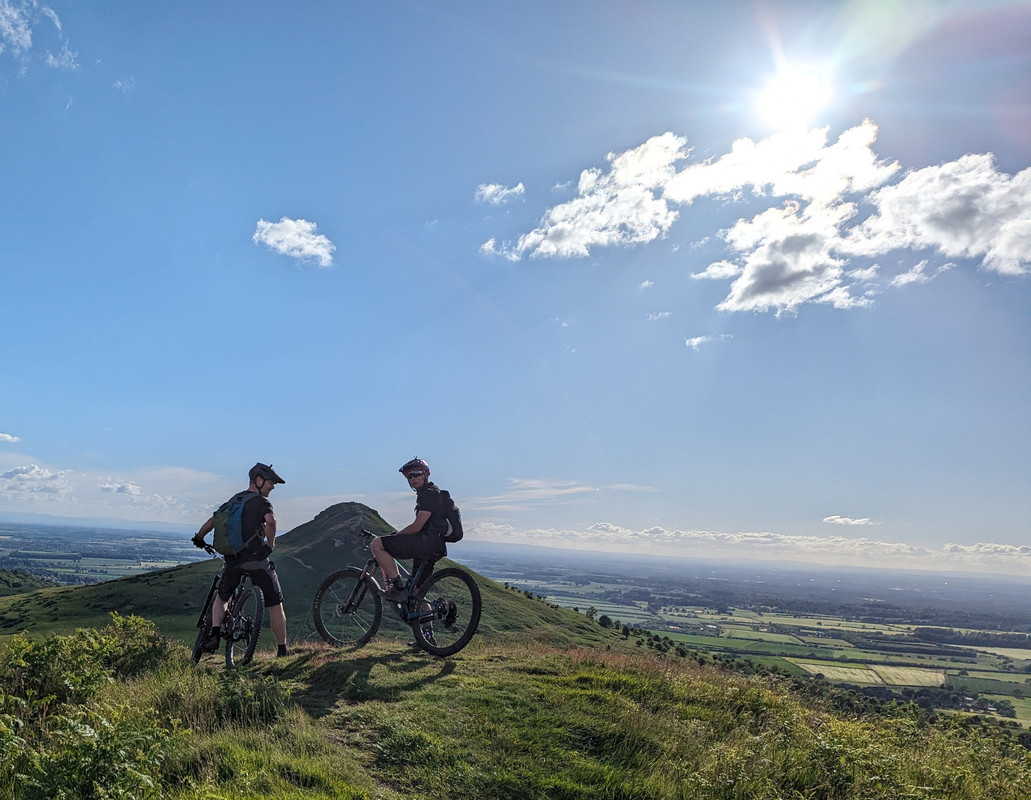
Fryup's better to ride down to than past (the YouTube link I posted gives you an idea of some of the good stuff). But that's the nature of these longer kit carrying rides I guess and you can't fit everything into one route... The loop out towards Roseberry Topping (I'll post a pic) is worth doing and if you check Strava or trailforks you'll see a lot of fun stuff round guisborough old trail centre that takes you in the right direction .
As I say that's the corner of the moors I know best but I'm not a local (we've a place on the coast), and I can fiddle with routes all day long... You'll have a good time I'm sure.