Could anyone in the new forest / corfe castle area comment on what the off-road riding conditions are currently like please.
We are doing a 4 day bikepacking/pub trip next week and I'm in a quandary as to what level of mud proofing we need.
The route is the 'rat run' that someone of this parish posted a while back.
I live just between the NF and Cranborne chase and ride various bits of that route regularly. Forest is well made gravel access tracks and holds up well in pretty much all conditions, expect a few muddy bits near stream crossings is all.
Up on the Chase and Purbecks expect a variety of firm hardpack, a few chalky flinty gooey slippy bits, occasional bottomless puddles of doom, some loose sandy bits, great views and cider.
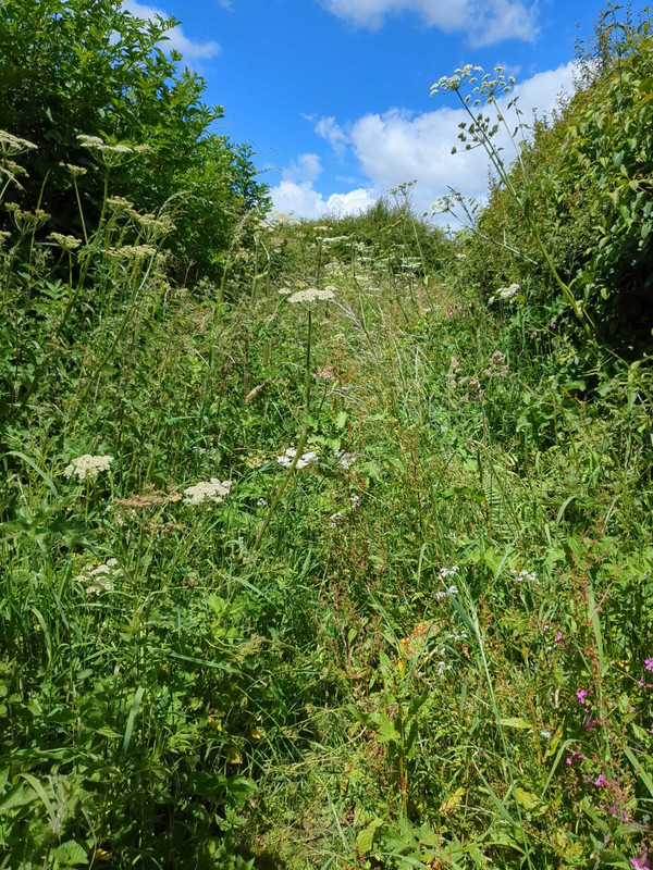
Purbeck section is fine Franks Tank is probably a bit over grown and East Creech to Nordan farm is pretty grotty at the moment, but with the forecast will have dried out by next week, you won’t be able to ride along (not would you want to) unless very early or late in the day.
I only ride the New Forest part (the creator of that route is my neighbours son - cool story) and as always it is pretty dry on the gravel roads/paths as they drain very well but can still be muddy when on lowest ground but they are drying out already now it has stopped raining for a while.
The 'illegal' single track is a bit muddy and the open land is boggy in areas but guessing the route doesn't ride on any of the ares you are not supposed to ride on so shouldn't be a problem.
Thanks everyone - with that info, the forecast and the photos on the rat run page, i’ll take the summer hardtail and discard the mudguards.
I did this route at the end of March. It was really muddy in places, made for slow going in sections. Should be a better by now
The part of Wessex Ridgeway on the edge of Ashmore Wood will be very claggy, but once you're on the lane up to the village you'll be ok.
The dirt part of the Ox Drove after the climb out of Tollard can also be filthy, lots of 4wd. If you're ok with a few extra miles, Chase Woods is lovely. Where the Ox Drove turns from tarmac to dirt, you can stay on the road towards Cuttice Lodge for 500m. Then hang a left on the track into the woods. You can then take either the bridleway or the byway back up the hill to the ox drove.
@jimmy748 what's the east creech / Borden farm issue during the day and is there an alternate route?
It’s a very good route through the Purbecks, but from the Grange arch, the route takes a zig zag road descent, along the road for a bit then into a mild descent with some boggy bits to Nordon farm, it’s got a shop and a couple of Peacocks, It’s a route I used regularly in the opposite direction, to get up on the ridge.
But instead you could add some great views, and a very good descent. Coming to Corfe from the Grange arch, when you get to the road here
https://maps.app.goo.gl/LZ55YAGyWUwnXfmK7?g_st=com.google.maps.preview.copy
Instead cross the road and stay on the ridge, up the short climb and you get a great view from the trig point at the top you enter a field as you leave, instead of following the main trail down to the right, head left at 45 degree heading up to the spine of the ridge, you will get to the highest spot as the woods end and a fence starts, (hop over the fence here, otherwise you have 3 gates to get through) )follow the fence line along the ridge then when you get to the small but fully opening gate go through it, stay on the highest bit and you get to the point, then head downhill and left to ride the chalky single track down to the Castle, there’s a footpath to Corfe which you can push/scoot along if there are people about, or nip along the road into Corfe village, Fox inn is the best pub for views if you sit at the end of the garden, and the village Bakery is excellent.
The segment from the view point to Corfe https://strava.app.link/DPFjGVRh6Jb
The route from the Grange arch to Corfe viewpoint
https://www.plotaroute.com/route/2640318?units=km


I was out there a couple weeks back. Reasonably dry, should be fine now, and hardtail would be good. The folks who rode Frank's Tank did suggest it was pretty ****ed by all the weather we've had. Horrible on gravel bikes, might be enjoyable with suspension, but it's definitely not in the condition it used to be in.
Franks has always been a bit overrated to be honest,
I've never understood the fascination with Frank's Tank. It's just a fairly flat, heavily rutted, track that's usually overgrown with gorse bushes.
There are far better trails in the Purbecks.
Exactly, it’s actually better riding up it than down.
Had a chance to look at this route in detail as I'd like to do it in a day next summer.
As a heads up the bit in the red circle down towards Winterborne Zelston is virtually impassable. It took me nearly an hour to bash through a mile of head high weeds and nettles last year. Follow the blue route instead.

I definitely recommend that. At the end of March I couldn't even get onto the route. I had to push (or carry) my bike through a few fields and ended up walking through a farm/house to get back onto the road. That detour would save a whole load of time. The route seemed to follow a path that I couldn't actually get onto, so had to skirt around.
Isn’t that the bit that’s marked as “nettle alley” or something like that on their official route map? Sounds like they’ve understated that a bit!
Great info. Our route has been updated.
I did this route a few days ago, I wish I'd seen the comment from @jonm81. That "Nettle Alley" part was nasty. It seems that the route creator is a fan of rough bridleways, but with this year's weather it's involved fighting through this sort of thing for almost 2 miles:
Apart from that, the route was absolutely brilliant.
We did it 6-9 jun this year. Absolutely magic. Dodged nettle alley (thanks above) but took a few liberties with the route. Notably dropping off ox drive to the north 10kish before salisbury and found our own nettle alley. Glad we had the hardtails with Suspension forks too - chapeau to those who complete it on gravel bikes, it's rough in places.
Had a lovely run in with a verderer, and her 6 dogs off-leads. She thought she knew the special rules but she ran into Brian Clough Dave. After 30 minutes of lively debate they agreed Dave was right.
For reference you can ride on bridleways (and various other routes - see link below) in the new forest and what we were on was a bridleway (thanks OS maps and the .gov.uk site). Yes we all have bells but don't usually use them, preferring to 'hello' or 'excuse me' to be friendly and not make them jump into our path.
Meanwhile she'd lost one of her cocker spaniels roaming the vast 'open space' of the new forest that we are banned from.
you lucked out with the weather! having never met a verder in the flesh did she threaten to take your bikes off you? as Ive been told apparently the byelaws say they can?!
@jonwe I think it's a shame that you skipped Ox Drove, that was some welcome fast gravel with great views along the top of the ridge after the slog through Cranborne Chase!
I agree about mountain/gravel bikes. I reckon a lot of people will try taking gravel bikes on that route and regret it.
That sounds like a bizarre run-in with the verderer. It's often the people who are breaking the rules themselves who are first to accuse others. She was claiming that bikes are banned in the New Forest when you were riding one of the recognized bridleways with the regular posts with bicycle signs on it?
We are three grumpy old men so i doubt she would have managed it. She did threaten to take our photos and post them online on some verderer website though. Obviously if she did we would have taken her photo and posted it on a well known mountain biking site but she decided we weren’t all as bad as the pair of bikes who’d passed her minutes before.
The irony of having the entire ‘open space’ to walk her dogs but taking them on the only bridleway and off-lead was lost on her with a ‘you could kill one of my dogs’.
Standing our ground, knowing our rights and not being ***** was a winner for us.
@hyper_real We did most of ox drove and glad we did - beautiful views and great tracks. Croucheston grove was the evil bit. Completely overgrown but it was steeply downhill and we did laugh about it at the bottom.
img src="https://photos.app.goo.gl/TXF2rtTVdCWM5wFJA"
Sorry fighting with images on google photo and the forum.

I've never knowingly met a verderer either - couple of rangers and an agister, all of whom have been fine. Commoners, though ...
Worth knowing that the new forest doggers' code (supported by all the local authorities, I believe) includes "Always keep all dogs under effective control; if you cannot reliably recall your dog or keep it close by, please keep it on a lead". There's a kind of "defence" if the dog's working but we all know that's bollocks almost all the time, and pointless if it can't be recalled/directed reliably
@jonwe, out of interest where abouts was your encounter with the verderer?
Sounds like the same lady (with a lot of spaniels) I had a brief and similar conversation with last year. She tried to tell me I couldn’t cycle where I was. But I was on a restricted byway and clearly told her as much before riding off.
There’s only one female Verderer and she’s a nice lady but can’t walk very far at the moment so I think it’s unlikely to be her. Sounds like someone trying it on. Where were you?
Always remember you are in prime tory/brexit/reform land with a lot of people completely isolated from the reality of the country. Being white will get you off to a better start!
I have never had a problem with the 'officials' but some of the people walking their dogs can be complete tossers but they are the exception. Luckily I am an early person and typically out riding by 6am so don't have to deal with them.
Likewise, I’m normally out very early or late. So don't see many other people.
If I do I always slow down and/or stop, especially if they have dogs, and find most people are pleasant and appreciative.
I’ve only had 2 or 3 negative encounters in 25 years.
@fieldmarshall south of telegraph hill on the bridleway in eyeworth woods.
6 or 7 dogs of the spaniel variety notably all the same breed. One older dog that was short cropped and going grey. She was definitely mobile and likely related to the queen judging by her accent. Walking with her husband who appeared somewhat embarrassed by it all.
I should add - we have dog encounters locally on a daily basis and like you we get on with the vast majority of them.
Deffo not a Verderer. That bye way is a rubbish route though. Better tracks either side of it on the actual network. Is it rideable these days? Last time I tried it 10 yrs or so ago it was horrible.
Very rideable on the day once in the woods. Very rooty but pretty dry apart from the odd muddy patch.
@jonwe . Yes that’s where I saw her too. I had actually already stopped as she had so many dogs running everywhere.
I politely pointed out it was a PROW and offered to show her on my OS Map. But she declined my offer.
So I just went on my way.
@burko73. It’s usually perfectly rideable from Spring to Autumn. Although I haven’t ridden it lately as everywhere has been so wet.
anyone got a map/link to this stretch? Can't picture it
(asking for a friend('s spaniel))

Dashed green line with alternating crenelations means "restricted byway. (Not for use by mechanically powered vehicles)". Now i need a lawyer to confirm that me and my pedal powered bike is not a mechanically powered vehicle but all my google foo suggests i am not.
Thanks @jonwe - must admit I wasn't aware that it was kosher but I ride the obvious route that approximates that line on a regular basis during "summer". Currently in good shape, just a few small puddles
https://www.google.co.uk/maps/place/Romsey/ @50.94334,-1.677639,1403m/data=!3m1!1e3!4m6!3m5!1s0x48738a467a935321:0x921d2f3be7c06e5f!8m2!3d50.98893!4d-1.49658!16zL20vMDE4MHF3!5m1!1e4?entry=ttu
@scardypants the route crossing clay pits bottom was challenging in a muddy bog sort of way. The route there wasn't very clear but I suspect the locals know the best way through.
That section is always a bit wet, apart from in the middle of Summer. In addition they were doing some work on the river a while ago, so it got really churned up by vehicles.
Restricted byway perfectly legal on a bike.
