![]() You don't need to be an 'investor' to invest in Singletrack: 6 days left: 95% of target - Find out more
You don't need to be an 'investor' to invest in Singletrack: 6 days left: 95% of target - Find out more
I basically can't see my Garmin 800 without putting reading glasses on (especially when I have the magenta route line near red roads on the map). It's okay for telling me when to turn but pretty useless for telling me where I am. Is the bigger Garmin 1030 better?
Have started using Viewranger on my phone and this seems much better - wonder if I need the Garmin at all?
what do you middle aged-blind farts do?
I use varifocals…
But for a period before that (and this also works if you don’t need a prescription) I used Hydrotac lenses on the inside of my glasses.
The 1030 (and Explore) are better—the screen is larger, crisper and has more contrast—but it’s not a sea change, and you’re still stuck with Garmin’s map styling which is pretty poor for visual clarity. I built my own maps for mine, they make it much easier to see the important stuff:
I use a phone. I did consider a Garmin but a phone is a fraction of the price for way more functionality. If you want a bigger screen then a phone is the easy option (also very easy to zoom in). I bought a cheap second hand phone for bike use and bolt it to the bars.
Smartphone with big battery (Moto G7 Power), OS maps app and a Decathlon smartphone bar mount...does the job perfectly for me
That's pretty amazing Bez. But couldn't you just get OS maps?
Smartphone with big battery (Moto G7 Power),
Laughing knowingly and stroking Ulefone Power5 😀
Cheers!
I.
I've not found the need for a big battery if you don't need it as a phone. In airplane mode the battery lasts ages on most phones.
I use a Garmin Oregon, preloaded with a few different maps. Just find a style of OpenStreetmap you like. One of the advantages of OSM is that you can add / delete / correct tracks and roads and gave them reflected in the master dataset.
But couldn’t you just get OS maps?
I've got OS maps on my 810, but there are pros and cons:
Pros:
• You get to see the (broadly speaking) definitive status of a trail
• You get contours
Cons:
• Zoom in and the display isn't great: it becomes pixellated and on the 1:50k maps it's often unclear as to how ROWs make their way through villages etc
• Zoom out and the display isn't great: it's not adaptive, so you retain the detail as clutter (until it snaps into the large scale map, which is too sparse)
• They're not actually super clear for road use: there's a lot of unnecessary detail and coloration
• They cost money
I tend to use them when I'm exploring new bridleways etc with an eye to linking up fragments of routes that I know well. I might also use them for MTBing if I used a Garmin for MTBing, although to be honest I'd be more likley to produce a variation of my maps for off-road use (ie making the trails much more prominent and the roads perhaps a bit less so). But for 95% of my usage, mine work better.
I use my phone and carry a spare battery on long rides.
Trailforks/Komoot and OSmaps...
Major benefit of OS maps is informing knobs "it's a bridleway according to the OS" or having taken my specs out and looked "I'm really sorry.... I was following the bridleway and thought I was still on it"
Nothing... getting lost is part of the fun. I'm sure my Garmin 520 has maps, but i've never used them 🙂
I want a bike computer but can't really buy one right now so going to use my old phone with smashed screen (so i dont end up breaking my current phone in a crash) and delete everything of it apart from strava, trailforks and OS maps and use it solely for the bike. Any recommendations on a mount for the bars?
I use a phone too, after years of trying Garmin's and whatnot that are really just quite unsatisfactory.
I do use a garmin watch to track the rides though, that takes the pressure off the phone battery which I can use just for nav (FWIW, I use Gaia GPS, more out of habit and a lack of motivation to try komoot etc).
For a bar mount, hard to look past quad lock and case - works extremely well.
I've previously just bought a bog standard case for the phone (or a replacement back cover if applicable) and a Garmin quarter-turn mount (available 3D-printed via eBay) and superglued them together—then it's compatible with any old Garmin mount. Cheaper than a Quad Lock, too.
you’re still stuck with Garmin’s map styling
I use the TalkyToaster map instead of the Garmin map.
<span style="font-weight: 400;"> https://talkytoaster.me.uk/</span>
Or you can instal OpenStreetMap:
https://www.dcrainmaker.com/2019/08/how-to-install-free-maps-on-your-garmin-edge
I'm fortunate enough to have a decent sense of direction and spatial awareness, allied to riding in Scotland where there is often only one route through a valley, over a pass/whatever, and I spend a bit of time looking over the route and images on the likes of geograph.org beforehand.
However, I understand it's completely different to biking networks in the south with all this permissive crap etc, f knows how I'd get on with that!.
For navigation in the hills on foot, OS app is bloody brilliant.
Garmin for an arrow to follow and beeps to tell you if you’ve missed a turn. In this country OS app on phone if need to see where we are, when abroad just used google maps.
The Ordnance survey subscription is the best value £24 I spend each year. The phone app is great, and you can download areas for offline use if going somewhere where data is sparse. I’m off up to Kielder next week so will download the area at 1:25000 as never been and no paper map.
I use Ride with GPS, voice cues, connected to mini bluetooth speaker mounted on rear of steerer. Phone in back pocket.7 or 8 hours no problem as screen not switched on on phone.

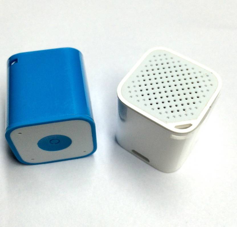
Speaker is really small, 1" cube
Hello Charlie-Ive always struggled offroad with the 800,screen clarity /brightness isn't very good.When you turn it up bright enough to see in strong daylight....the battery quickly dies .
Default Magenta line does just look like roads so very difficult to see where the course line is.
You can change colour (I always use the brightest-which is red) within each individual courses settings by setting the course to 'always display' - then you can change the colour to what you want. This helps ,but for me I think my old and departed edge 205 greyscale screen was much easier to follow and see courses that I had pre made.

you can change the colour to what you want
That sets the colour of the track, but if you use navigation then it always overlays its calculated route in magenta, which you can’t change.
I have a very strong prescription and wear varifocals. For riding I have glass with a single vision insert (on grounds of price!). It's good enough normally but strong sunlight and dark lenses like today make it difficult to see the route on the GPS.
Bez- I don't use navigation,as it never seemed to work for the offroad riding I do ,so I have just always followed the courses I create and change the colour of them so I can see them better whilst riding. There were times early on when I've not been able to distinguish between roads and the bizzarre default choice of the Magenta course 🙁 I've learn't the hard way.
I use a massive 7" screen xiaomi mi max 2 with backcountry navigator OS app. In my pocket if its dry in a dry bag in easy access pocket in rucksack if wet. They're fairly cheap but not waterproof.
That sets the colour of the track, but if you use navigation then it always overlays its calculated route in magenta, which you can’t change.
that explains a lot. Farted around for ages trying to make my course lime green or something.....
For riding I have glass with a single vision insert
I've found that if you're basically just riding and using a GPS then bifocals are fine as a budget solution. Not great once you're off the bike, but fine on it. Single visions plus Hydrotacs is a good way of testing the theory for £15, but it's hard to keep the Hydrotacs clean and clear over time.
Not really been riding anywhere new on the mountain bike for ages but usually just take a BMC / Harveys type map out as they fold down relatively small. Road riding I print out Landranger 1:50k at 1:100k on waterproof paper or just use OS Map downloads on the mobile. Might get round to using a gps for routing but I'm usually just exploring an area and then ride everything from memory.
Cons:
OS maps show you roughly where the RoW is supposed to be. OSM-based maps generally show you where a trail of some form actually is.
That sets the colour of the track, but if you use navigation then it always overlays its calculated route in magenta, which you can’t change.
I moaned about this to Garmin when I first got an Edge 800. They took it on board as a "feature request" but I think it says something about Garmin that this issue is still driving people mad nearly a decade later.
You know, I've been using Garmins for years and if you'd asked me I wouldn't have been able to tell you the colour of the route line on the map 😁
I guess it's just never been an issue for me so I've not thought about it.
I think it's particularly bad if you use the OS maps, as it really is identical to a 1:50k A road. I originally assumed that this was why they never picked it up in testing (because they're not based in the UK), but my revised theory is that Garmin just don't do any real world testing.
For a big natural ride -
Route to follow on Garmin 520, which I'll make on map my ride
Phone with viewranger as a map to check if I get lost.
I use a suunto watch straped to the handle bars. This just shows a trail of bread crumbs. But it works for 95% of junctions. It was cheapish £110? and really tough. I wear bifocals all the time. But i think i can naviagate with no glasses in the rain. 5% of junctions need the phone
just found an old smartphone in my drawer, so thought i may have a play with this, nothing to lose.....
whats the best software to use for a phone? viewranger? im thinking that id be asking on here for a route in say the peaks, then somehow load it to the phone so i can follow it if ive never been there before.
is this simple enough to do? and does it work like a satnav, moving the screen as you move so you can see where turn-offs are?
thanks
I use Komoot, you can search for routes then save them for using offline. Simple enough to do once you’ve done it a couple of times. I don’t have a sim in my phone and turn off Bluetooth, WiFi etc so get good battery life. I find it much easier than using my Garmin which has been nowt but trouble recently.
Btw, yes it moves the screen and gives you turn by turn navigation, with voice commands if you want them.
And here am I with my merry Garmin Etrex 20...
I wear a close-up contact lens in my left eye and a distance lens in my right. It doesn't work for everybody but it does for me.
I usually plot a route on cycle.travel. Upload it to ride with GPS. Then cos I don't have a paid account I then use an app called bike tracker which piggy backs off ride with GPS and gives you turn by turn navigation
I use Komoot, you can search for routes then save them for using offline. Simple enough to do once you’ve done it a couple of times.
just tried it, cant work out how to build a route. started in hope and thought id go up roman road to hope cross for starters but couldnt get it to plot anything.....
starting to make a bit of progress with it, but i find it hard to change things if it plots in the direction i dont want it to. either that or it plots the waymarks in the wrong order....
one thing that may be useful is importing other peoples routes. so has anyone got either a .gpx, .tcx or .fit of a route or two in the peaks that they wouldnt mind sending me to try out? username at gmail dot com.
ill also try to build a short routs from home to try it out. all looking promising so far, if i can get this to work ill look for some sort of handlebar mount for the phone.
thanks
I’ve tried Komoot a few times, I just can’t make it work anything like how I want to. It’s tolerable for walking IME but hopeless for any sort of cycling. YMMV.
seems easier to plot a route for me now than viewranger..... just downloaded that for comparison but cant get it to follow bends of roads or owt when im plotting, everythings 'as the crow flies'.
ill keep playing with them both....
I use a variety to be fair.
Garmin, komoot, cycle.travel, viewranger.
Once I've made the route I want i download the gpx and save it in garmin for turn by turn nav on my fenix.
Also save it on OS maps as a back up.
By exporting the routes via email you can also have a folder with all your previous routes saved there.
think im struggling actually make a route tho. firstly tried in komoot doing a local ride, but the numbered waymarks change and when i try to put in the next one it sometimes shoots off in a direction i dont want to go. this is maybe cos i selected 'round trip' and so with every waymark it then tries to 'finish' it and send me back. if i dont select round trip i cant finish where i started.
viewranger just puts a direct red line from a to b and takes no account of the turns in the routes.
i know its gonna be user error, but some advice on how to do this a little easier would be welcome 🙂
cheers
starting to make a bit of progress with it, but i find it hard to change things if it plots in the direction i dont want it to. either that or it plots the waymarks in the wrong order….
Plot start and end first then bung in way points, then move them as you like.
It's a bit of an acquired skill and sometimes it needs a massive forcing but overall it's good once you get used to planning routes.
thanks, ill have a play with it. although plotting start and end first is the same as plotting a round trip isnt it?
I think it’s particularly bad if you use the OS maps, as it really is identical to a 1:50k A road. I originally assumed that this was why they never picked it up in testing (because they’re not based in the UK), but my revised theory is that Garmin just don’t do any real world testing.
Yeah, the magenta route line is near enough the same colour in OS Maps and Garmin's own maps as big A-roads / motorways.
The blue line showing where you've already been isn't far off the colour they use for water either.
A bright red or orange for "route to follow" and a better demarcation between blue water and blue "where I've been" would be nice.
I tend to follow routes drawn on Strava which seems to result in a far less crashy Garmin. It's noticeable that routes planned on RWGPS are much more prone to crashing the Garmin - maybe they overload it with waypoints or something, not sure.
You could try changing your settings from "Follow Course" to "Use Map". It makes route calculation longer but the magenta line drawn on the screen is about 3 times wider and has a white border.
Or buy a Wahoo, which is what I did.
Komoot and an old phone with a Quadlock for me. Works great for on and off-road.
I can't understand it when I see comments saying Komoot is hard to work, I found it super simple and intuitive. I did try Strava for route plotting, now THAT was tough. I'll maybe get a Wahoo one day if I feel flush.
Used my Explore with GBOpenmaps today - first time with a Garmin I’ve managed to follow a whole course with no annoying freezes or ‘Ready to Navigate’ appearing. Was a breeze and the Open maps colour/layout excellent.
I posted details on other Computer for biking type thread.
(Route was created in Tracklogs and saved to GPS)
The trick with Komoot is to set the start of your route then plot points along the route you wish to take using "new end point" each time. It then sticks with where you tell it you want to go rather than trying to find a route for you that you may not want.
Sadexpunk - If you PM me your komoot user name I can connect with you and you can access my peaks routes.
stgeorge
I use Ride with GPS, voice cues, connected to mini bluetooth speaker mounted on rear of steerer.
ridewithgps app' plotting and editing seems much improved of late though i do pay so not sure what get for free...I've found with my Samsung volume turned up I can hear the directions with phone in back pocket clearly enough this is much simpler than trying to get my lezyne gps unit to connect to my phone reliably...works well when it works but that isn't often
Sadexpunk – If you PM me your komoot user name I can connect with you and you can access my peaks routes.
pm sent.....