![]() You don't need to be an 'investor' to invest in Singletrack: 6 days left: 95% of target - Find out more
You don't need to be an 'investor' to invest in Singletrack: 6 days left: 95% of target - Find out more
As the local trails begin to blag up the gravel(ish) bike is seeing more use and heading further afield. 3 maps required yesterday. They were a proper faff to store and access. What are you solutions? Or do I need to embrace GPS?
Wrapped in a Co-op carrier bag in back pocket.
Learn your local road and trail network! 😆
Splashmaps. OS maps printed onto fabric. Can just roll them or fold them into a pocket.
In the pocket on the back of my shirt if needed to be referd to often
It is annoying tho how often you end up on the edge of a map thus needing two or 3. sometimes if thats the case I print out a screen grab from memory map to cover the area I need a map for
Subscribe to OS maps, use their app on your phone.
If you're going somewhere with no signal you can download for offline use.
I plot gpx's using their Web app on my PC and get the missus to print em out colour A3 at work too - but normally I just end up using the app...
I only own a couple of maps as I live on the boundary of the two. The latest one I bought had a free digital download so I downloaded the app and it seems ok. I'll probably end up planning a route on the paper map and using the phone when out for convenience.
It's a shame I don't have a digital version of the 1st one I bought.
os50, in a small os50 specific waterproof holder that gf got me(carrier bag prior to that), in external rucksack net (I run a gps and use map for larger context)
I'm finding Viewranger quite good for similar exploring. You can set routes, and download 'tiles' of maps (Open Cycle Map is working quite well for me).
[url= https://www.decathlon.co.uk/500-smartphone-holder-yellow-id_8385554.html ]phone holder[/url] on the bars.
Another vote for the OS Maps app on a smart phone, it works really well. Whilst I still carry a proper OS map I've never had need to take it out other than to practice proper naviagation skills like taking back-bearings etc.
OS Maps app on iPhone. £1.67 per month subscription for unlimited maps.
Use Bing, select the OS version and then print them on paper, its all free.
So print as many copy's as you need. That's what I do. Then you don't mind if they get wet or muddy.
It is annoying tho how often you end up on the edge of a map thus needing two or 3. sometimes if thats the case I print out a screen grab from memory map to cover the area I need a map for
If you’re riding in specific areas where this happens frequently, OS do offer a custom sheet ... 16.99 normally, only a bit more expensive than two maps, and you get to pick everything about it.
GPS is useful but should never be relied upon exclusively. Devices break, batteries fail.
OS maps App
Viewranger App
Backcountry navigator App
Trailforks
All work well, whichever you fancy. I currently use Viewranger, but will switch to OS soon, as it's defo great VFM.
Proper map in backpack. Use OS GetAMap and print out area where you're cycling. Pop in plastic and then place in dinky top tube mounted energy pack or whatever they're called meaning it's easy to reach.
UK Map app on iPhone, free to use, get 1:10,000 as standard and then can download whichever 1:25,000 maps you want for free. Get a 3D map view too. It's a great app.
A4 ziplock plastic bag with stiff board inside all zip tied to bars & fold map inside said plastic bag
In my Garmin Oregon. All of the UK at 1:50k and 1:25k. What's this "edge of the map" thing? 🙂
When it’s about to get very wet?
😀
I usually print off the os map and laminate it for waterproofing, double sided with a bit of an overlap( stops the map edge problem) for when its bigger areas. Done st cuthberts (+ a wee bit extra) in 6 a4 pages (was about 70 miles total) at 1:25/explorer scale
double post
Paper map all the time here. OS Getamap - A3 print out at 1:50,000
Just can't route plan or navigate tin the wider context off a small screen.
Also use a Garmin Edge 800 to capture ride data and as a "get out of jail free card", but never navigate with it. Even if I was doing,I'd still carry a paper map as back up
Joy of the paper maps this week was in easily replanting the route when it became clear that I was starting to lose the battle with time. Just a pity that 2 explorer maps in a plastic bag didn't easily fit in jersey pockets and access rendered tricky with the shell over it all.
Etrex with full OS mapping as primary and I also print out 1:50k on A4 paper and put in one of these Ortlieb waterproof document bags. Never had an issue with water getting in and they roll up and go in my pocket.
https://www.cotswoldoutdoor.com/p/ortlieb-document-bag-a4-E9214016.html
[img]  [/img]
BackCountry Navigator app (others are available). Still use paper maps for walks tho, as I still love map reading and navigating. MTB tho, it's a bit of a no brainer, instantly knowing where you are is ace, rather than constantly having to re-orientate the map and then find your location on the map. Constant map faffage is ok on your own, but with a group you want the ride to flow as much as poss. I always carry a paper map tho.
ViewRanger on iPhone always in backpack. Proper map in Evoc when in area of any uncertainty, along with a compass.
In a sea to summit waterproof map case or I photo copy and print in colour and laminate them.
I mainly use a garmin. Only time I have an os out front is when I'm touring so either on an ortlieb Handle bar box or round the bar bag holding the tent.
GPS with full OS and a splashmap for backup.
scotroutes - MemberWhat's this "edge of the map" thing?
Its where the dragons are. Your garmin thingy obviously is not up to date if it doesn't have "here there be dragons" warnings
I use a garmin Oregon for initial nav and following a GPX
If I'm somewhere I don't know i'll take a proper OS map with me, 1:25k or 1:50k, and lob it in my pack or a bag on the bike
Sometimes i'll print a bit of the map off from somewhere like bikehike
Aye, ffs don't go off the edge...
[img]  [/img]
In the pocket on the back of my shirt if needed to be referd to often
Having misread TJ's comment I now may try printing maps on the front of t-shirts, upside down for ease of reference.
OS map in ziplock bag slipped into Polaris Maptrap on the bars.
[img] 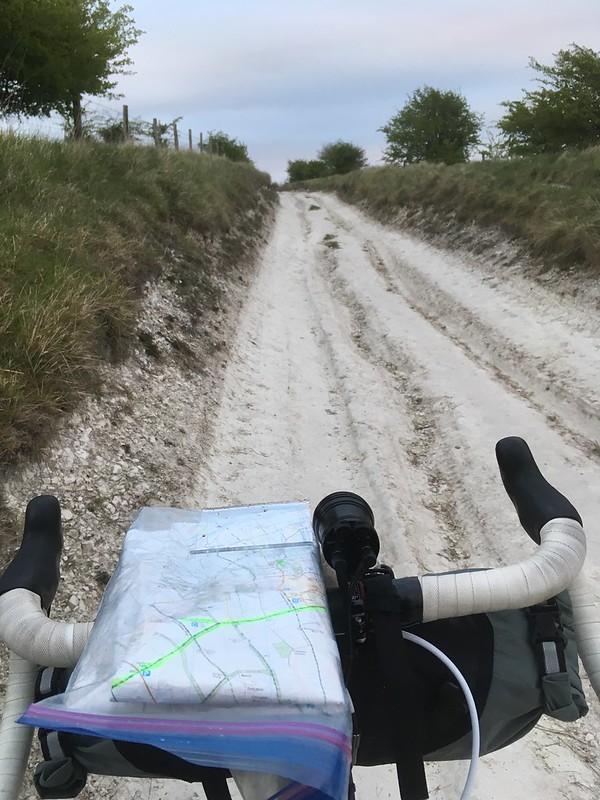 [/img]
Or of course in the pub
[img] 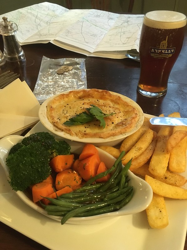 [/img]
If in unfamiliar territory memory map print on a4 in a slippery fish, route on garmin and memory map on phone, garmin usually enough though. I also carry co2, pump, inner tubes, patches and tubeless repair anchovy kit.