![]() You don't need to be an 'investor' to invest in Singletrack: 6 days left: 95% of target - Find out more
You don't need to be an 'investor' to invest in Singletrack: 6 days left: 95% of target - Find out more
So rode the red & some of the blacks at Llandegla today with a mate.
I used my Lezyne Super GPS and my mate used his Wahoo Element.
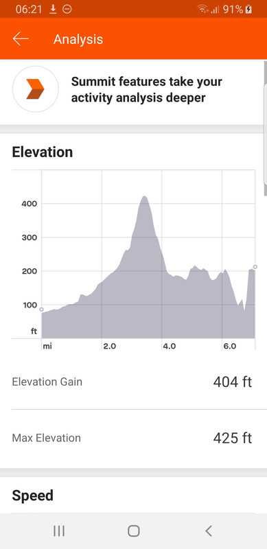
Distance measured is pretty close on both but elevation is different by about 500ft.....
My Lezyne shows 1100ft and the Wahoo 1600ft.
Why the discrepancy?
I appreciate that if it uses barometric pressure that can be effected by weather but wouldn't have thought it was that much.
I think it's just a "feature" of using barometric pressure to estimate elevation mate.
I have same Lezyne, click blue elevation figures on ride summary page on Strava and select correct elevation.
I have this with my wahoo bolt, it'll often show me as below sea level. Strava correct elevation normally sorts it out.
Thanks all - Strava correct has changed it to 1471ft now which is a fair bit closer.
If the air pressure changes during your ride eg a front coming in, the barometric thing can end up being quite out at the end of a day as the air pressure can change a few 100 mb during the day, so you'll gain or loose a load of height.
I'm keen to find the 'correct elevation' function, but can't see it. Do you need to be on a computer rather than the app? Or need Summit? Or am I just looking in the wrong place?
 I'm keen to find the 'correct elevation' function, but can't see it. Do you need to be on a computer rather than the app? Or need Summit? Or am I just looking in the wrong place?
Not sure on the app, try logging in via the webpage (might have to go to the desktop site not the mobile page). It flags the elevation figure with a little symbol if its suspect (i.e. uncorrected).
Feet! What century is this?!
@Spin - indeed!
On the web page on a desktop computer when you open up the activity underneath the figure of elevation gain is a link with the text "Elevation(?)" click that it brings up a pop-up with a button to correct elevation. There's also a link to this help page - https://support.strava.com/hc/en-us/articles/216919447-Elevation-for-Your-Activity
generally the "error" on gps for vertical is twice what the error in x,y. Your x,y will be +/- say 2-4m generally, vertical could be up to twice the error. This i understand is corrected in strava when it overlays actual terrain. Log into the website and there is a gps correction button as above.
Katies Lezyne Super GPS seems to consistently underrecord distance (by about 10%). My Garmin is “accurate” and her track gets corrected in Strava.
Haven’t looked at her climb figures but my conclusion is that the Lezyne is a bit crap....
(My Garmin 130 has barometric alti. Functionally seems less useful than gps to me - unless you correct it manually EVERY RIDE the “actual” figure is junk. Surely it could automatically calibrate using gps and be c5m out rather than 100m out?)
The Super GPS will allow you to start recording an activity with 2 of the 4 GPS dots checked IIRC, but its elevation and distance accuracy improves if you wait until you have 3 or 4 dots (which often means needing to have the unit turned on a good ~5mins+ before you plan to set off).
These days I always correct elevation and distance, the former rarely changes by more than ~500 feet, the latter very rarely changes by more than 0.5 miles over rides of typically up to ~65 miles and up to ~5000 feet. A few of the lanes I ride have a dense canopy of tree cover over them, so the GPS lock gets weaker in the summer months.
For ~£95 in promos, the amount of features you get are far greater than I'm aware of for similar price Garmin/Wahoo etc. units. My only real critisism of it as a non-racer is the auto-correcting navigation when paired to my mobile has been an absolute lottery since they released firmware updates from around Jan 2018, when they began to get ready to release the Mega XL model (which has offline mapping and a huge battery).
It's also worth mentioning that Strava's elevation data is still changing, the altitude of some hill lanes I climb has been tweaked several times over the last few years.
If you follow the link I provided then Strava note that if your traced route varies from that actually taken (which is mostly likely in tree cover) then you'll get the elevation data from those points not those on the track.
I've two Garmin devices: an Edge 520 and an Oregon. For the same loop that I've ridden lots so have a good idea of the true amount* of elevation gain the Oregon will give a higher figure and the 520 a lower one. Once uploaded to Strava they are corrected and will usually then be within a couple of metres of my historical average.
As @yetidave says, measuring altitude via GPS has a higher margin of error than lat/lon. The fundamental reason is that you need a minimum of four satellites to be able to work it out rather than three and those satellites need to have a degree of separation and not be clustered in the same part of the sky - the satellites are all in slightly different orbits so their distribution varies from minute to minute.
*If I went geeky and plotted the frequency of the elevation gains then I'll get a standard distribution curve around a figure that's going to be close enough to the figure you'd get if you went out with a theodolite and measured it that it's not worth arguing about.
Here's another thought - could the auto pause feature bosh it up?
Mine seems to randomly pause especially on steeper climbs where I'm usually fairly slow - more of a spinner than a grinder.
Thanks. Will have a look when I next get to a computer.
What's wrong with feet?? I like to see my distance progress in miles.
Right, off to start another thread in my search for a hardtail five hands high and with a reach of one cubit.
The Super GPS will allow you to start recording an activity with 2 of the 4 GPS dots checked IIRC, but its elevation and distance accuracy improves if you wait until you have 3 or 4 dots (which often means needing to have the unit turned on a good ~5mins+ before you plan to set off).
These days I always correct elevation and distance, the former rarely changes by more than ~500 feet, the latter very rarely changes by more than 0.5 miles over rides of typically up to ~65 miles and up to ~5000 fee
That really shouldn’t make much difference to total ride distance. Katies will be typically reading c40Km when mine is reading 45km for the same ride.