
With the SUW passing nearby we often find ourselves riding short sections on our rides (Galloways and Lowthers) so we thought it might be a jolly idea to ride the whole 215 mile length.
We (me and girlfriend Jill) are very much NOT bikebackers these days so will be riding stages as day trips or weekends as time allows and to keep logistics easy it will be out and back from the van (I guess that means we are actually riding both ways!). Might take us 1-2 years or more but there's no rush - just a great way to see our local wild spaces.
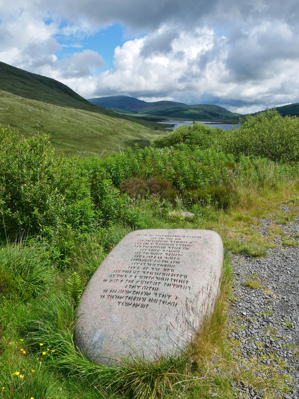
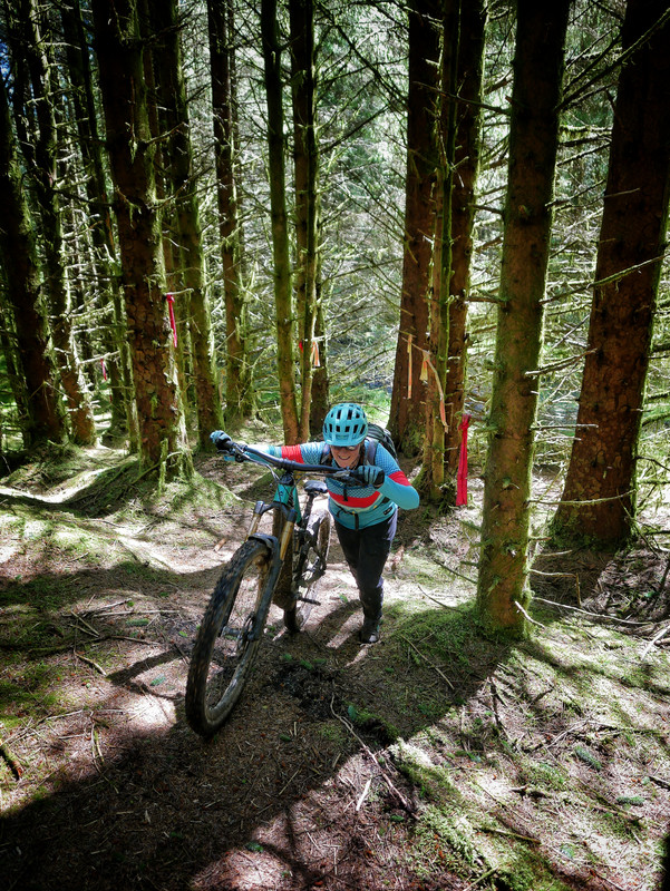
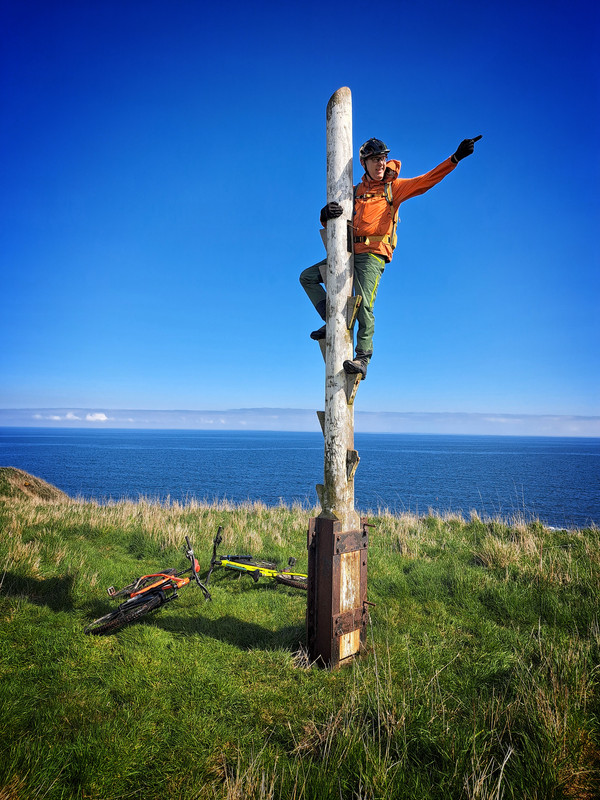
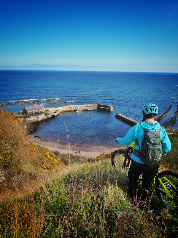
Started Saturday with a corker of ride between Portpatrick and the Caves of Kilhern (then back).
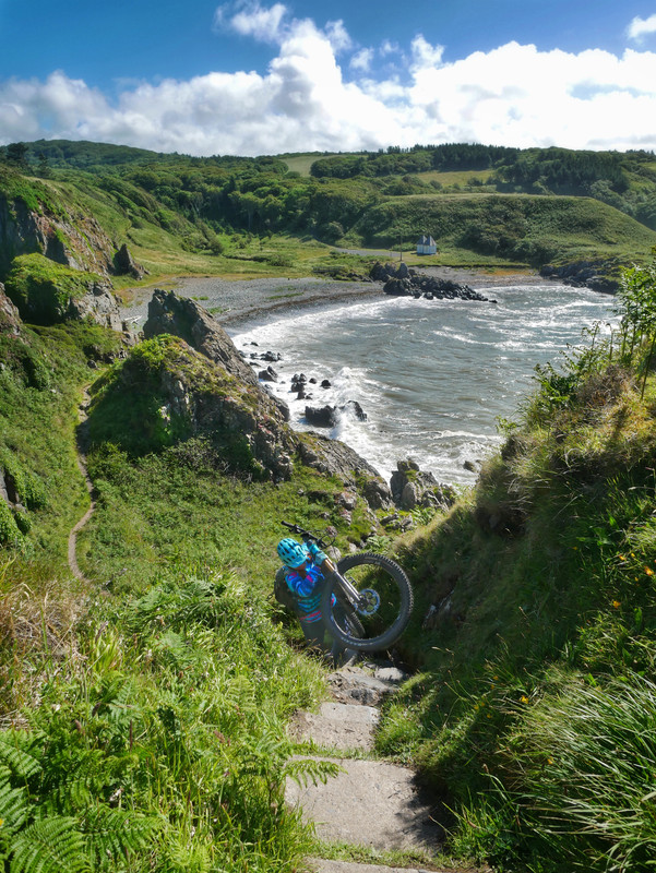
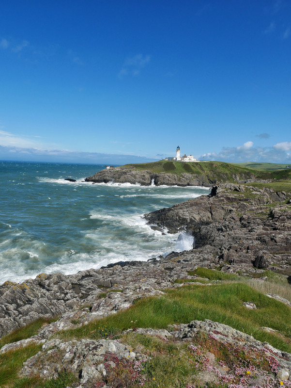

Looks stunning!
my mate used to live in that lighthouse and i lived in new luce so cycled up to the caves many times. ace.
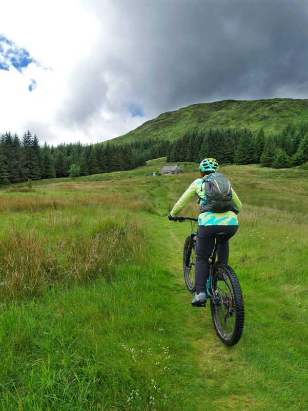
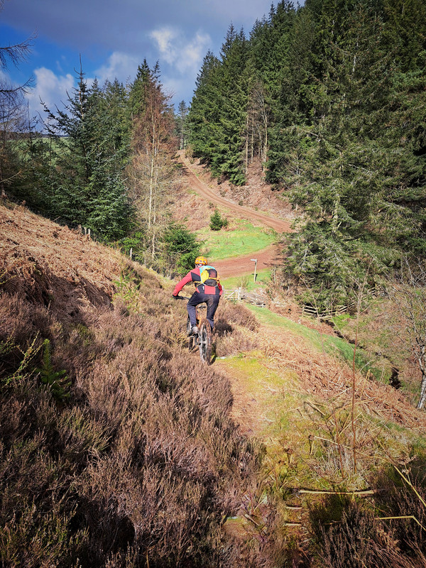
So we're not necessarily doing the 'stages' in order... with todays section taking us between Glentrool and Dalry (St Johns Town of Dalry to use it's Sunday name) then back. Big amount of gravel using a chunk of the 7 Stanes Big Country loop then a nice wild singletrack section from Clatteringshaws Loch over to Dalry.
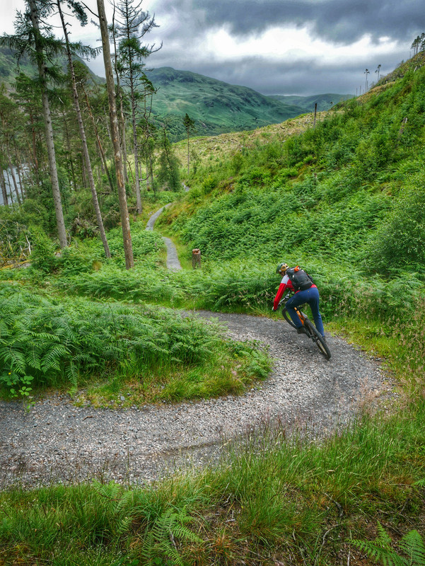
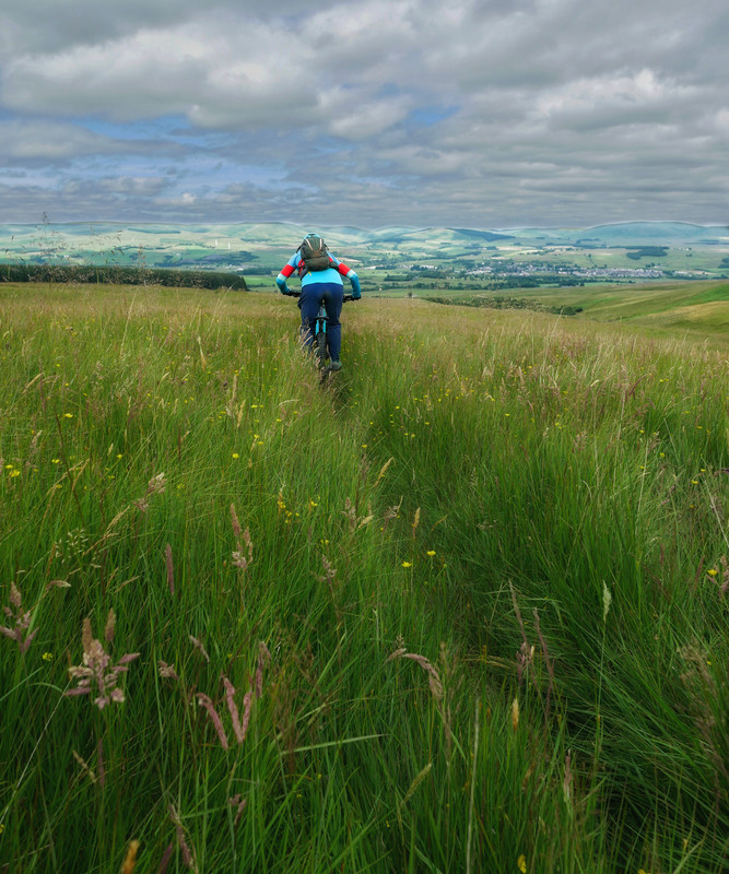
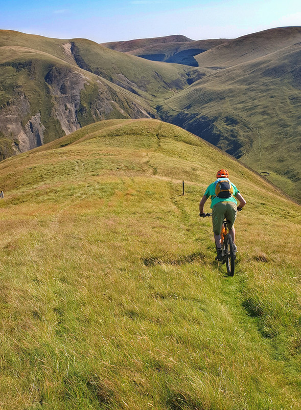
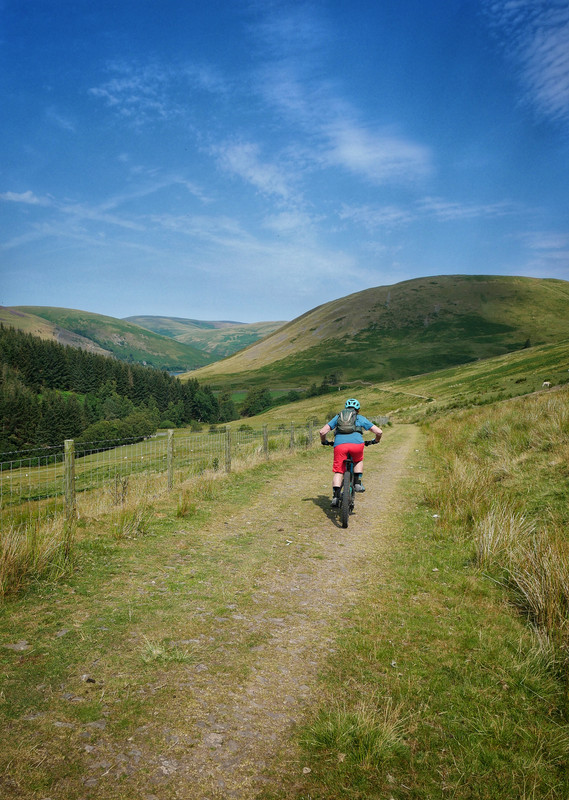
Managed to syncronise a couple days off together so we got the bikes out for a really picturesque section of the SUW from Bargrennan over to the head of Glentrool, returning back around the loch. Some long lengths of tricky, narrow singletrack along the River Cree and Water of Trool.
Wildlife highlight was heading around a tight corner and coming face to face with a sizeable Sika stag in all it's antlered glory.

Nice, great memories of doing similar on foot as a kid, not so great memories of Bog Wood on the Glentrool section 😆
@squirrelking I suspect a lot of work has been put into the paths around Glentrool area in recent times as they mostly seem fairly robust with only the occasional squelchy hole (this time of year).
I imagine so, I can't remember if it was even part of the way or if there was a navigational error involved, we were supposed to be doing part of the yellow then part of the white walk. Needless to say it lived up to its name on the wrong side of the equinox.
Bookmarking this thread
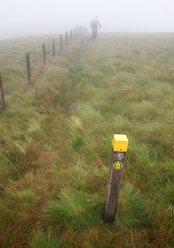
Back tracked a little for our next section - New Luce over to Bargrennan (we actually did Bargrennan > New Luce > Bargrennan). It was a bit tougher and we can see why a lot of hikers hate it as it is a "bit moist" in places and the trail becomes indistinct. We didn't have any navigational issues as could see most marker posts away in distance but would be a bugger in poor visibility.
One of the 'indistinct and moist' stretches...

Beehive Bothy

Craig Airie Fell
When you come to do the Sanquhar section you could get the train up from Dumfries and cycle back via Ae forest. You go into the forest rather than dropping down into Beattock/Moffat. There are a few big hikes. First one is just out of Sanquhar over to Wanlockhead with a good descent into Wanlockhead. There is a cafe at the Lead museum. The next section probably best to avoid is the trail up to the radar station and take the road up,massive climb. However the section from the radar station is another section best avoided and go down Enterkin Burn which is/was a vague sheep track marked on the map by a black dotted line. Then join the Dalveen Pass. The section up from the Daer reservoir is another big horrible hike(although there are turbines in that area now so not sure about that) I have not ridden the part after the Daer since the wind farm was constructed but I think there will have been a few changes. Some friends are doing Dumfries to Innerliethen soon. You will probably find some of my photos and other stuff on here if you do a search
This has been very inspiring! I shall keep an eye on your progress. Like you whenever I have done a bit of the SUW , I have thought I should have a go at the lot but being time limited, your way of doing it seems the most likely.
Nice!
If your down near Newton call in or your welcome to stay!
Urgh! that New Luce -> Bothy section is aweful when even the tiniest bit wet. I love that they built bridges. Do not love that the bridges are 10ft inside the pools of water! And as you said in a lot of places no sign of where the path is meant to be!
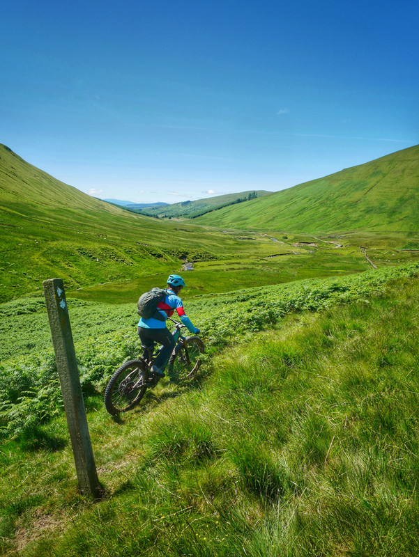
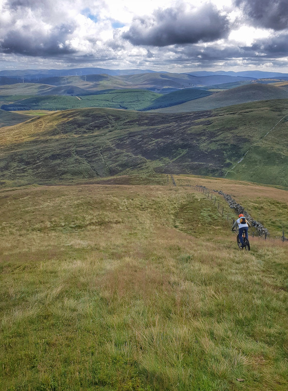
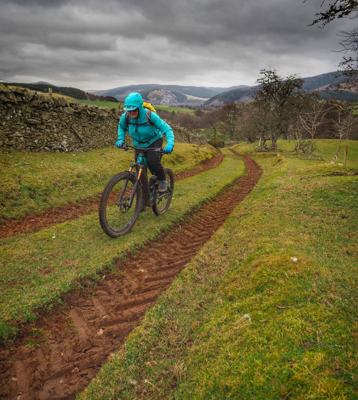
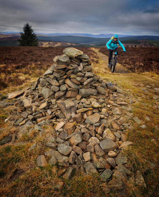
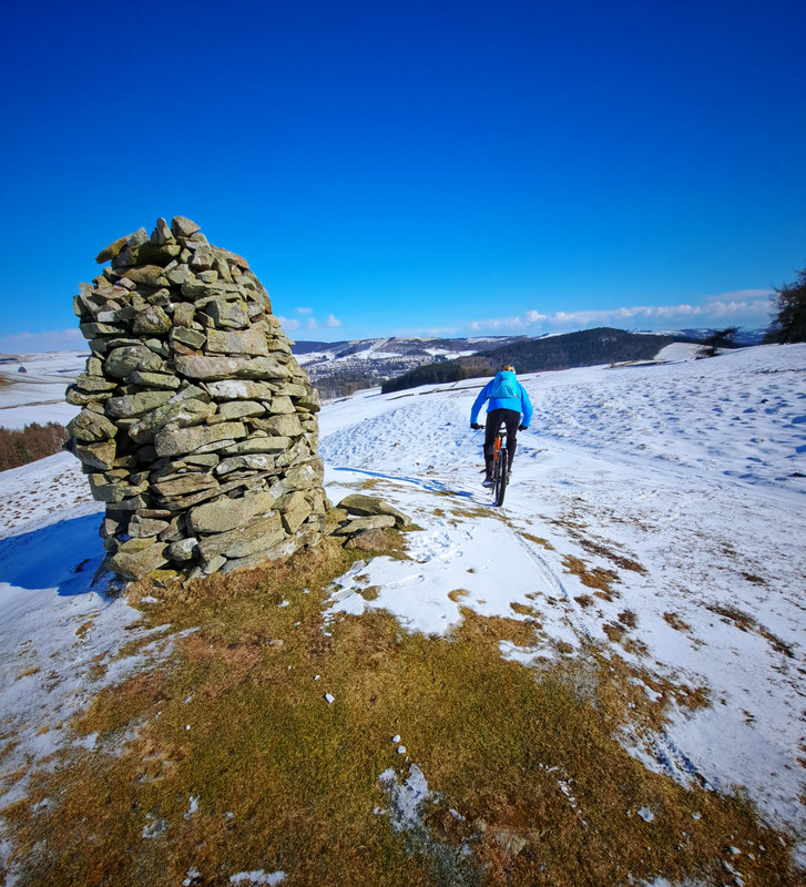
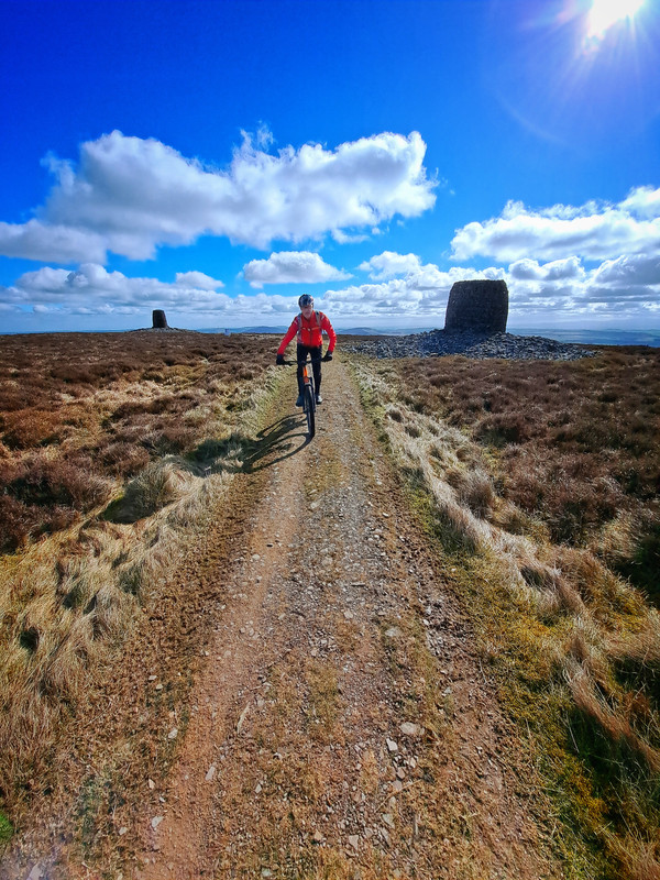
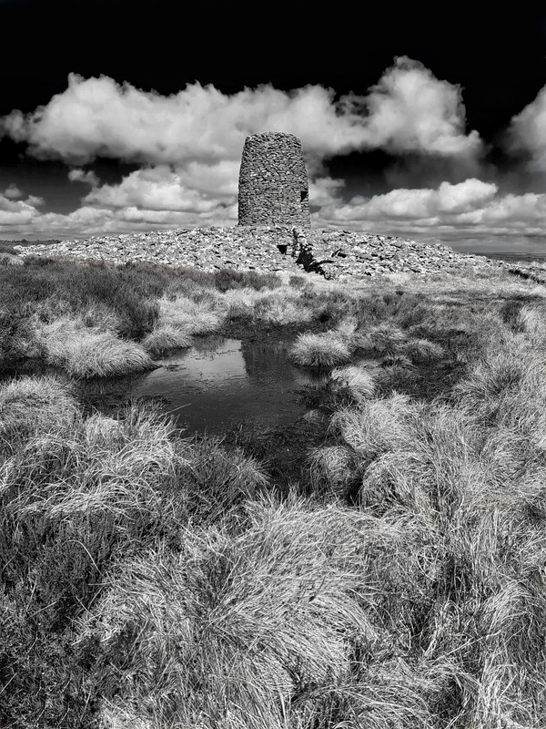
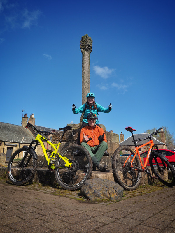
Saturday turned out rather nice - started at St John's Town of Dalry (Earlstoun Power Station) and made our way over farmland and open moorland to Stroanfreggan with its cairn and bowling club. Turned around and headed back - finding it enjoyable riding the trail in reverse - different views, climbs, decents.

Typical of the terrain we are riding at the moment...
The Stroanfreggan Indoor Bowling Club
Thanks @Trekster, we have ridden the section from Sanquhar over to Wanlockhead a few times as part of various loops in the Lowthers (we are up in Cumnock). We have also ridden the section down to the Dalveen and actually rather enjoyed it - combined with a blast down the Roman road to Durisdeer - maybe it was the church tea that I enjoyed!
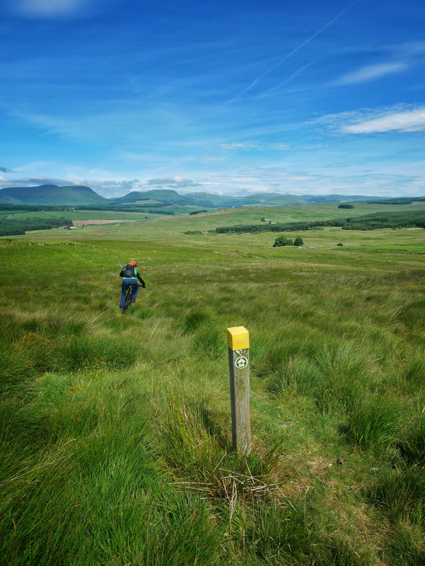
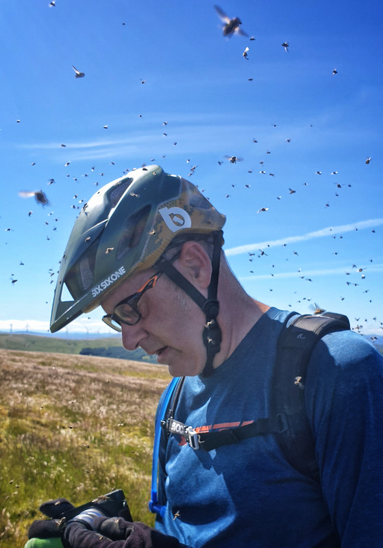
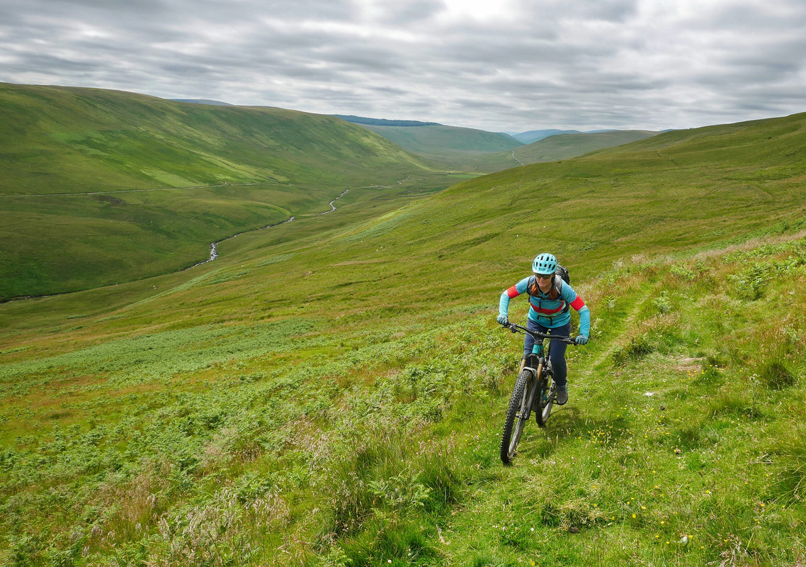
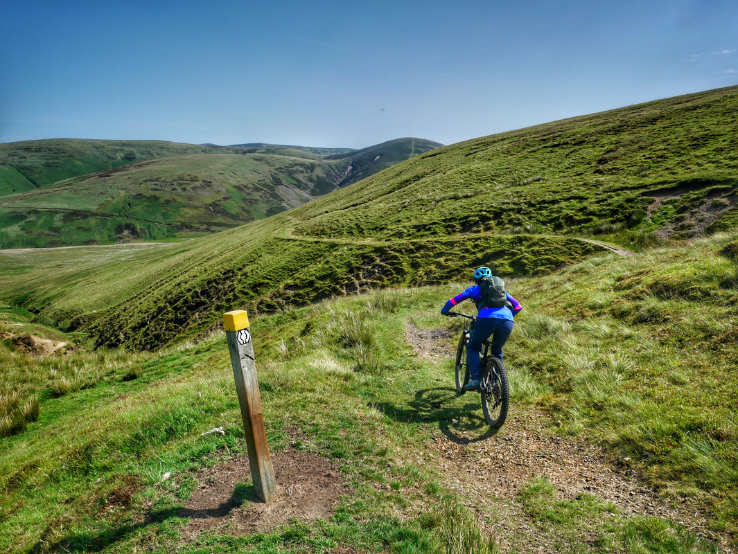
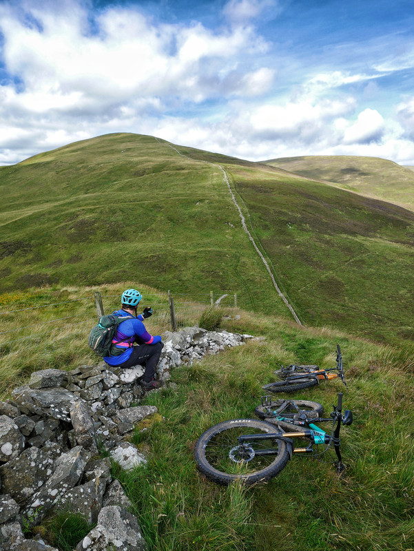
With our regular Sunday group ride cancelled we decided to carry on the SUW with a leg from Stroanfreggan up to the Striding Arch on Benbrack (and back). We knew things were getting a little tougher now with bigger hills but what we hadn't prepared for was (cue dramatic music) - the flies!
They started appearing about 4km into the (8km) climb and then the swarm just got larger until there were hundreds. If we stopped momentarily then you immediately had a seething carpet of flies covering your helmet, backpack, gloves, bars. We both had Smidge on so they never seemed to want to land on our skin - just everywhere else.
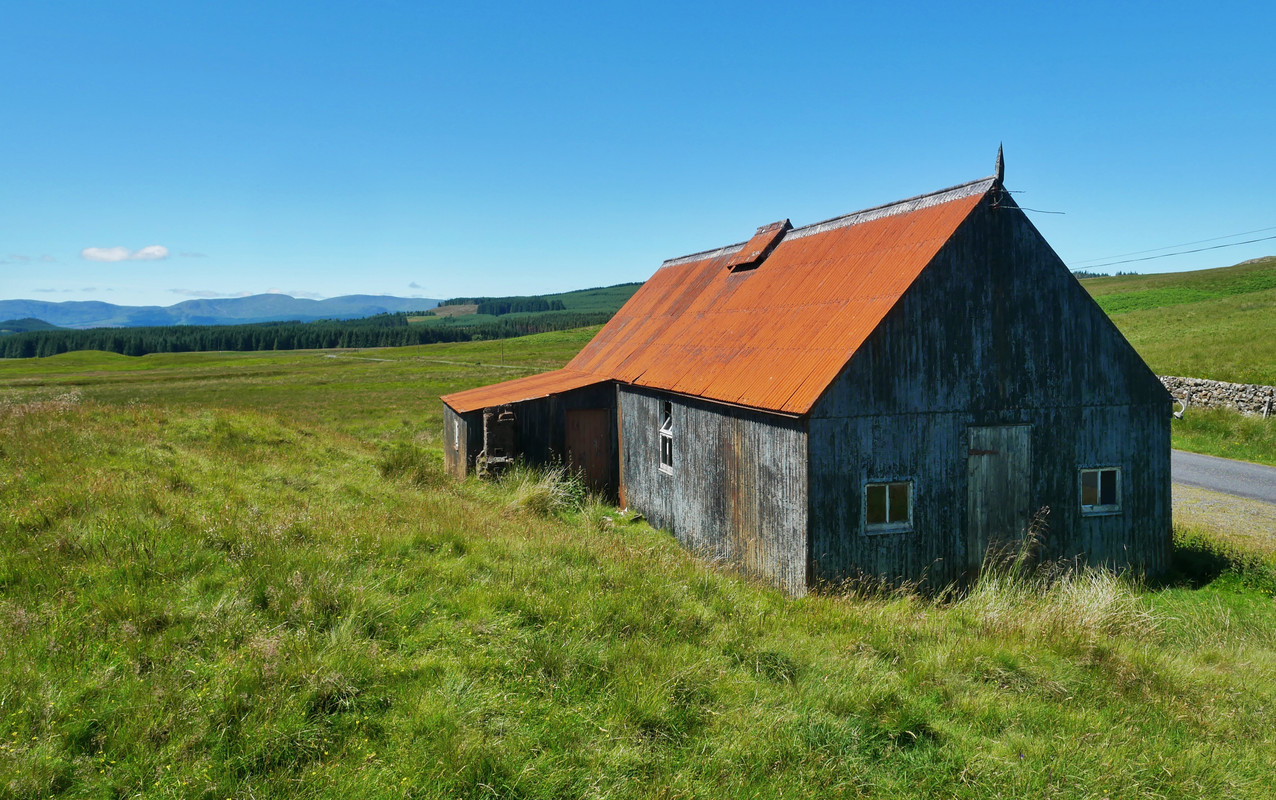
On reaching the top of Benbrack, the out-n-back plan was dumped and we dropped down to the Polskeoch Bothy and back along the quiet valley following the Water of Ken.
Riding away from Stroanfreggan...
Minging...
All smiles down in the valley...
The alternate route back wasn't too bad either....
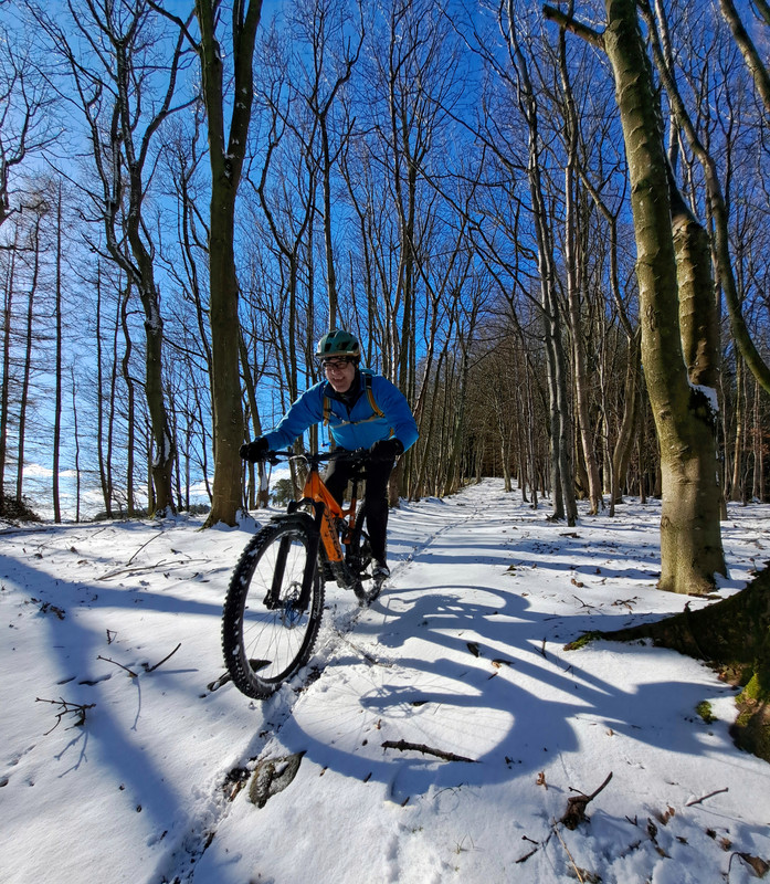
Despite this being our "back yard" we had never ridden the section of the SUW from the Polskeoch Bothy over to Sanquhar - mistake corrected. We 'looped' this time, up the Euchan valley then back down the SUW including a tasty 8km of single-track taking us over Cloud Hill and a long descent back to the van.
Good thread! as a local now living abroad (yorkshire) I've harboured a desire to bikepack the SUW for a few years now, but keep finding other things to do with fewer tussocks, bogs and clegs. If you keep posting lovely pics I might just find the inspiration! keep it coming....
tussocks, bogs and clegs
Describes the Galloway section to a Tee. The midges give me The Fear an aw.
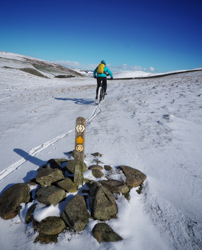
With us getting a long weekend for the Glasgow Fair, it was back up in them hills again - this time taking the SUW from Sanquhar up to Wanlockhead on the 'summer' route then returning back down the 'winter' variation.
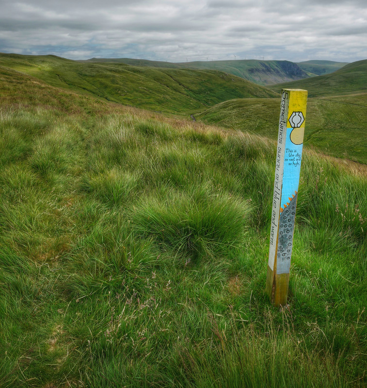
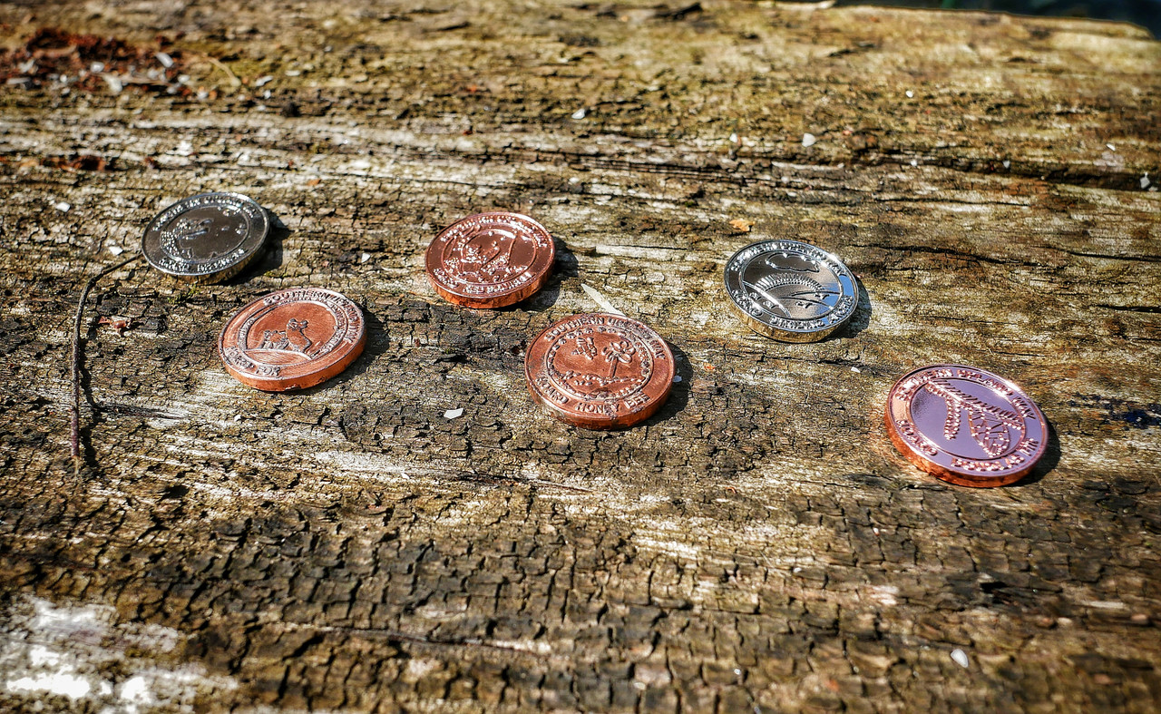
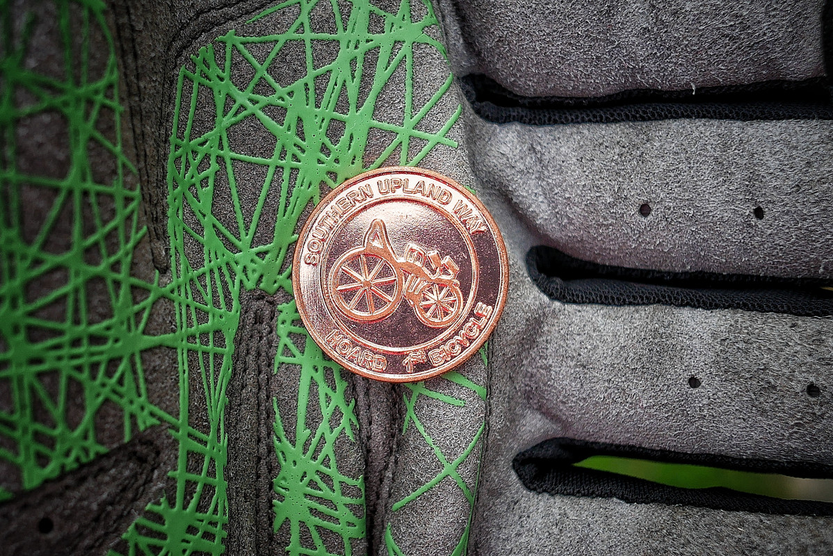
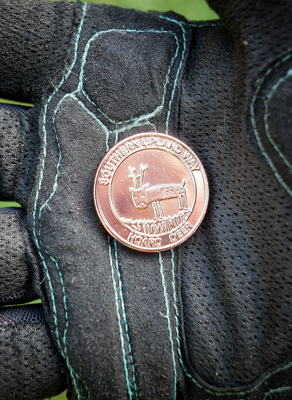
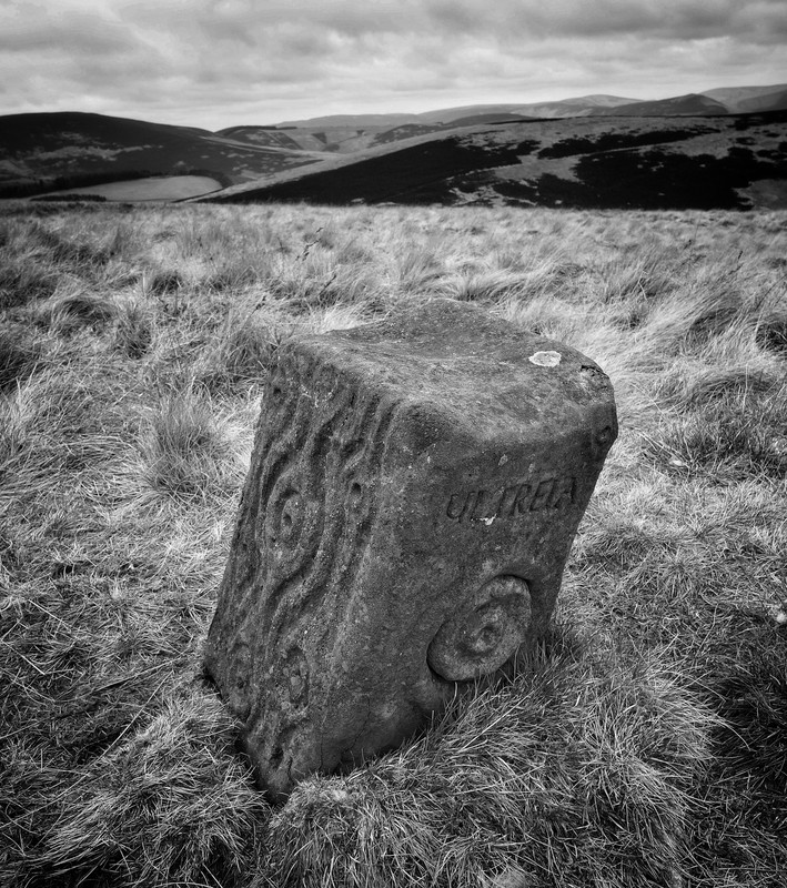
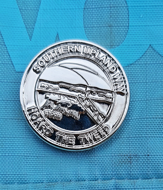
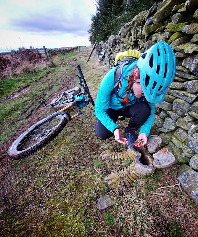
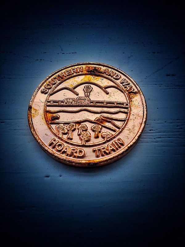
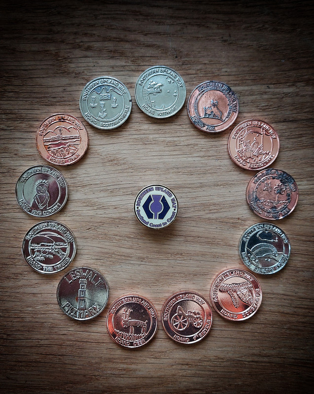
Managed to bag another of the Hoard coins - these are specially created medals semi-hidden at 'cists' along the entire route - usually in fairly remote locations on the SUW. 13 in total. Their locations are not pinpointed but you get an indication on a waymark post that you are near and then you keep your eyes peeled.

Good thread wmgscot, think you must be cheating with those coins though.😀
Looks amazing. Looking FWD to the next instalment.
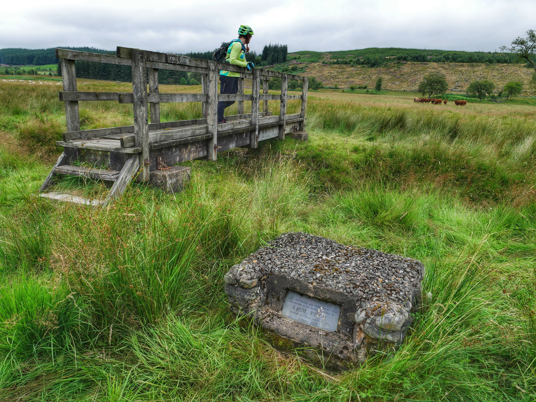
Work plans aligned and we were able to get out in the hills again and continue our adventure. Our goal Saturday was to head from the Dalveen Pass over to Beattock then back. It started OK but, as can happen, the weather got a bit manky as we headed up from the Daer Reservoir.
We reached the Brattleburn Bothy after some cracking singletrack but decided to call it a day and retraced our route back... only for the weather to cheer up!
We had a half-day Sunday so parked at Beattock and rode out to the bothy along the SUW then back and on to the foot of the next big hills west of Moffat.
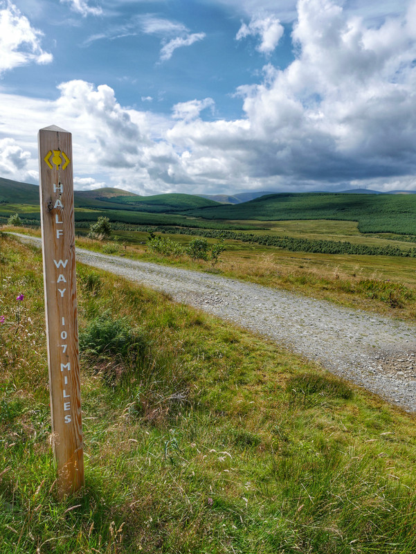
I'm not really one for stats but, as we have passed the 107 mile 'official' half-way point, Jill totted up the rides from her Garmin app thingy and we have managed to ride 396Km and 7200m height. Its been great so far.
Halfway
Climbing away from the Daer Reservoir
Returning down to the Daer Resrvoir
Foy's Bridge
Great stuff.
Was on the SuW last night near glentrool damn it's overgrown at points!
What section was that @duncancallum ? Along the Minnoch (Roman Bridge)?
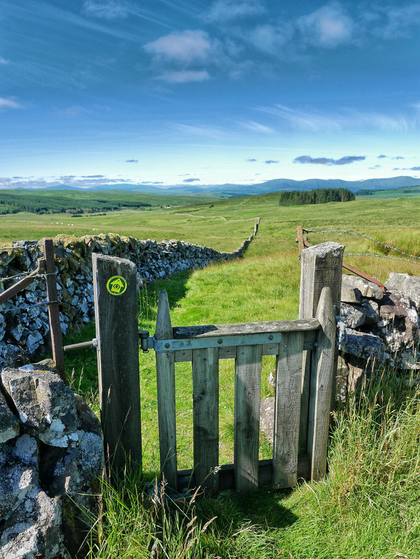
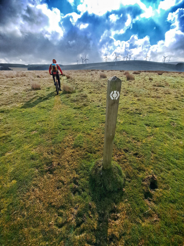
We have found most of the SUW fairly well cared for by the two D&G rangers but I can imagine the continuous mowing is a big struggle this time of year. Loads of old kissing gates have recently been upgraded to bike/horse friendly types but there are areas where a bit of portage over styles is required.
Yeah by the bridge. It wasn't too bad a couple of points where the ferns had closed up. Still passable but you couldn't see the path.
So overgrown I couldn't get the bridge however
[url= https://i.postimg.cc/8s1JpDHk/IMG-20220808-201305-958.web p" target="_blank">https://i.postimg.cc/8s1JpDHk/IMG-20220808-201305-958.web p"/> [/img][/url]
That's the main path not the bridge.
Tbh I'd not fancy strimmerimg this all summer it grows like mad
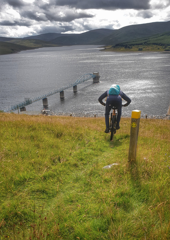
Back up to Wanlockhead for the chunky section down to the Dalveen Pass, and what a day for it! We made a loop by following the road into Elvanfoot then climbed back up on the old Leadhills to Elvanfoot railway track bed. Brucy bonus was another Hoard coin.
Climbing away from the highest village in Scotland

Rules
Big climbs mean big dscents
Snack break
Reward
Some fantastic photos above. Myself and three mates have been walking the SUW a section at a time, Beattock to St Mary's Loch last Friday being the most recent. 21 miles and didn't see another soul all day. Glorious.
That's our next section @kennyp - did you take the 'high' route option over Gateshaw Rig and Croft Head and do you think it is do-able on the bikes?
@vmgscot Yes we did take the high route option. Very scenic. To bike it you would need to be extremely good at climbing, and brave/skilled/daft at descending. I'm none of those. It could be done I guess but personally I'd do the lower bit if I was on a bike. Most of the rest of it is very bikeable though apart from a couple of short pushes towards the end.
I think this section has to be my favourite so far, the trails and the scenery made it pretty special - and the weather didn't hurt either.
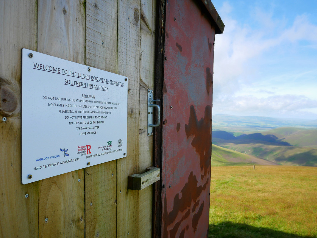
Headed out of Beattock and climbed into the hills following the new 'high' route (thanks @kennyp for the heads up 🙂 ) - absolutely stunning. Headed on to the bothy at Over Phawhope then headed back but along the 'low' route for variation. Located and collected another Hoard coin.
The High route option
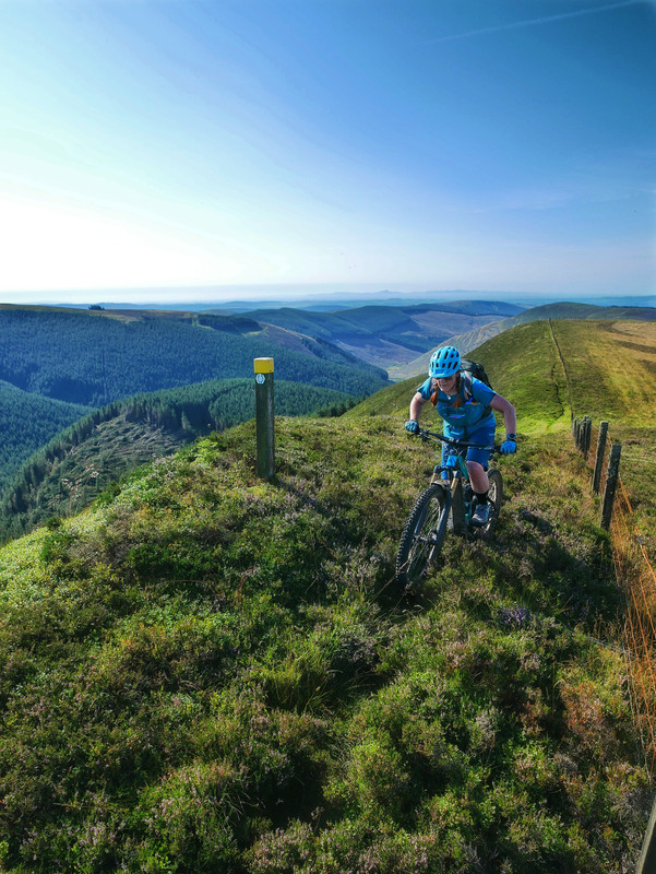
About to descend off the Cat Shoulder
SUW Artwork

Was a stunning day for the ride
Another little reward for our efforts
Managed to put a loop together for our next stretch. Started out from St Mary's Loch (my god, what a hideous circus the camping there looks like this time of year) and followed the 'Captain's Road' drove route over to the Ettrick valley.
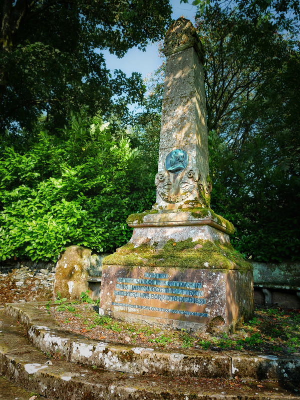
Immersed ourselves in a little literary culture (the birthplace of the 'Ettrick Shepherd') before back on the SUW from Over Phawhope bothy to St Mary's Loch.
We're back on it!
We have been desperate to get back out and re-join our little adventure so with a forecast of "no rain" and an alignment of work time we were able to make our way over to the Loch of the Lowes and back on the SUW trail.
This stage took us from Tibbie Shiels over the hills to Traquair. A strong cold headwind on the entire outward leg dispelled any silly notion that Spring might be here but helped propel us once we had turned around at the village hall and headed back over. Collected another of the SUW coins for the collection.
Kist
Climbing away from Traquair
I can see the van...

I hope to spend a night at Over Phawhope bothy this week, was it ok and did it have a stove?
It was 6 months ago we passed there and met a couple of lads doing maintenance on the bothy at the time.
Can't confirm the stove situation but the inside was one of the better bothys we have passed on the SUW this far.
It even had a "toilet block"!
Thanks
There is a stove at over phawhope bothy. Personally I would rather be at dryfehope bothy if you are in that area.
Met @vmgscot on today's leg from traquair to Melrose. Good effort the pair of you. Did you manage the Melrose bakery?
Our busiest leg of the SUW by far!
The trails between Traquair and Yair Bridge seem very popular with all sorts of folk - families, runners, walkers, horsey types and even a fellow member of our very own STW congregation (Hi @onehundredthidiot, we never made Melrose this time). And a little personal nature highlight for me - seeing my very first crossbill - actually a male/female pair just a few feet away.
First time passing this impressive spot so mandatory pic
Another Hoard coin was found
We have passed a few of these so far on our journey
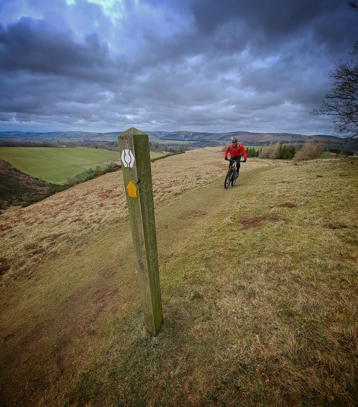
So our plans to celebrate my 60th birthday down in North Wales this weekend were scuppered by the weather - but that opened up an opportunity to further our quest along the Southern Upland Way. This chilly stage took us from Yair Bridge over to Melrose - it was strange that the SUW seems to make a point of avoiding civilisation yet, here we found ourselves, twisting through the town parks, pathways and backroads of Galashiels, Tweedbank and Melrose.
We opted to return via a short recce of the Borders Abbeys Way (possible future riding) to Lindean then down to Sunderland Hall and back along the Tweed.
Heading away from Yair Bridge
Descending down to Galashiels
With our usual Sunday group ride decimated by Mothering Sunday obligations, we decided to pick up the "Roman Road" section of the SUW from Melrose to Lauder with a slight variation on the return. Found another of the Kists (searching becomes an obsession) and another Hoard coin for the collection - 2 to go.
The biking and scenery has definitely changed since reaching the Tweed Valley - much less "out there" and more rural farmland.
Jill searches the Kist contents for a Tesco trolley token
Climbing away from Lauder
agree with matt_outandabout brilliant thread.
OP can i ask what bikes you and your wife ride please ?
Thank you for your kind words Gentlemen.
@ton - for this journey we have mostly used our ebikes - mainly because we didn't have a clue what the trails might throw at us and, as ageing weak and feeble types, the ebikes allow us to ride pretty much everything rather than substantial chunks of hike-a-bike otherwise. Jill has a 2020 Merida eOneSixty and I have an alloy Orbea Rise and we use them in their lowest "tunes" to eek out battery life.
Might be 2 or 3 weeks before we can get back over for the next section but I am looking forward to seeing the Twin Law cairns.
vmgscot
Full Member
Thank you for your kind words Gentlemen.@ton – for this journey we have mostly used our ebikes – mainly because we didn’t have a clue what the trails might throw at us and, as ageing weak and feeble types, the ebikes allow us to ride pretty much everything rather than substantial chunks of hike-a-bike otherwise. Jill has a 2020 Merida eOneSixty and I have an alloy Orbea Rise and we use them in their lowest “tunes” to eek out battery life.
fantastic mate, thanks for the reply. myself and the wife are looking at buying a pair of ebikes. this kind of thread is very inspiring. cheers.
Managed to take advantage of the religious weekend and made our way over to the Borders for another leg on Friday. We started over at the small village of Longformacus and made our way back over the Lammermuir Hills to Lauder - turned around and headed back again.
Couldn't move for the numbers of Red Grouse, Curlews, Lapwings and many other birds taking to the air and the superb visibility gave us stunning distant views.
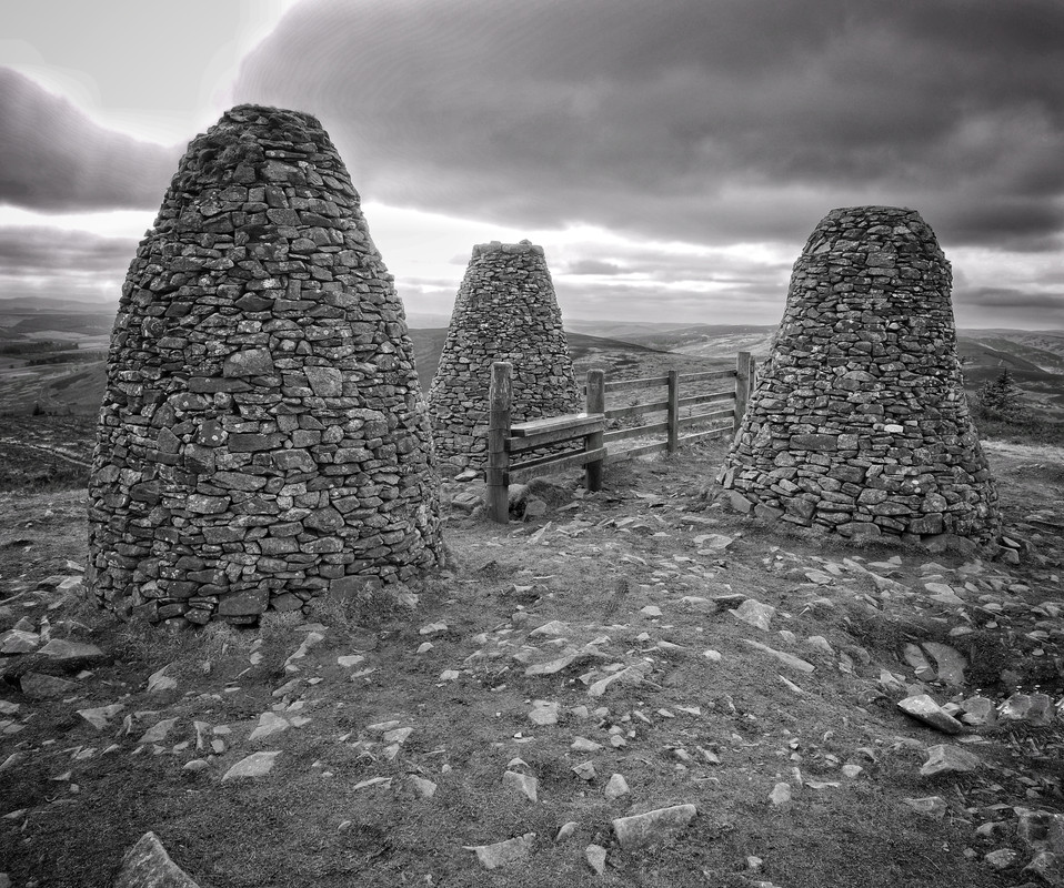
Twin Law cairns
Bagged another Hoard coin - only one more to go
Nice pictures, often cycle up and around SUW and into Lammermuirs as based in Lauder. No homemade sloe gin in the cairns? Used to be a near by local would put one in for the colder months
Brilliant thread! Thanks 🙂 I've done small parts of the route and just got motivated to do some more. Cracking photos!
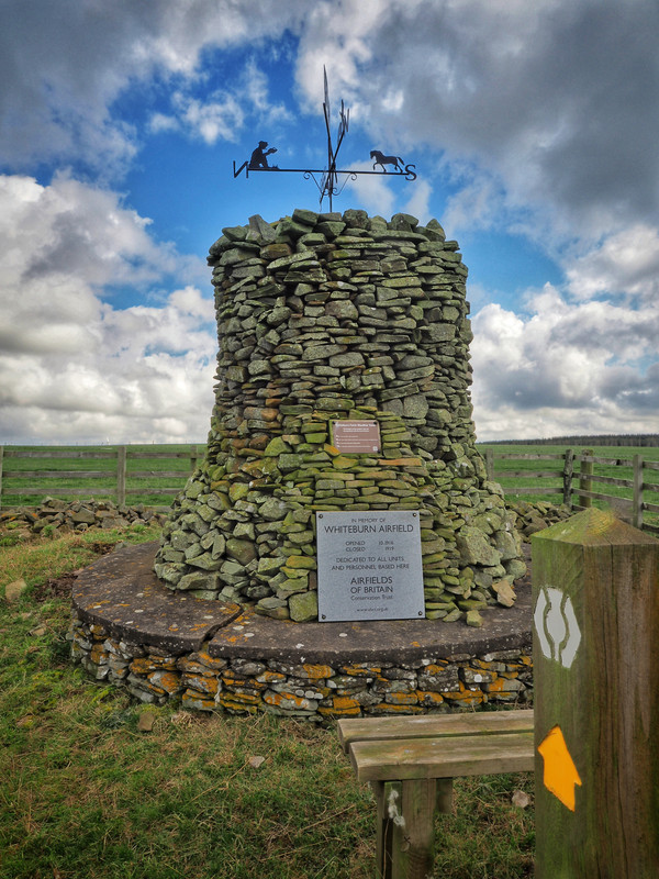
We opted for a cheeky last minute AirBnB Friday night so we could take advantage of the fine weather for another ride. Returned to Longformacus and headed East on the SUW over to Abbey Saint Bathans (apparently the cafe has recently re-opened so bacon bagels all round) then on to Whiteburn Farm and the site of the old WW1 airfield. Turned about and retraced back to the van.
Only one more ride left (we can almost smell the sea air) but it will have to wait.
Heading away from Longformacus
Robbers Cleugh
Whiteburn WW1 Airfield cairn
This feels like it needs a STW meet up to help you celebrate finishing it. I should do some of this, my parents live in Lauder, I spent three years at school in Longformacus and did a couple of summers working near Abbey St Nathans. I have ridden a little of it from Lauder heading east and I've ridden to Inners in the other direction.
@stevenmenmuir - Where was the school at Longformacus - it seemed a very quiet (but affluent) village? I was impressed that they still have a phone box with a working and connected phone inside.
We certainly did a bit more than planned on the recent leg as we bumped into a hiker at the cafe in Abbey St Bathans who we had seen earlier in the day. She explained that she had left a lense up on the trail somewhere so we back tracked up the route and eventually found it a few miles from Longformacus resting on a stile - and have posted it on to her.
We are keeping one eye on the weather and one on our commitments. Hopefully get a couple more snaps and pop our thoughts down on this little low-key adventure.
I also need to ride a bit more of the SUW.
I can almost see one section of it from my house and ride and walk bits of it all the time.
We even use one section of it to walk to the pub.
It was on the corner as you come into the village from Gifford direction. I'm guessing the original building is still there, it's 40 years since I was there.
Well that was delightful.
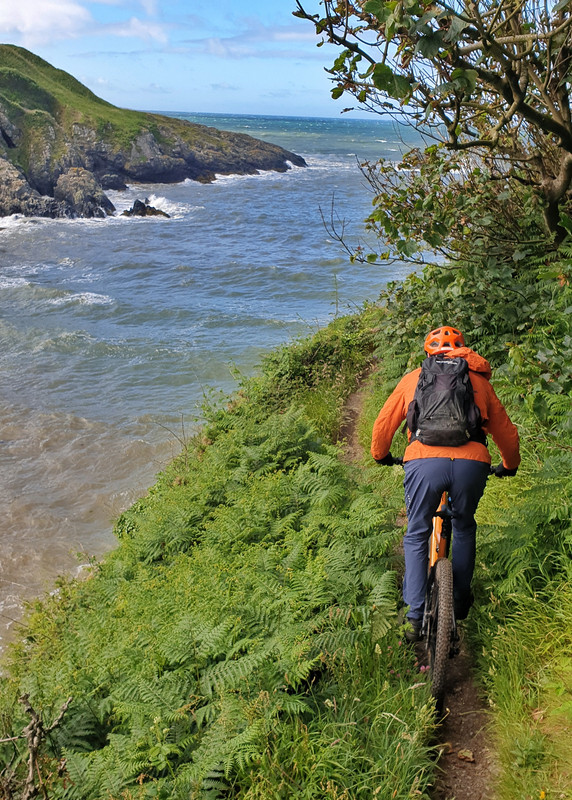
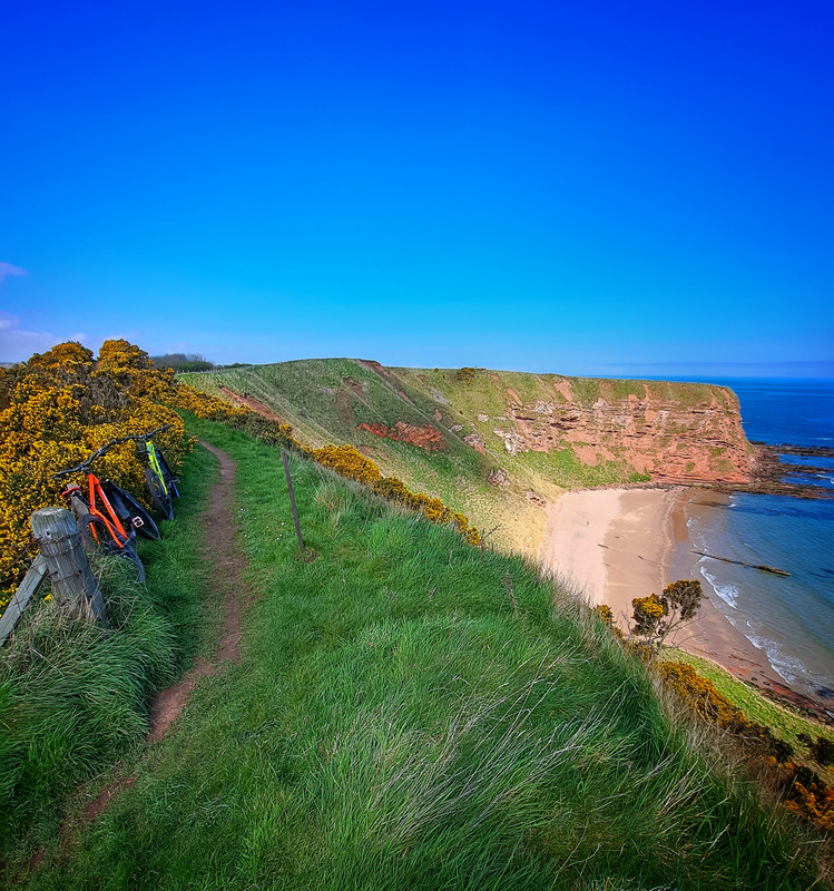
Weather looked promising so we jumped in the van early Saturday morning and pootled over to Cockburnspath to complete the last leg. We made a loop - headed out on back roads to pick up the SUW at Whiteburn Farm before an undulating saunter across farmland brought us to an "exhilarating" dash across the A1 trunk road and a climb up through Penmanshiel forest. There appears to be loads of tasty looking steep trails cut in this wood - anybody ride here? A new logging access road suggests they may disappear shortly.
Dropped down through a quiet but steep sided valley, climbed past a sizeable caravan park then onto narrow cliff top singletrack with stunning views of Cove Harbour (and the slightly less picturesque Torness nuclear power station). Final mile headed back inland to finish at the mercat cross in Cockburnspath - no pub, unfortunately, so had to celebrate with half a limp cheese sandwich from the bottom of the backpack.
I'm not fussed about stats but Jill added up the logs off her Garmin watch and our way of biking this coast to coast route managed to rack up 734km and 13500m ascending. For us, it was never going to be about a test of character or pitting ourselves against anything - just a lovely way to see the wilds of Southern Scotland and we thoroughly enjoyed it.
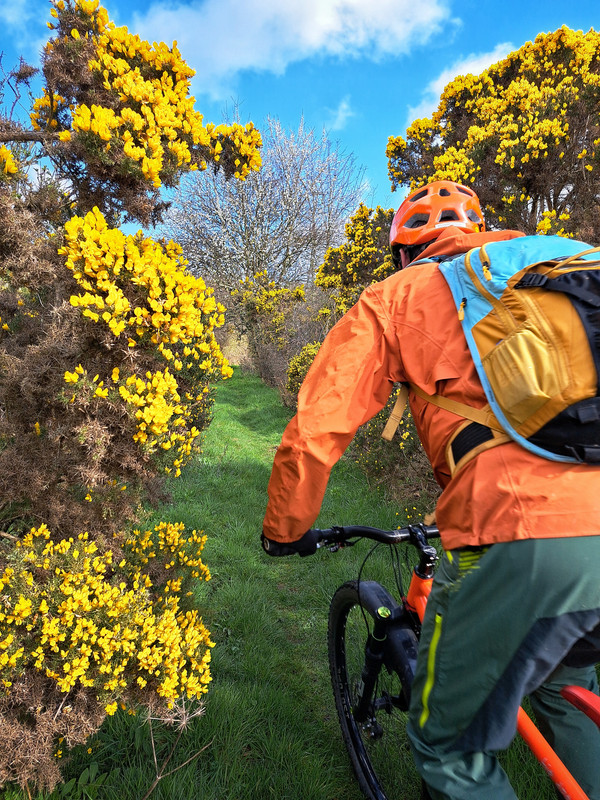
Turned out a lovely Spring day
SUW website says this section is not for bikes - yeah right!
Practicing navigation techniques - in case the Garmin fails
Giant biker or tiny harbour?
And so it ends
Excellent ride - and thread with great pics! inspiration for a possible SUW trip in September.....maybe.....
Penmanshiel forest. There appears to be loads of tasty looking steep trails cut in this wood – anybody ride here? A new logging access road suggests they may disappear shortly.
The road has cut right thru the majority of the trails TBH, the tops and bottoms are still there but IMO not worth bothering unless you're close by.
I swum in Cove harbour last autumn. Lovely but brrrrrr!
Well done! Enjoyed reading this and reminiscing of the time we did it (11 years ago).
We did it in 3 stages over the space of 14 months so I don't think your efforts are the slowest:D
Epilogue - forgot to say that we managed to locate all 13 kists and their contents.
It's a fun challenge but can become an obsession (ask Jill) - we cycled one stage twice in the same day to find one and spent 45 minutes hunting at a location (it was hidden behind a fallen pine bow).
I'm considering giving this a go as a bike packing trip, maybe at the end of summer.
Photos look great 🙂
I'd hoped it would be suitable for the gravel bike but maybe would be better off on the MTB.
Not sure how many days I'd need to do it in either, I'd hoped 4 but just started looking in to it and think it'll be slower going than that.
A mountain bike would be better than a gravel bike (I reckon) unless your bike handling skills are far better than mine. Though to be honest that's not difficult.
A hardtail, or short travel full suss would be fine. Other than a few steep downhills there's not much that's really technical. Just lots of bumpy grass tracks where I think you'd want a bit of suspension, just for comfort, as it's a long distance.
@phil5556 - timely question as a local acquaintance was looking for input from us as they have been asked to design a "gravel" SUW - a bit like the Kirkpatrick C2C they were involved in popping together.
My opinion is that the "easy" East stretch from Moffat to the coast at Cockburnspath is do-able on a gravel bike by those who can tolerate a tiny amount of Rough Stuff Fellowship style of riding.
The West half has a lot more tougher terrain - with a few sections of long wet soft (bordering on boggy) terrain that would mean pushing a loaded bike so slow going. We did these sections on eebs which made them OK for us but they could possibly be bypassed on back roads to make a far more enjoyable "gravel" experience. - I think that is what the new gravel SUW is going to do.
However, this is based on our own cycling prowess and we are in our 60's and weaklings so it may not be as tough for you youngins.
Thanks for that, that might be enough to put me off tbh!
I'm happy to carry / push my bike if it's too steep but the thought of miles of bog & overgrown path doesn't appeal. I reckon you doing it in sections is probably the best way. And I don't like riding on the road if I can help it, so bypassing by road isn't ideal.
I'll go back to my plan of working out how to ride back home to Ayrshire from D&G, there must be a mostly gravel / off-road route I can string together 🤔
Where you starting (D&G) and heading to (Ayrshire)?
We are up in East Ayrshire but one of the good things to come out of the Covid times was we spent a lot of time exploring all the hills on our eebs looking where tracks and trails went so if we can be of help at all just shout. The constant windfarm projects and new pylon runs are changing the available "gravel" routes almost daily - many not on maps or even satellite images.
I’m in Troon and don’t really mind where I start tbh, ideally with a train station.
I like the idea of getting the train down there and then pedalling home over a couple of days. I know there’s plenty of routes in Scotland, would be nice to be able to do something close to home though.
I’m sure there will be loads of tracks but like you say, if they’re not on the map yet it’s difficult to plan unfortunately.