Are you navigatin’? Because we’re askin’. Is modern tech leading to a route finding revival?
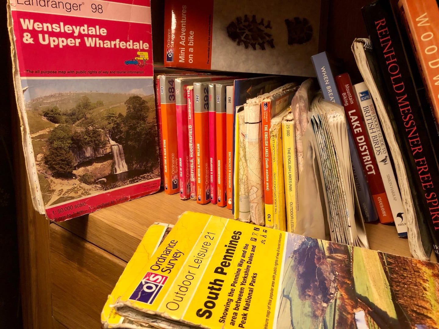
Who remembers the good (bad) old days of mountain biking when trail centres and bike parks didn’t really exist? When the only way of finding new places to ride was following route guides from magazines or books? Stopping every few minutes to unfurl your OS map to check your progress and next steps.
Basically it was a right PITA and I, for one, am glad to see the back of such faff and frustration.
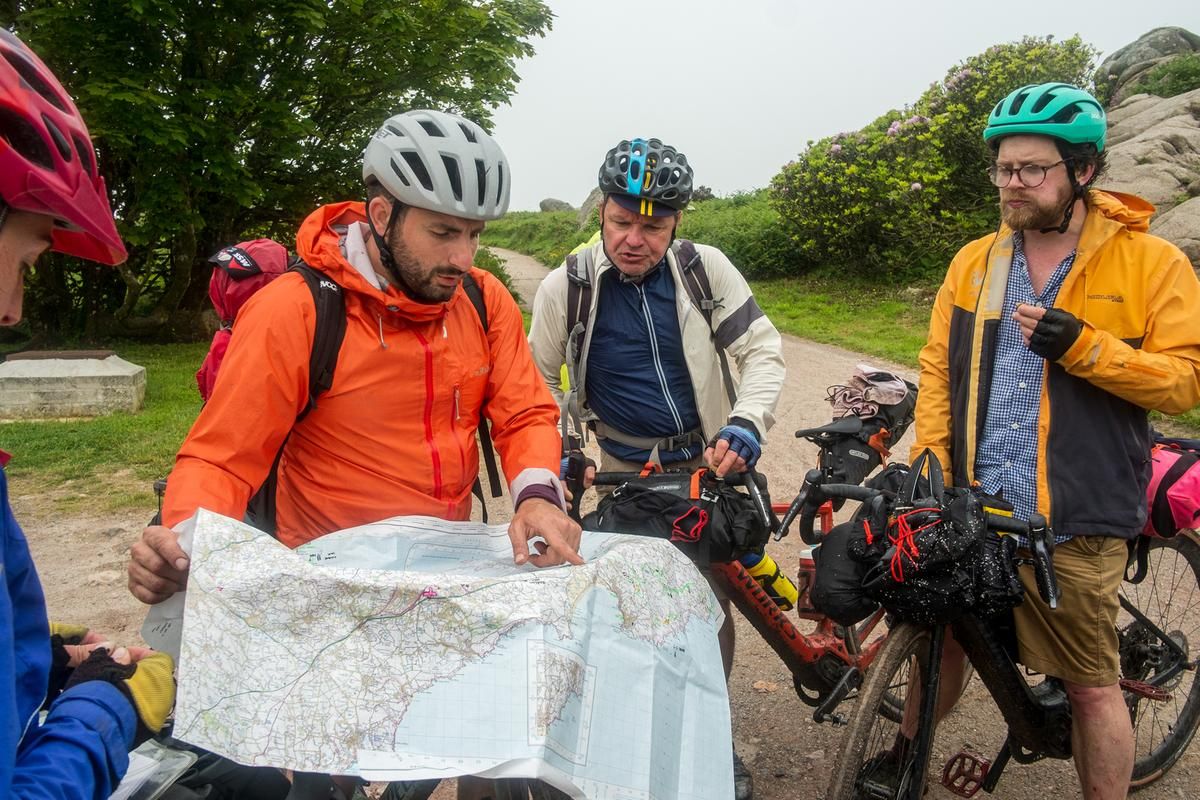
But we all still want to ride new stuff, don’t we? The issue is: how?
Latest Singletrack Merch


Buying and wearing our sustainable merch is another great way to support Singletrack
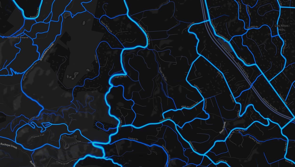
Personally speaking, my main modus operandi for local-ish stuff is scouring Strava Heatmap and using an ebike to have a nosey. If I’m daring to head into territory further afield (ie. a few hours drive away) then there’s a bit more at stake. No one wants to waste their time (and petrol money) on disappointing terrain. This is why we find ourselves riding the same old stuff all of the time! Typically I try to tap up anyone that I know lives near the target area and probe them for pointers to the Good Stuff (they do the same to me).
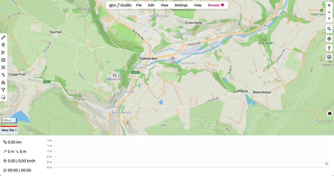
Anyway… once you have got a hitlist of trails – or a complete route – in mind, how do you go about navigating your way on the day? Typically I either create and/or then download a .gpx into my phone and open it in GPX Viewer app. I create .gpx files in GPX Studio by the way.
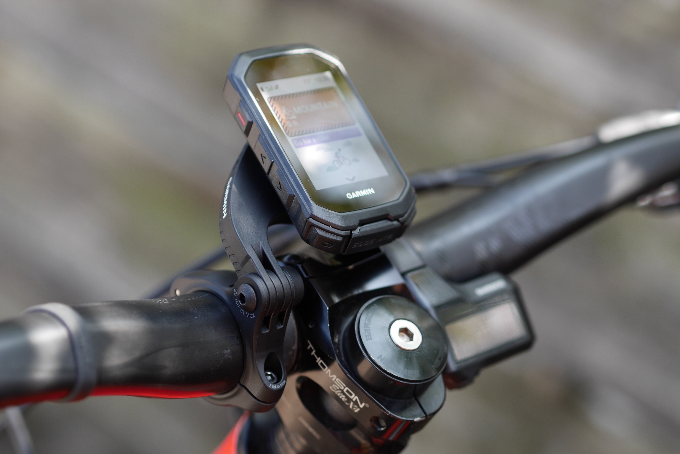
Very occasionally I mount my phone on my stem to reduce the amount of stopping and faffing to get phone out. I have also just got a Garmin Edge MTB to try out, which looks promising. There are also GPS watches as an option, which some people are fine with but I have concerns of route legibility and battery life.
How do you do it?
Over to you. What are the ways you find – and follow – new places to ride? Or if you don’t, do you want to? What sort of info – and technology – would you be interested in? Has the era of ebikes had an effect on people’s willingness to explore new stuff?
To relate to stuff we’re talking about in Singletrack HQ, should we think about bringing back route guides? How about tagging photos with their location (Google map pin? OS grid ref?)
Please leave your comments below. Ta!

I tend to mostly ride enduro type stuff, so It’s a combination of Trailforks, Strava segments and other peoples recent rides on Strava (like el_boufador I’ll look for a top 10 rider on a segment and look through their recent rides).
Komoot’s my go-to and has been faultless for 3 years of use for MTB, gravel and hiking.
I still have a bunch of olde worlde guidebook printed on paper and everything, mostly the V-Publishing ones. I find them and OS mapping a pretty good start with the potential for, you know, looking at the map and adding/removing bits. Mostly trails and routes stay broadly the same over time. On top of that, there’s a thing called google I sometimes try: ‘Best mountain bike routes in Milton Keynes’ that sort of thing, which take you to assorted mapping / route resources, where mostly all I want is to download a GPX.
I find it really hard to get massively animated about apps, I have a legacy OS sub with Outdoors Active, but while the mapping’s good, a lot of routes stuff seems random and the UI is a bit of a mess. I’ll sometimes use it to translate a guidebook route into a GPX file. As far as paying for stuff, while I’d love people to create brilliant software and then let me use it for nothing in perpetuity, I also get that it’s not really a viable commercial model. I do sometimes download routes from Strava tbf.Mostly I ride local trails from the door which I file inside my head FOC. I find it increasingly hard to justify sitting in a car for hours just to ride a bike in a different place when I have really good year-round trails from my door and can still find new ones – aka footpaths – if I want something new.
This has become more of a thing for me since moving to Aviemore. I actually rode in more parts of the country when I lived in Edinburgh but now drive so much less as there’s so much on my doorstep. Road riding options are a lot more limited/repetitive though so I’ll sometimes drive for that.
I ask on here sometimes. And other times I just go and ride around looking for possible tracks that disappear off the side of trail, paths and other tracks. An ebike helps nowadays as it makes exploring easier and if I get down a deer path and it’s crap I can usually spin back up easily rather than pushing up like in the old days having wasted 45 minutes.
Strava heatmap is really good for finding hard to find trail heads, and as others have said a bit of Strava stalking of fast local riders 😁
When out riding I try to follow a rule of trying any likely looking trail I spot, or note it and try it another day.
I occasionally go riding with a Wednesday evening group in Haldon Forest, and that’s great for being taken down new (or at least new to me) off-piste trails.
I still do look at OS maps if planning a big day out, especially as round here in East Devon we have a great abundance of green lanes and bridleways that can be linked together.
For local rides I use the Bing OS maps to scope out bridleways. Mostly end up being crap though but had some fun exploring over summer whilst they were all dry – probably turned into a bog again after all the rain today though!
I tried Komoot but didn’t really get on with it. Strava heatmap has been ok.
I use Komoot for MTB, Gravel & Road. 100% perfect for me & has opened up a lot of routes from others & that I have created.
i have to admit to using Strava challenges for a little motivation sometimes…………………..
Can highly recommend Wikiloc for hiking & biking all round Europe & Morocco. It’s great value at €20 per year, and has an easy to use GUI and filter system.
I use it and Trailforks to find MTB routes. As an early subscriber to Trailforks it costs me £12 per year.
Never liked the look of Komoot, and Strava can **** right off.
Mixture of 3 things for me
1 Strava Heatmap or segments to then find routes done by fast locals
2 OS Maps
3 Knowledge generally off here
Interesting what people say about Komoot. Just been abroad. Komoot was showing some routes but Strava showed no use at all. I trust Strava over Komoot
Trailforks, Alltrails, Strava, random exploration.
Back in the day, when I were a lad… it was a bit of a nightmare tbh. I remember going to Swinley the first half dozen times – I’d only ever been there before for orienteering, parking up on the far end of it – and genuinely had no clue where the decent trails were or how they linked together. Eventually some kind soul on here sent me a marked up OS map as pdf, which I downloaded and used religiously from then on, until it became a kind of muscle memory of how to tie them all together into a 2-3 hour ride.
Nowadays Trailforks is my go to. It’s an absolute binfire compared to how it used to be (it kept telling me I needed to buy a subscription, so I did… and it keeps telling me I need to buy a subscription), but it is the best place for compiling all the trails in one single app. And a bit of map reading (and your phone’s GPS) makes it fairly straightforward to work out how to get to the start of the next bit of singletrack.
Strava/Trailforks is good for mountain bikey stuff. For the gravel bike I use OS maps via Bing before I ride to plan a rough route and then Strava/Google Maps to find the lay of the land when I’m out. I could really do with a phone app with OS overlay to make things easier…
If I’m planning a ride somewhere beyond my local area, the process usually looks something like this:
Start by looking on OS maps (either digital or paper) for promising Looking rights of Way or paths.
Consult Strava heatmap to see how popular they are (bearing in mind the “sport bias" of Strava Heatmaps)
Consult Trailforks to see what the popular trails are (bearing in mind the “crowdsourcing unevenness" of Trailforks
Consult the forum here for advice from locals
Maybe bang the locality into a search engine & youtube to see what turns up
Place all of the above into a blender to create a route. Plot on OS maps. export to Garmin device for navigation on the ride (backed up by both digital & paper OS, depending on severity of locale).
Trailforks isn’t showing all the trails, but it is an excellent resource. I suspect more folk involved at adding the ‘missing’ trails would help, but what is available is very good.
It usually starts with some sort of inspiration, maybe trails I’ve spotted on a family walk, trails I’ve spotted whilst out on a previous ride but didn’t have the time/confidence to check out then and there, trails I’ve spotted from the car or from the train, etc. etc.
I’ll then go straight to Strava heatmap. In fact there was a series of commutes by train when I basically had it open on the table in front of me, checking trails as I saw them out the window, which resulted in a pretty awesome, singletrack heavy gravel ride following the train lines from Edinburgh to Stirling.
I always check the running and walking heatmaps as well, they are an absolute goldmine for nadgery singletrack, especially the sort of thin, muddy and twisty stuff created by dogwalkers through virtually any strip of trees running between fields. This stuff is great in winter on the CX/gravel bike when you want fun times but not much elevation.
I’ll (grudgingly) use Komoot as it has a lot of photos showing what trails look like on the ground (as does Strava, although frustratingly a lot of people seem to upload pics of sunsets/dogs/views to Strava rather than the actual trails).
I use Geograph less and less these days sadly, it’s just not as up-to-date as the other platforms and is infested with crappy ads now (not my fault, I donated! 😎).
I virtually never use OS any more, sadly it just seems antiquated compared to Strava + Heatmap. I still love looking at an OS map but never use for route-planning any more.
Trailforks comes in handy some times but for the sorts of ride I plan (typically longer distance, CX or gravel bike) Trailforks is rarely appropriate, in fact if a trail appears on Trailforks then it’s probably too gnar for me!
If I don’t have time I’ll even nip 1 or 2 metres along a trail and double back, leaving a little breadcrumb for myself on Strava to research in future.
So much this, which is why gravel has become such an obsession for me, a good ride can incorporate any amount of quiet country roads then suddenly ducking into nadgery singletrack, fast gravel, slippery muddy stuff, etc. etc. I have a whole winter of relatively local loops lined up all taking in a huge variety of trails. And frankly I mostly have Strava heatmaps to thank for that, would have taken me years of false starts and abortive research to find them all otherise (although I guess perhaps I am a bit nostalgic for the days of finding that perfect bit of trail the old fashioned way).
I travel/move a fair bit throughout Europe and am often in new locations.
Trailforks is useful for me. I’m happy to spend 10€ a year on it given the amount I use it. Not all trails are on there and the Heat Map is a bit hit and miss, but for a general guide it’s pretty good.
Komoot is useful, but more so for planning gravel/road rides rather than “enduro"/MTB rides. Although I use it in combination with Trailforks to plot routes. I paid for the world map several years ago, yet have no intention of paying anymore for it.
I use Locus Maps app, specifically the OSM Open Topo Map, if I want an overview of an area. You can download large areas with lots of detail for offline use. Quite a detailed map, not OS, but pretty good foot the continent.
And the most reliable source is simply asking the locals…. Be that those I meet in the trails or I’ll ask at a local bike shop.
I travel quite a lot in the camper van and plan my XC rides and walks using OS mapping in Outdoor Active app. Being old school I just ride bridleways and byways, it’s automatic route planning for mountain bikes uses them, but will use footpaths for walking routes. Best bit is it then does voice navigation for the trails. So the phone stays in my pocket.
Can also view openstreetmap layers and import gpx.
Like the idea of checking out routes by people high up the Strava Kom list.