James Vincent rides possibly the best descent of his life in the North West Scottish Highlands. But is it worth the steep price of admission?
Words & Photography James Vincent
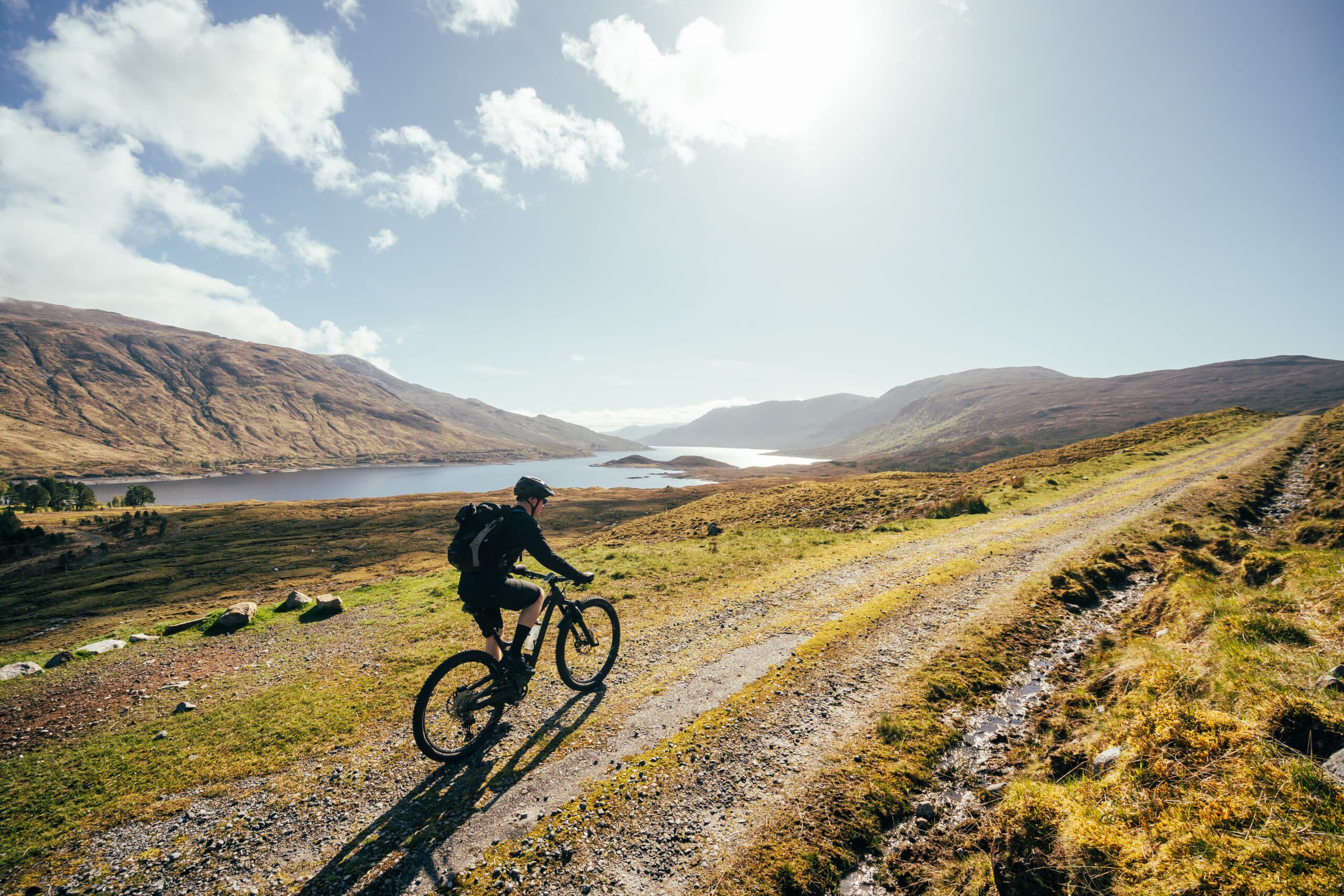
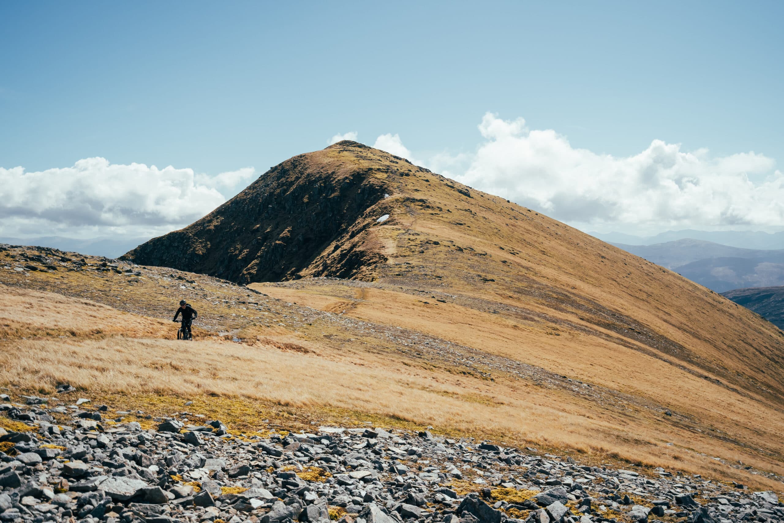
A pleasant surprise greets Luke and I as we crest the first summit and Munro of the day – Creag a’ Mhaim. Ahead of us is your classic Scottish Highland scene with mountains as far as the eye can see, and what looks like gloriously rideable singletrack meandering off into the distance, perched atop a narrow ridge falling away increasingly steeply at the sides. Loch Cluanie creeps into the bottom right of the view, while an abundance of blue fills the sky above and cotton wool fluff balls of cloud shroud distant peaks.

We waste no time at the small summit cairn, eagerly pulling on our knee pads – we’ve been climbing relentlessly, both on and mostly off, the bikes from The Cluanie Inn for the past couple of hours and are keen to get stuck in, to discover first-hand whether the South Glen Shiel Ridge is even remotely worth taking a bike along. This first descent serves as a perfect warm-up, easing us in gently to the day ahead. There’s nothing too technical, just the aforementioned narrow ribbon of singletrack finding its way over a relatively benign gradient. To be brutally honest, it doesn’t set our pulses racing, but the views and the fact there’s a decent trail is enough to keep us sated for now.
Latest Singletrack Merch


Buying and wearing our sustainable merch is another great way to support Singletrack

Show us some rideable trail James!
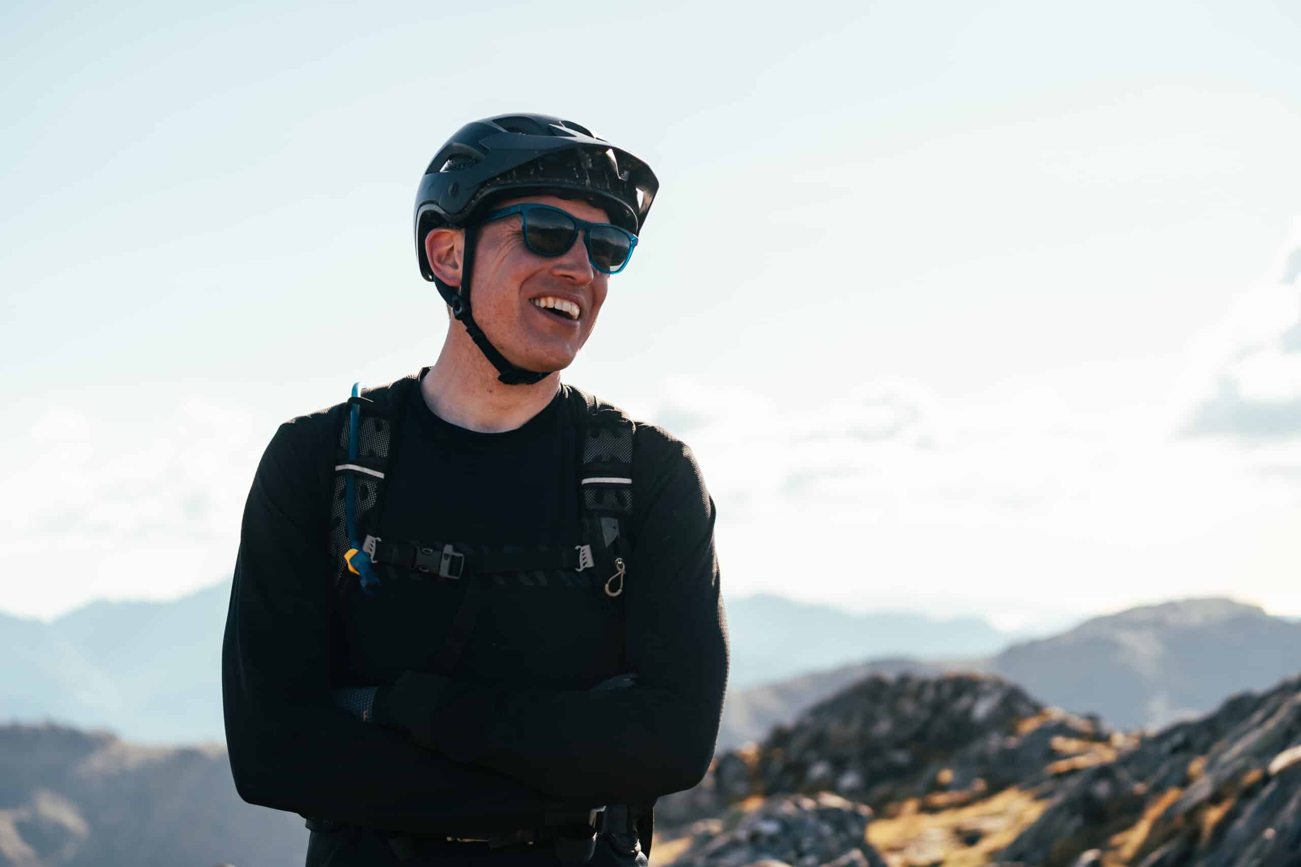
I’m not suggesting there was an element of doubt in my decision to tackle the South Glen Shiel Ridge and its seven Munros in a day with a bike, but let’s just say that volunteers to join me were few and far between. For a start, it’s a long way from pretty much anywhere, situated to the northwest of Loch Ness, a solid six-hour drive north from my home in the Lake District. Trying to garner as much intel as possible about the ridge in preparation for the mission, I asked Singletrackworld forumite, MunroBiker, aka Luke Ellis-Bradley, if he knew whether it was a goer. “Not done it myself, but have it on the list,” came his prompt reply. “I do have a pal who’s done it at least once (one trip involving a ride home in a Sea King…) so I’ll ask him. Want some company?”
Err… yes, of course. But also, crikey! What on earth have I let myself in for?
On the flip side, Rhys, Amanda and I have been talking about riding the ridge for ages, with Amanda’s earlier attempt a few years back thwarted by some overly amorous stags. By her own admission, Amanda’s tolerance for hikeabike is about 1/10, so if she’s keen then it can’t be too bad. Can it?
All was looking good for the four of us until Rhys went and injured himself in a crash. “Bad news, we’re not going to make it over later, sorry.”
How very convenient.
And so it begins…
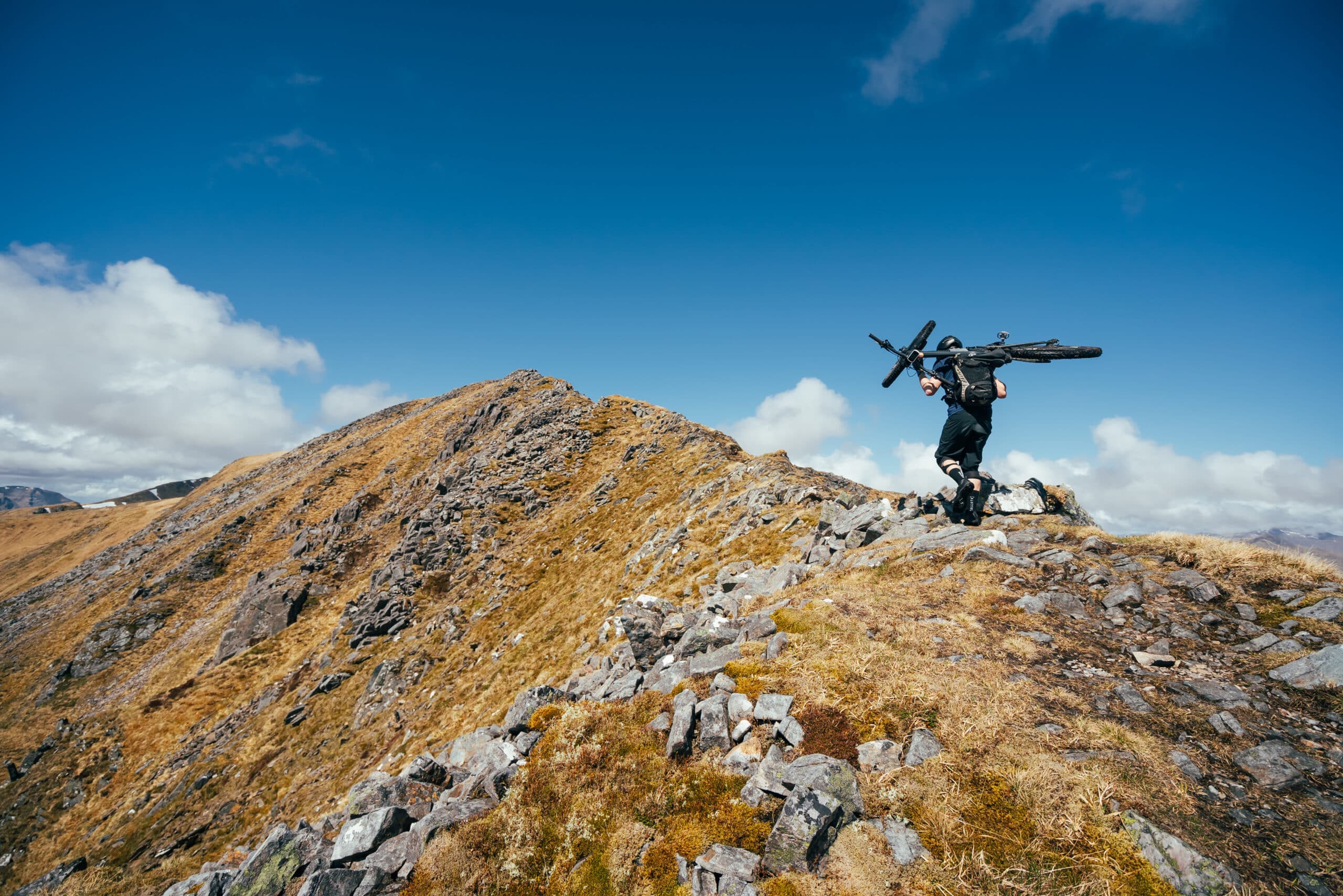
Descent one ticked off and in the bag, the trail levels to a brief scramble across a narrow, heavily exposed section of the ridge that does very little to quash our mood. In fact, Luke and I revel in the precarious nature of the traverse – it makes a change from the usual dreary trudge of a regular hikeabike. Bikes fixed firmly on our shoulders, we quickly gain our second summit and Munro of the day – Druim Shionnach. We’ve been ‘riding’ for about three hours, and after the slow initial climb onto the ridge, we’re now moving fast and feeling optimistic.

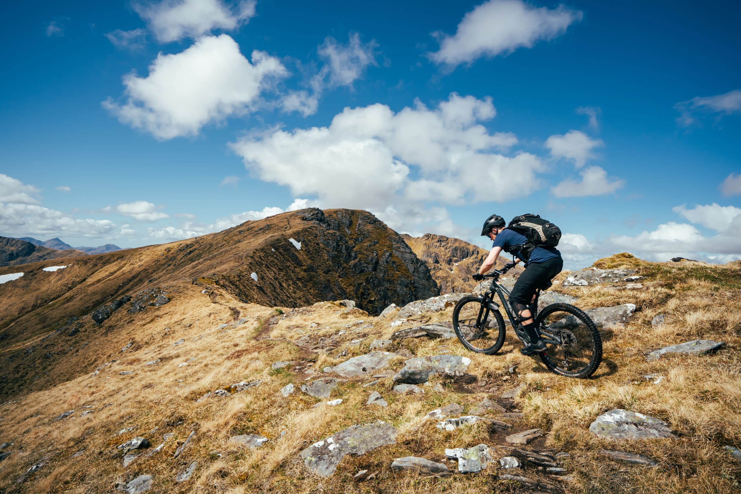
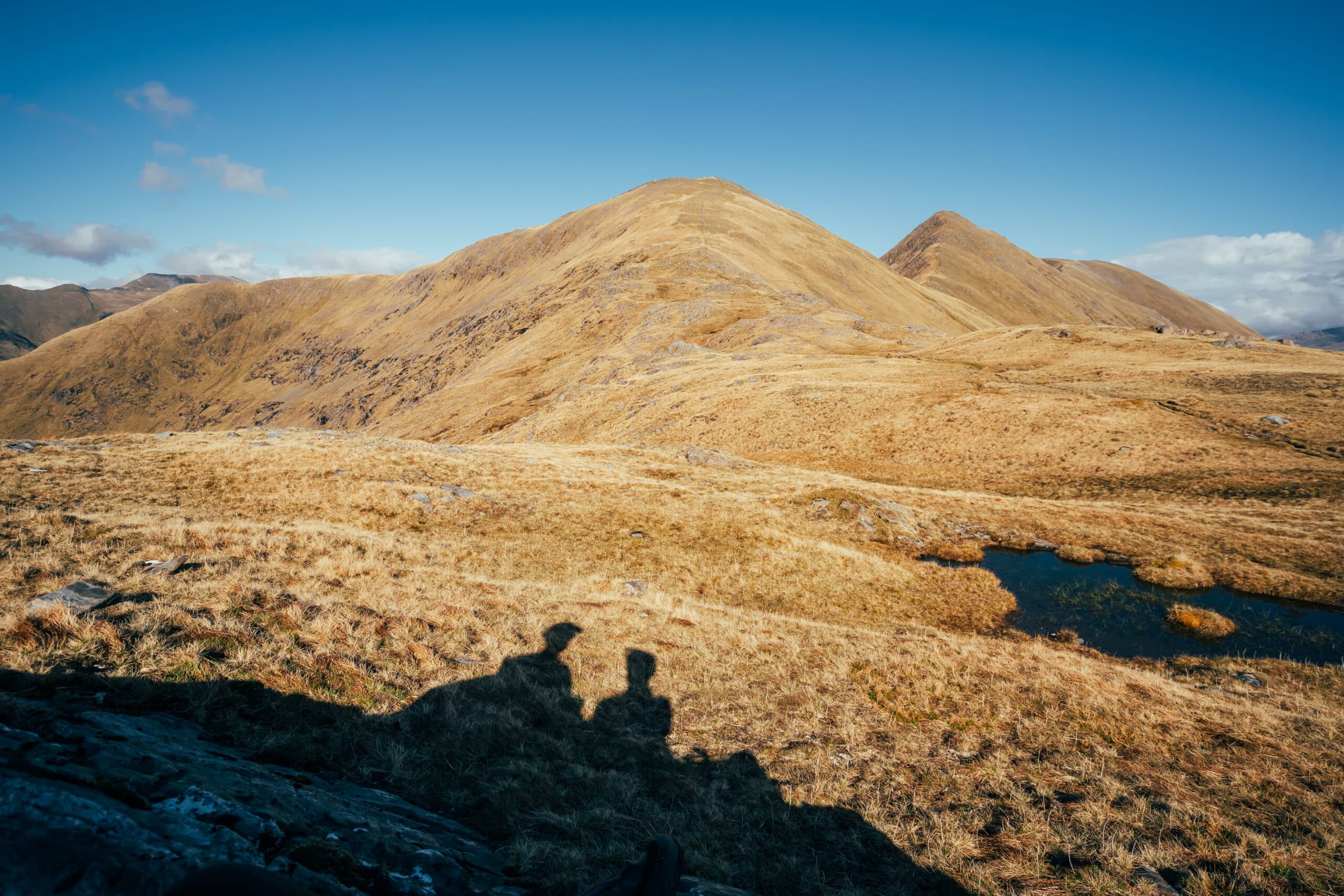
Things reach both a geographical and emotional peak with our third and highest Munro of the day –Aonach air Chrith. Sitting at 1,021m above sea level, it’s not really all that high in the grand scheme of things but the views from the summit cairn really are quite something (not that they’ve been even remotely shabby until now). From this highest point on the ridge, we’ve got an unfettered view of the remaining Munros stretching off into the distance while signs of civilisation are few and far between, limited to The Cluanie Inn to the northeast and a small cluster of farm buildings to the southwest. Looking behind us, Luke points out Ben Nevis, way, way off on the horizon and nearly lost in the midst of the vastness.
This is good, like really good
Turning our attention to the trail ahead, I can’t help but send a message to my good friend Max. “Holy Jesus this is good!” For although there were many sceptics, there are a few like-minded individuals who’ve had the South Shiel Ridge on their hit list for some time and are keenly following our progress. “Looks super-duper”, comes his reply. This is good. Like, really good.
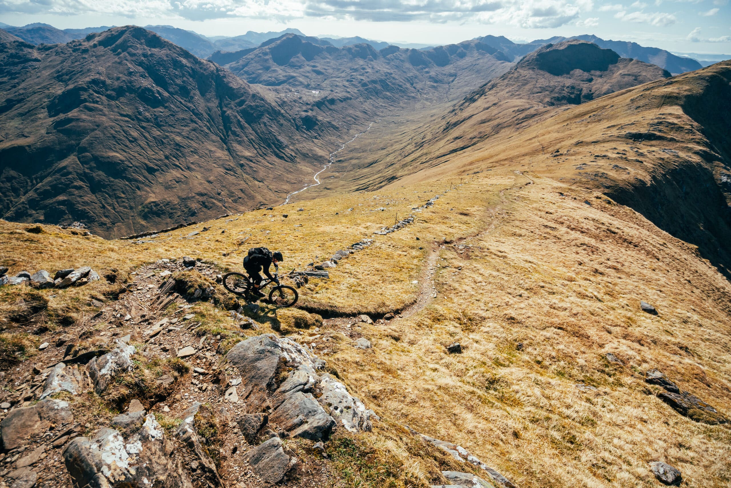

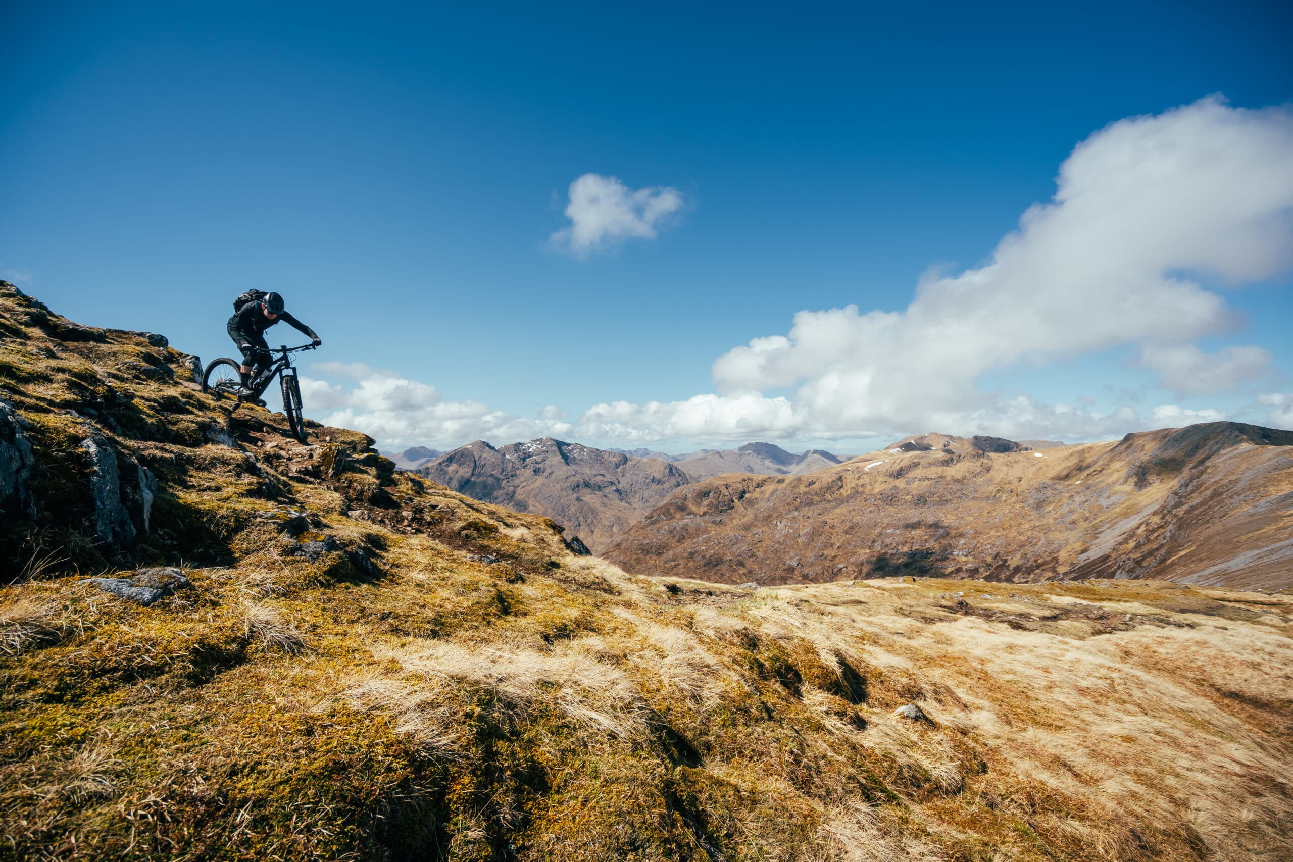
What follows is one of the best descents I think I’ve ever ridden. To start with, it’s just the narrowest of paths carving its way across the ridge before dropping away over a blind crest. Rocks poke through the grassy blanket to keep things interesting, as Luke and I become increasingly aware of the amount of thin air on either side of us. To the left, the ridge fades away gradually, but to the right it’s an abrupt edge, with some serious consequences all the way to the glen below. We are frustrated by one small step involving an awkward weight shift from left to right and a sharp left turn that coincides with a sheer drop down a gnarly-looking gully. We both make several attempts, but discretion is the better part of valour and we concede defeat – the risks of a fall here just don’t bear thinking about and escape routes off the ridge are few and far between. In spite of this brief hiccup, the riding is everything Luke and I could have asked for and more. There are no berms, no jumps, and some would argue there’s no flow, but to a certain breed of rider, this is nirvana. Borderline rideable technical singletrack, where the challenge is as much about getting through a section cleanly as it is about speed. Even a short slab where we’re forced to down-carry does little to dampen our mood.
This is a drag
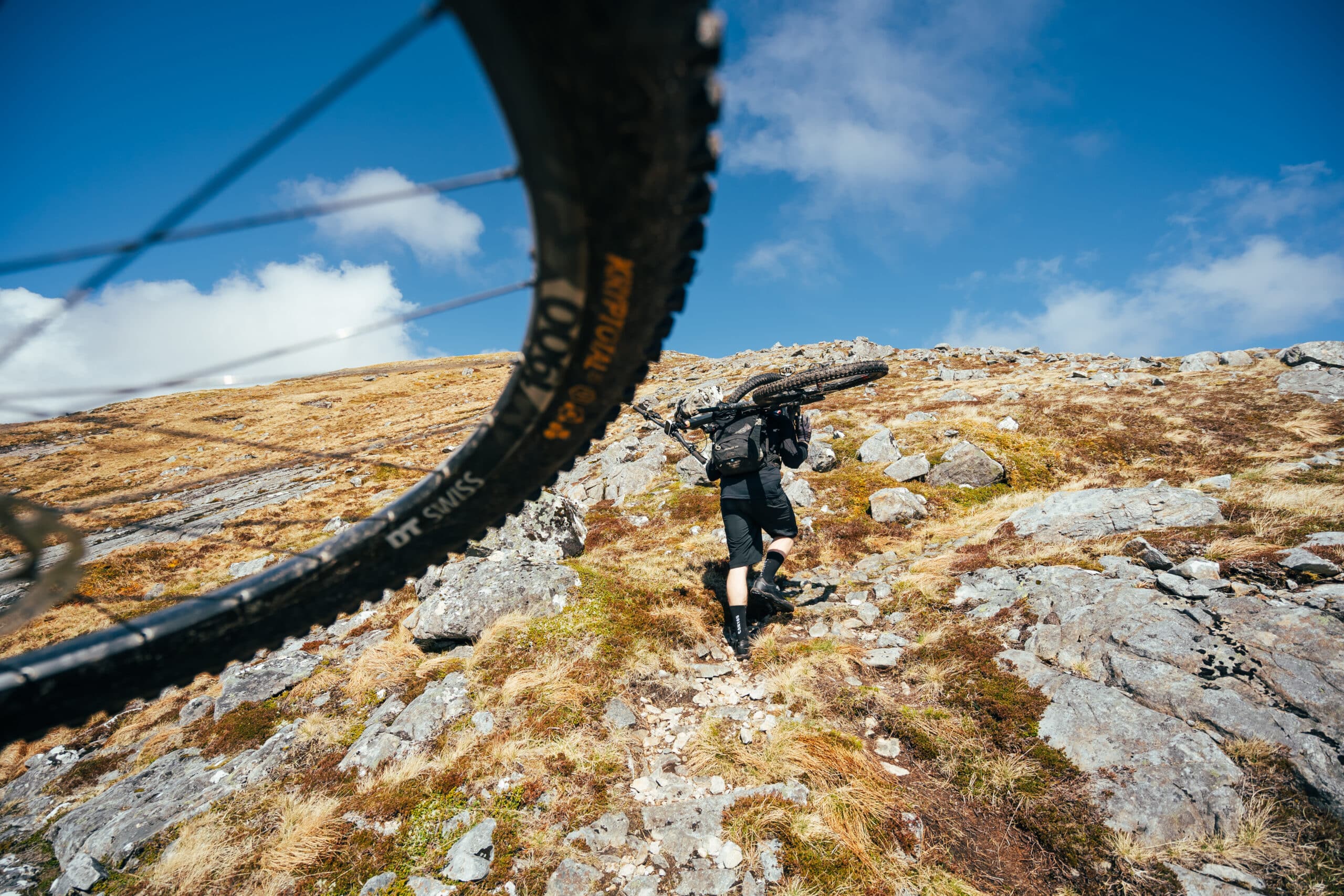
While some people’s tolerance for hikeabike is pretty low, I have to say that mine is usually around 9/10. Not because I actually enjoy carrying my bike – I would pedal everywhere if I could – but rather because carrying my bike usually means I’m heading somewhere exciting and to a path less frequented. What sucks more than anything in the world, is hiking up, only to be confronted with an unrideable descent that you have to carry down. Information about the whole ridge was hard to come by and Google Earth can only tell you so much, so even though we had to expect it at some point, it comes as a little bit of a surprise and more than a lot of a disappointment to have to carry down the bulk of one of the descents. In isolation, and without six hours of activity in our legs, we might have given it a better shot, but by now we are both starting to tire. Whether we’re carrying up a short technical climb, or in this case down a more awkward steeper descent, it becomes something of a mantra between Luke and me. “This would have been fun six hours ago…”
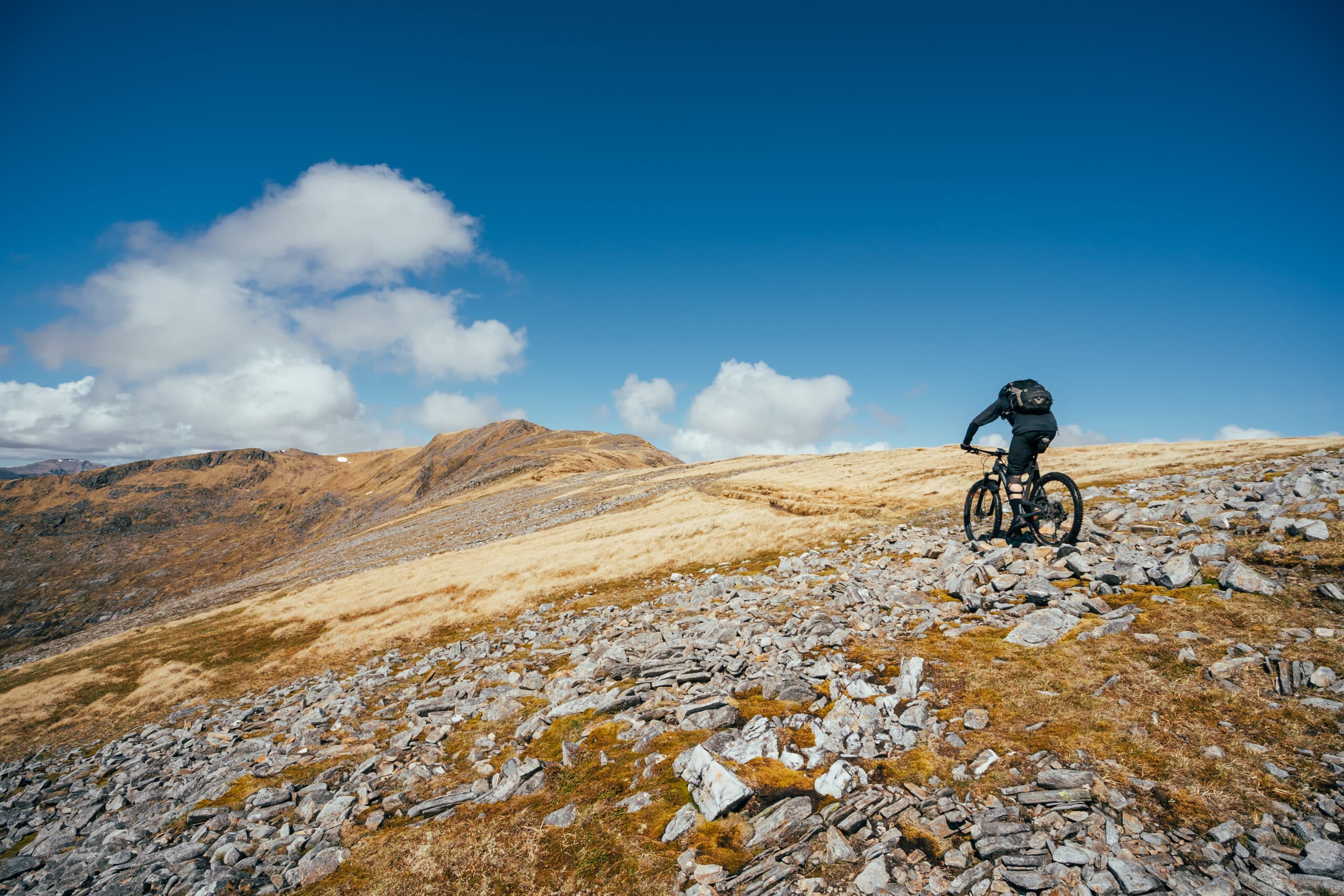
The fatigue really makes its presence known in the confusion I start to feel over where we are along the route. I’ve been using the Munros as a checklist to track our progress, and with numerous smaller rises along the way, I’ve lost count. The names of them are largely irrelevant to me as I struggle with the Gaelic pronunciation, ending up with some sub-standard, bastardised version that no one can understand. They all have a tendency to blur into one (the names that is, not the peaks), and I’m not concerned with ticking them all off a list. More than once I find myself cresting a minor peak, foolishly thinking it’s a Munro, only for Luke to helpfully point out that it’s not… and that’s the Munro over there. There’s a reason his forum name is MunroBiker, and there’s a reason I’m very glad he came with me on this journey.
The net result of all this is that my enthusiasm for the day starts waning. The ground becomes more broken up and harder to traverse, while I start to look longingly to the north, begging for our path back down to make its presence known. I just want off this bloody ridge.

I could have sworn we’ve already done this
To compound our misery, an ominous-looking lump of dark rock rears up ahead of us. Walking guides suggested just the one short scramble somewhere on the ridge and seeing as we’ve already completed two short scrambles, I start optimistically looking for a way round. It would appear that Luke is much more of a pragmatist and heads straight for the crag, somehow knowing there is no other way. There’s no photographic evidence of this because for once Luke was struggling with the climb and it feels like a bit of a dick move to ask him to pose precariously on a rocky scramble with his bike on his back while I dance around taking happy snaps. In retrospect, he says it would have been fine, but you’ll just have to imagine the scene.
At last
For most of the day, clouds have been skirting the entire ridge only briefly troubling us with their presence. Now, as Luke and I head further west towards our departure from the ridge, the clouds have all but disappeared and we’re treated to the most incredible late afternoon/early evening light. A little bit of haze to give definition to the light, the Isle of Skye away in the distance. The stuff of dreams I tell you. In spite of my desire to get back to the cars and start the long drive home, I almost wish we had a bit further to go so we could make the most of these conditions. Almost.

It’s with mixed emotions then, after what seems like an eternity and an interminable number of false promises, that Luke confirms this is indeed our path back down to civilisation and our time on the South Shiel Ridge has come to an end.
Most big days out are usually engineered around a banger of a final descent, a crescendo of stoke, ready to spit you off the mountain frothing with energy to get you fired up for the next adventure. Maybe it’s that we’re both utterly knackered, and wish this moment had come six hours ago, or maybe it’s just that this last descent isn’t actually all that good, but Luke and I aren’t feeling this. It promised loads, starting with a delicious rocky slab into some switchbacks, but more often than not it’s just too vague, too slippery and too chunky to find any sort of rhythm. My frustration turns to anger, and before long I’ve given up, walking down sections I’d have attempted six hours ago. I’m glad that we’ve dropped out of the light and there are no more photos to be had. I just want to go home. I’m done.
And with that, the South Shiel Ridge is over. All that’s left is to transfer back to my car at The Cluanie Inn and start the long trek home.

On reflection
Reflecting on this mammoth day after the event has been something of a rollercoaster. Chatting with Luke in the immediate aftermath, I messaged him. “It was ace. The alternative was not doing it and going home. I’m very glad I did it. So yes, 100% worth it.” Conversely, talking through the day with other friends, some of whom still have it on their hit list, I found myself trying to talk them out of it. Too much carrying I said, not enough reward. Then more recently discussing it, I caught myself getting excited again, especially when looking back over my photos. Granted, I didn’t take many of the hikeabike up, and I took even fewer of the descents we carried down, so there’s definitely some confirmation bias at play here. Even so, there remains some utterly sublime technical singletrack up on that ridge that I’d love to have another crack at if only it wasn’t so hard to get to. I’ll be leaving the camera bag at home next time though, so I can 100% focus on the riding and have more energy for the tricky bits. If you find yourself near the South Glen Shiel Ridge on a reasonably sunny day and after reading all this still decide it’s a great way to spend your day, please do report back. I’d love to hear how you get on.

So, you’re not put off then? Want to know more?
The South Glen Shiel Ridge is a classic mountain ridge in the Scottish Highlands not far from the coast to the west of Loch Cluanie. Dominating the skyline to the south of Glen Shiel, you might have spied it while heading along the A87 towards the Isle of Skye. With seven Munros strung out along its length, the ridge makes for a popular hiking route (although we only saw one other person on the ridge itself).
On the other hand, while rumours abound that we weren’t the first to tackle this ridge with bikes, finding people willing to discuss their escapades with us proved tricky. Cycling beta is thin on the ground so in the build-up to this ride I had to resort to trawling walking blogs and poking adventure runners for intel.
Good friend and experienced mountaineer Gary Tompsett helped out with some contingency plans and reckoned we’d be on the hill for 11 hours. At the time, I laughed. In retrospect, Gary was pretty much bang on – we started at 9.10am and rolled off the hill just over 11 hours later at 8.12pm. Our moving time was around six hours, and seeing as we didn’t stop for too long on each Munro, I reckon a good three to four hours (maybe more) could be shaved off the total time if we weren’t documenting our day for this feature. Elevation gain was about 5,788 ft (1,764m) over a distance of 18.96 miles (30.5km).