In the vast Himalayan landscape, a solo trip is the stuff of dreams.
Words & Photography Matthias Stitz
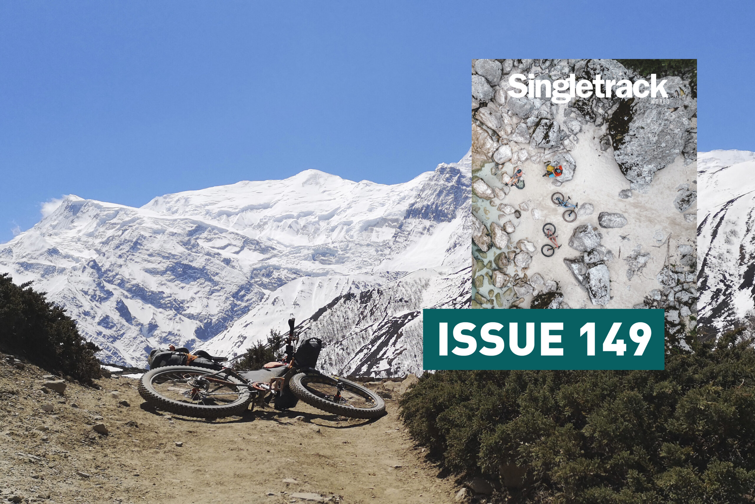
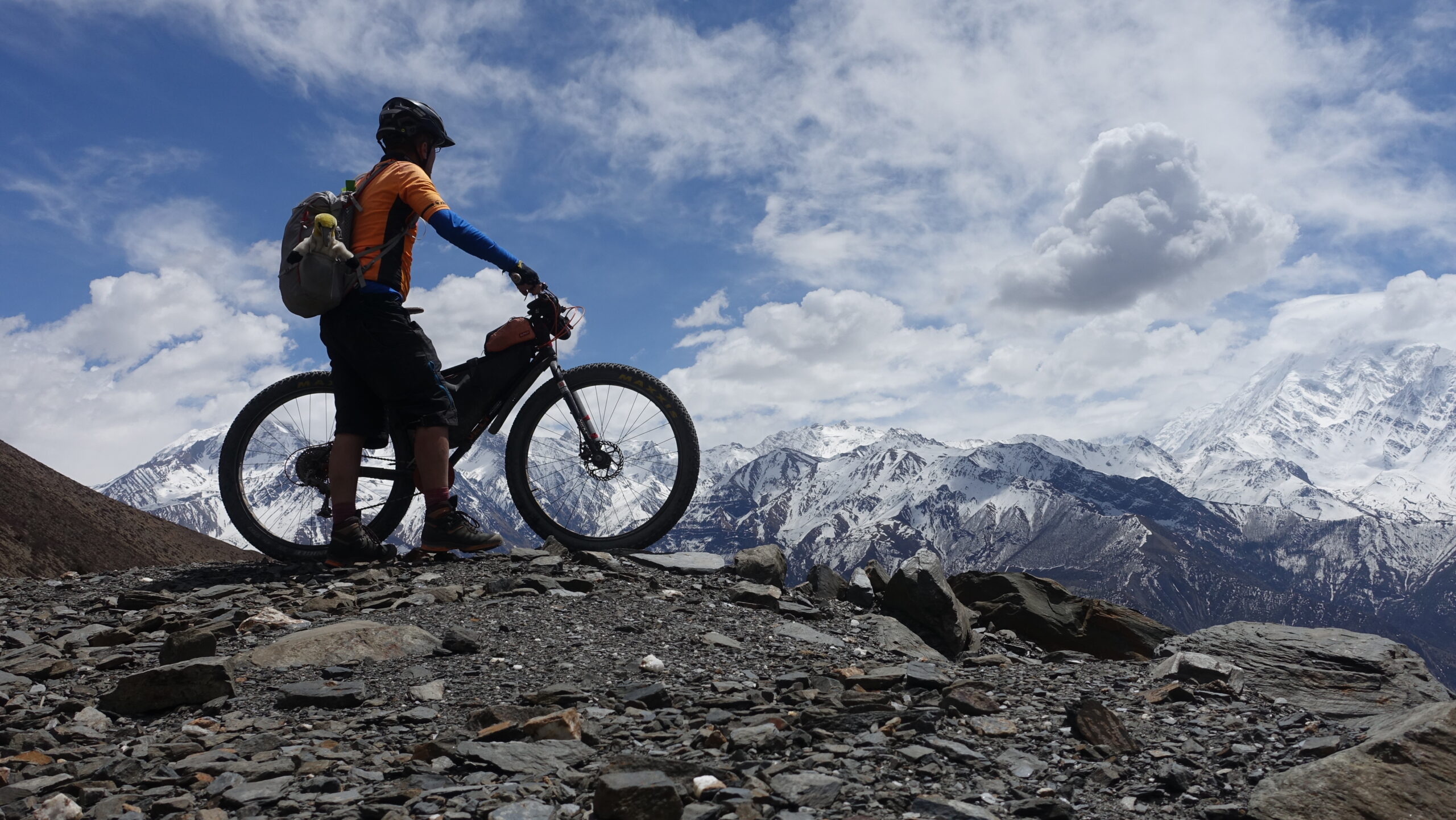
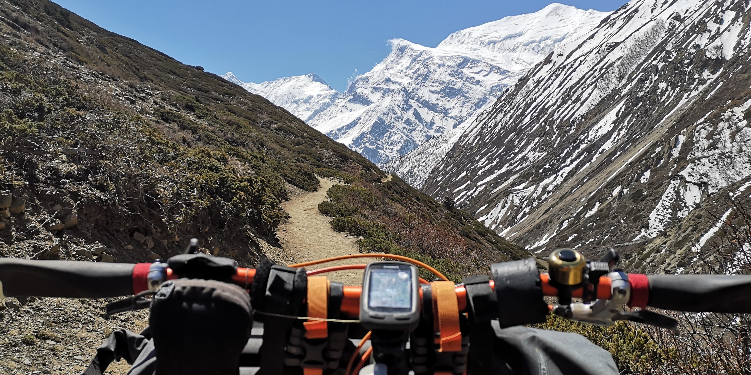
It’s 4.30am. Dawn is breaking, it’s freezing, and I’m standing at the foot of the 5,416m Thorong La pass in the Himalayas with my bike. My aim is to cross the pass and descend to the Manang valley on the other side. From here to the top it’s 1,400m up, and then a further 600m down to High Camp. The weather is fine, the forecast fair, but the air is thin – perfect conditions.
Six months ago I was sitting on the rooftop of a restaurant at Braga in Nepal. Located on the famous Annapurna Circuit, the village is one of the major trekking destinations in this small country at the very heart of the Himalayas. When I entered the restaurant, four mountain bikes with bikepacking bags resting in the shadow of a wall caught my eye. Talking to a woman having breakfast at the table next to me, I found out that one of the bikes was hers and listened to her stories about crossing the Thorong La pass two days ago. Instantly I was hooked.
Latest Singletrack Merch


Buying and wearing our sustainable merch is another great way to support Singletrack

Changing times
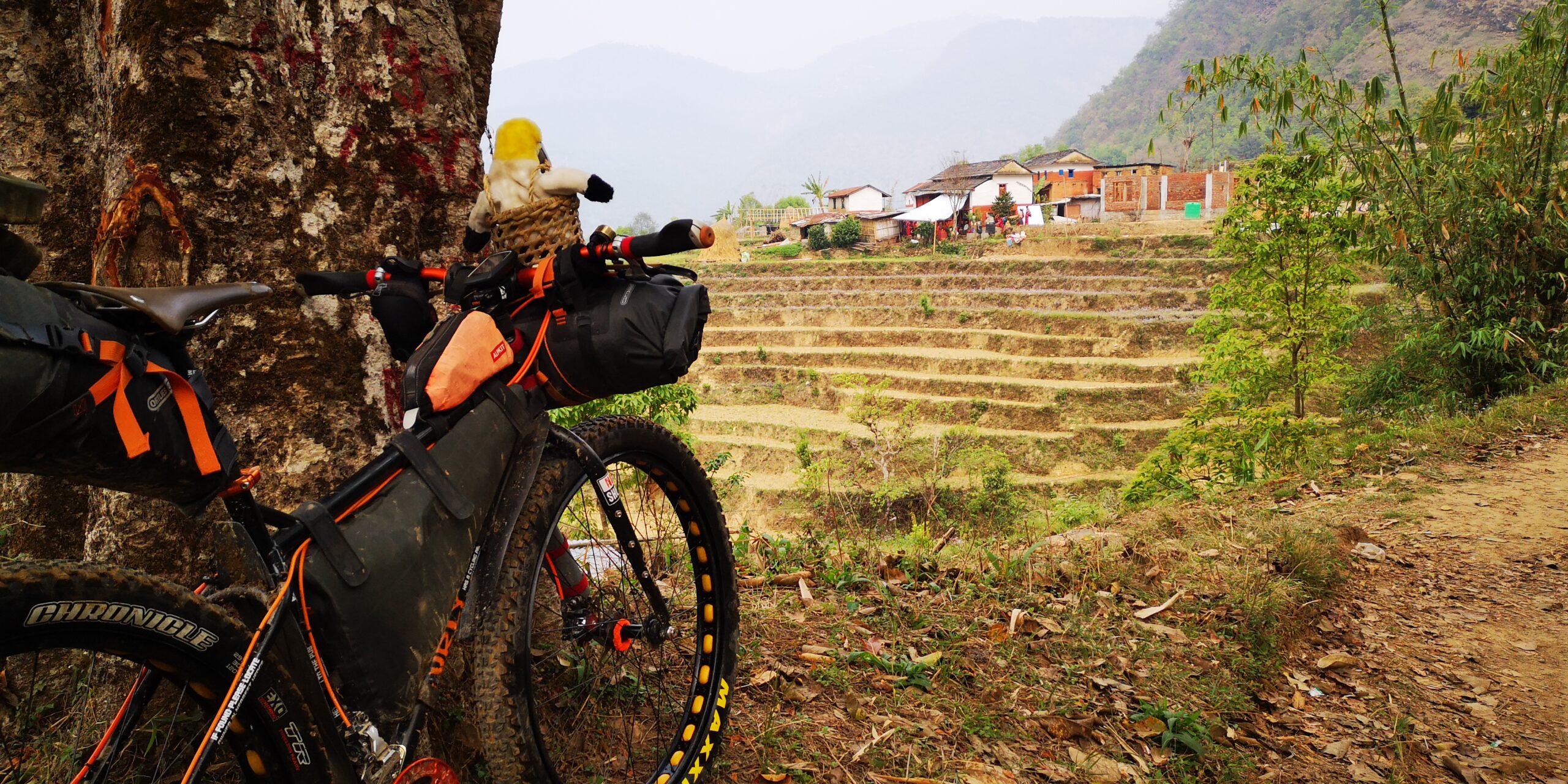
Nepal is perched between India and Tibet. Compared to its huge neighbours it’s a tiny country, but with outstanding natural beauty. I’ve travelled to Nepal several times, enjoying the trekking routes that lead to Everest, and around the Annapurna, Manaslu and Dhaulagiri mountain ranges. It’s a paradise for outdoor activities, and over the years the infrastructure in the trekking areas has changed from small walking paths clinging to the hillsides to jeep tracks and small roads. With those changes, cycling in those areas has become more accessible too.
My relationship with Nepal is special. Over the last 20 years I’ve spent a good part of a whole year here on several trips. I’ve made close friends and watched their children grow. I have experienced rural village life, travelled crammed into buses and the back of jeeps. Over the years I have witnessed profound changes. I saw refrigerators and televisions arrive with the power lines. I was blackmailed by Maoists and walked with the Nepalese army during the time Maoists were ambushing the country. I was able to witness a different Nepal once peace between the government and the Maoists was negotiated. I saw how the internet profoundly changed Nepal. While a phone call home at Christmas Eve from a rickety wooden shack in the mountains once cost a fortune, the Wi-Fi in the Thorong Base Camp Lodge is now as normal as in any other country.
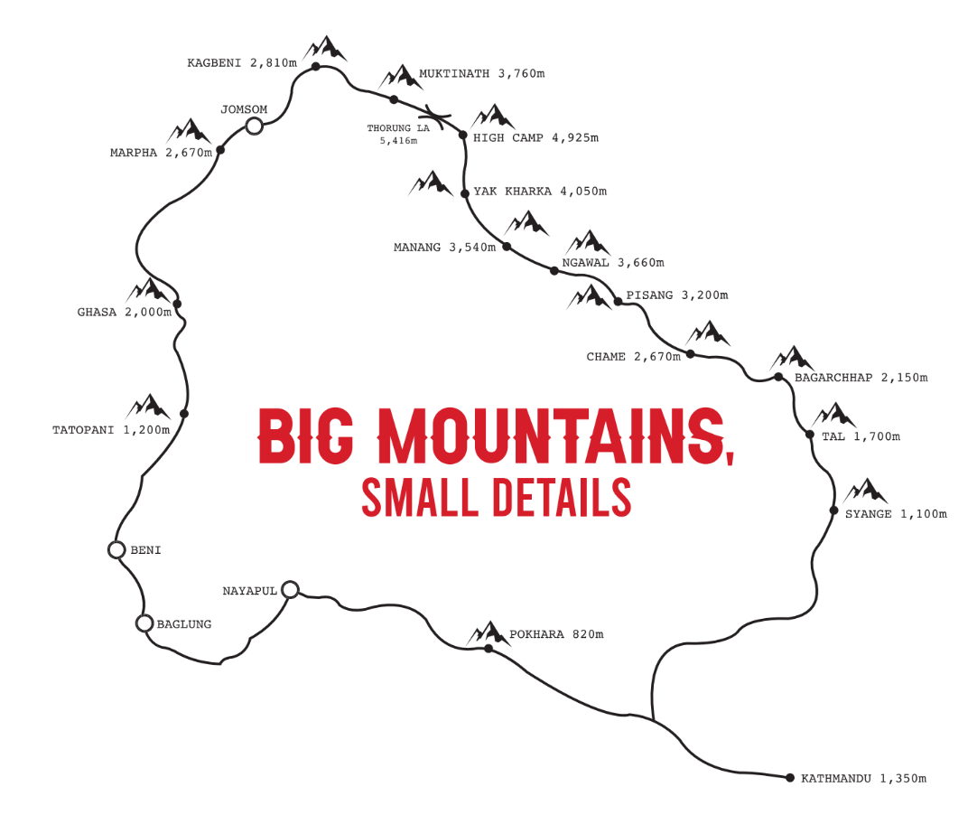
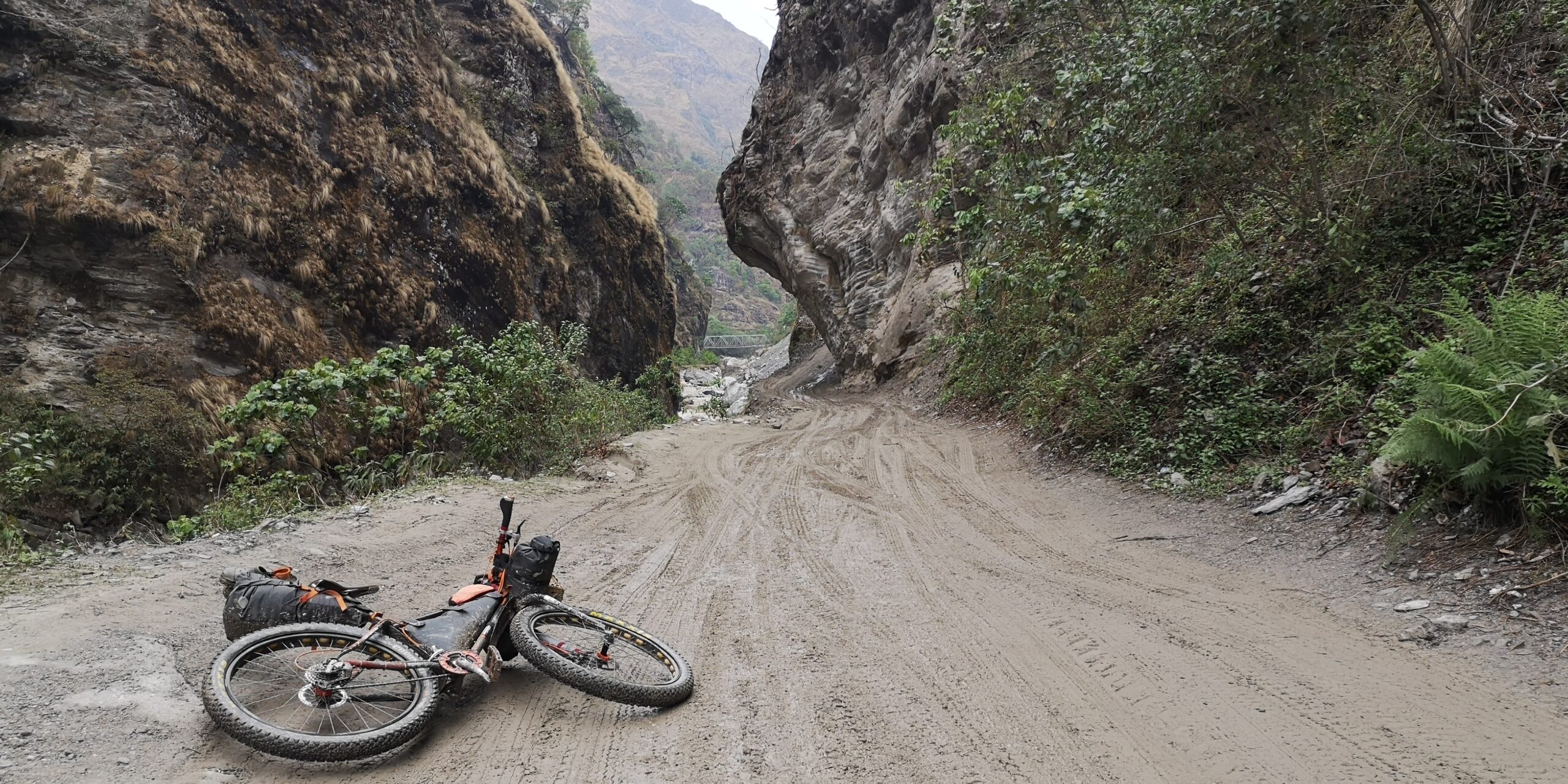
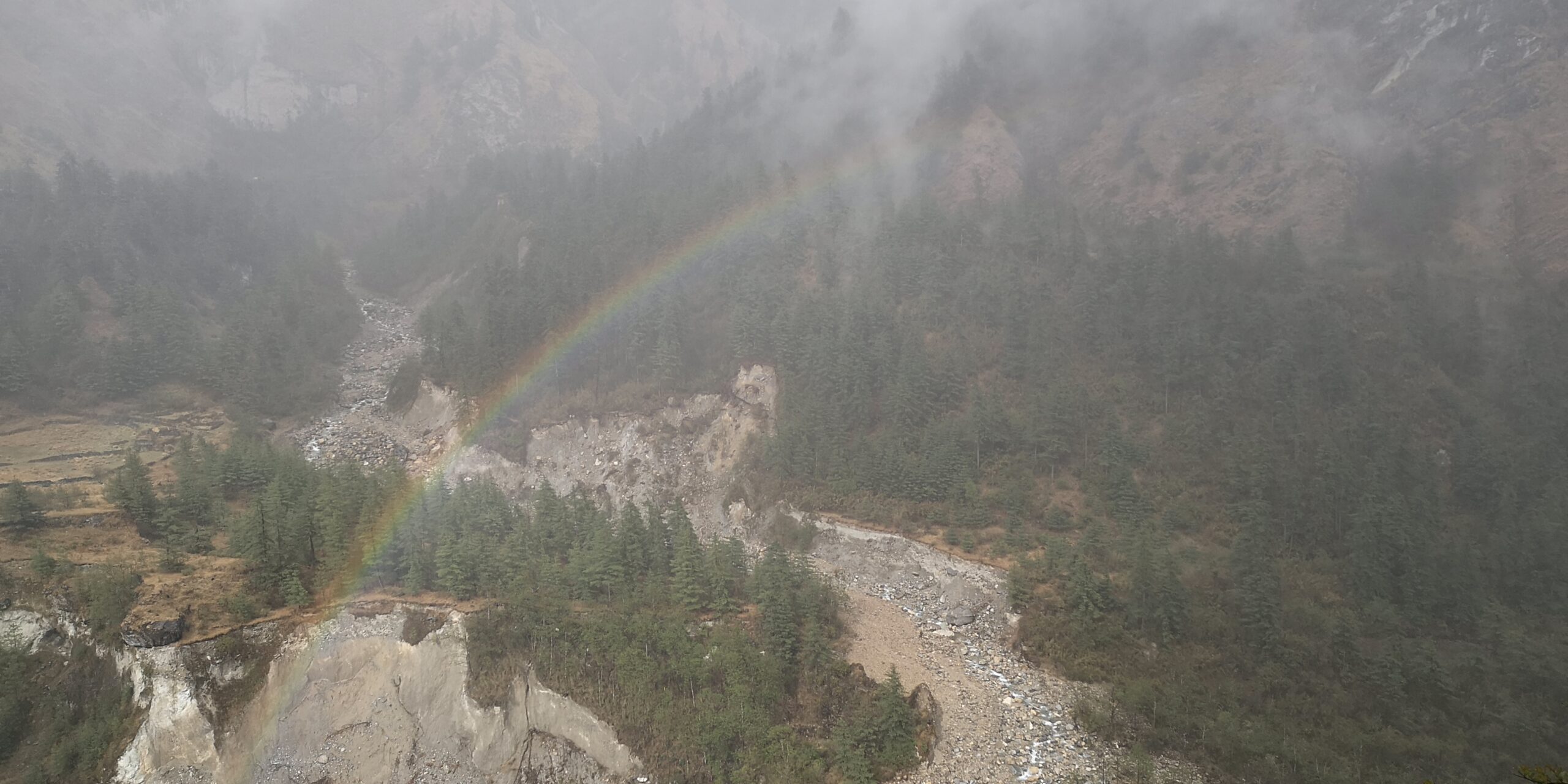
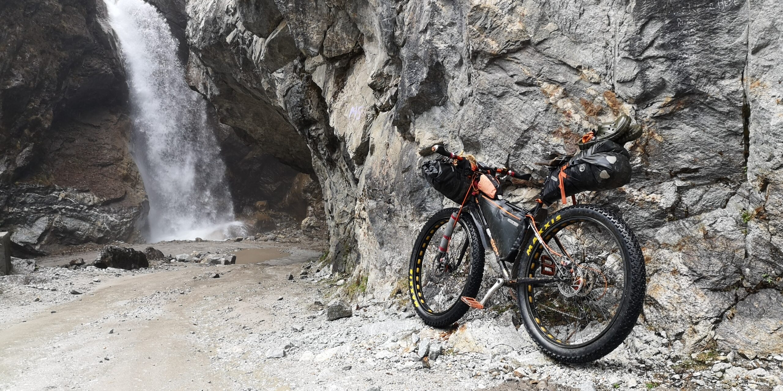
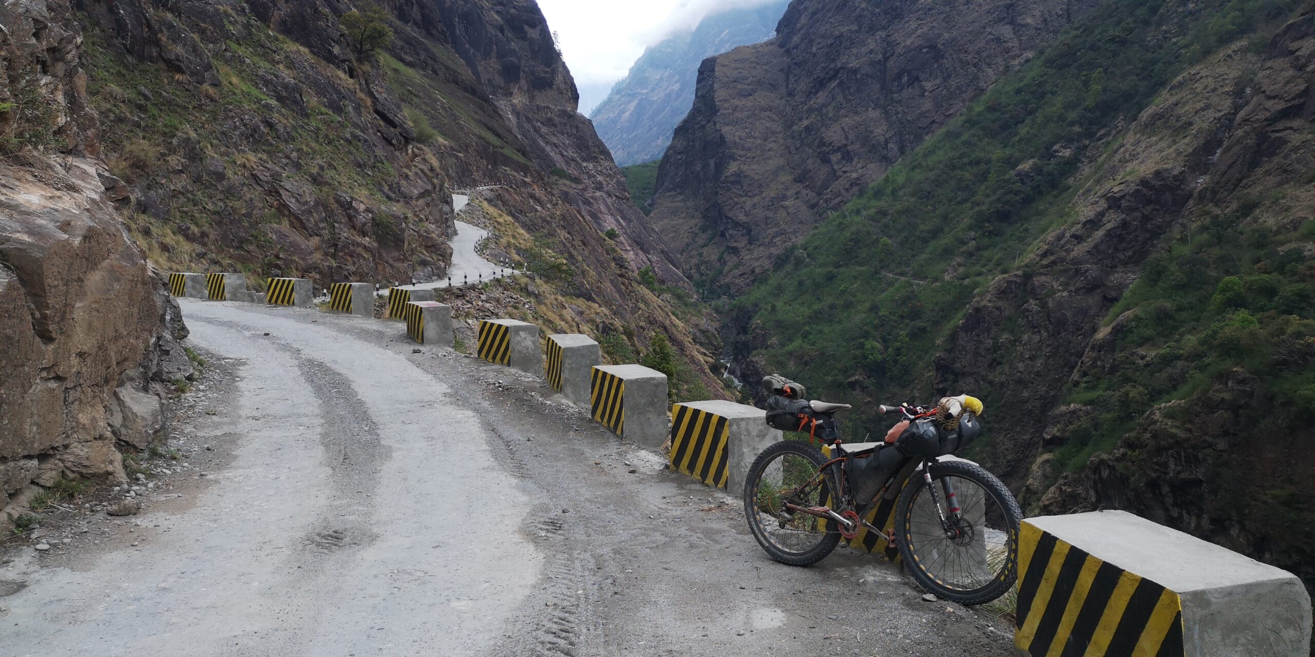
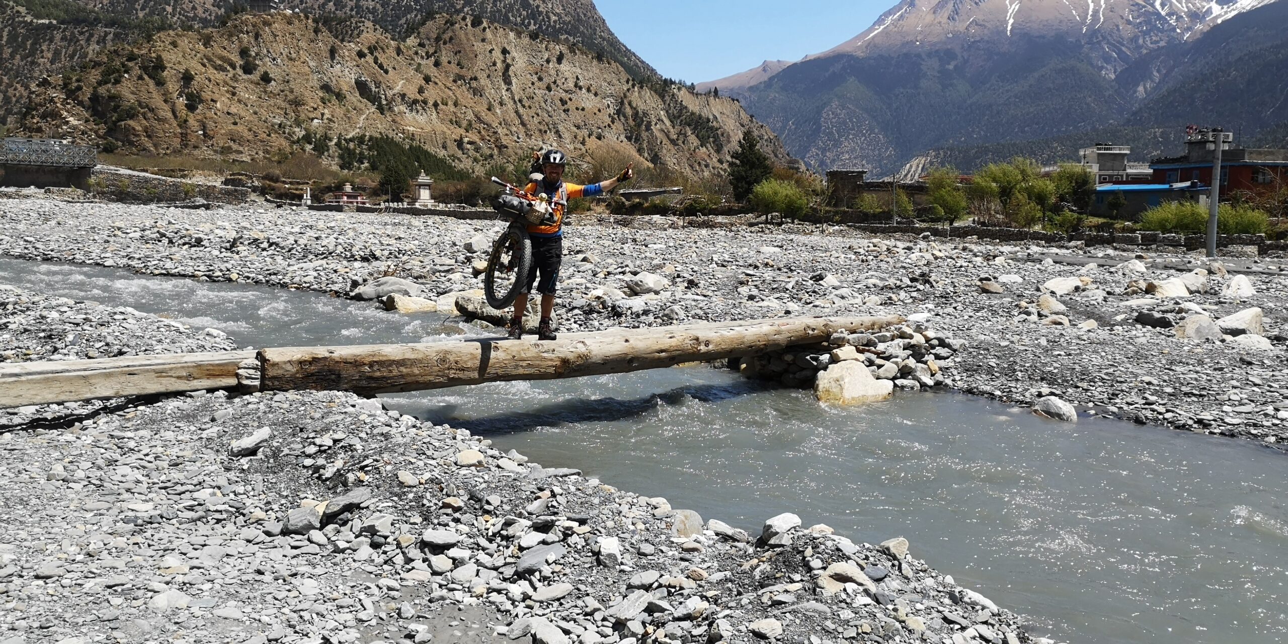
The 230km long trekking circuit around Annapurna, the world’s ninth highest mountain and the first 8,000m peak to be conquered, is one of the top trekking routes in the world. It follows two rivers, the Marsyangdi in the east and the Kali Gandaki in the west, divided by the 5,416m high Thorong La pass. The construction of roads now makes it easier to cycle a fair share of the circuit. Although it hasn’t lost its beauty for trekkers, it has recently become a haven for mountain bikers, who can enjoy the supporting infrastructure, such as teahouses, lodges and restaurants, while plenty of accommodation along the way makes it easy to travel light. The loop offers a mixture of short sections on singletrack roads, well-worn dirt and jeep roads, and superb singletrack higher up, often shared with trekkers. A few suspension bridges need to be crossed and, depending on the route, creeks and tributaries may require balancing over a single log at times.
Planning ahead
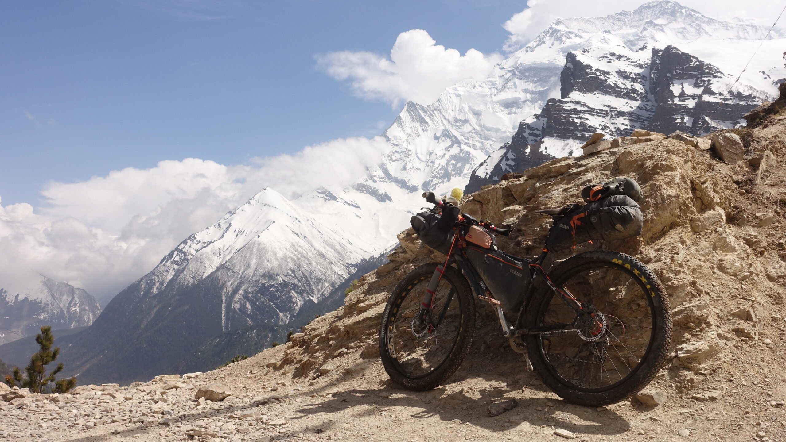
For my ride of the Annapurna circuit I chose a rigid Surly Pugsley with 29plus tyres. A saddle bag, frame bag and front roll provided enough space for my gear, and a small backpack including a water bladder that added a safe space for my electronics. Fat tyres not only contribute to comfort and traction on rough sections as well as on snow, but also prove to be a perfect conversation starter.
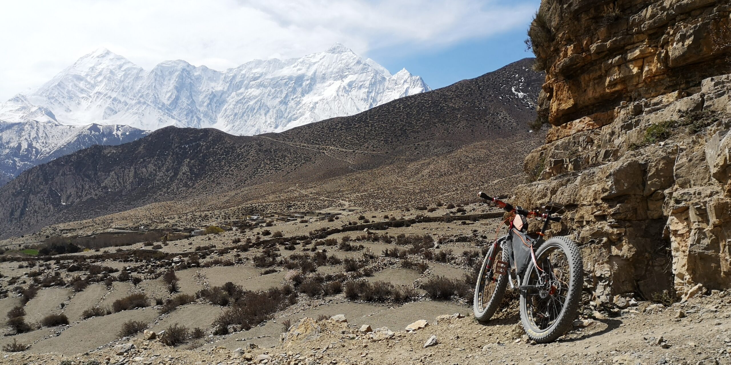
Most people walk the circuit anticlockwise, starting in the more remote Marsyangdi valley, crossing the pass and finishing in the Kali Gandaki valley. Going in that direction requires 400m less climbing when crossing the Thorong La pass and helps to adapt better to the altitude having a longer, more gradual climb to the top of the pass. Knowing the pass well, I chose to go in the other direction, starting in Pokhara and finishing at the trailhead of Besisahar, a descent over four days down the beautiful Manang valley. Travelling in April, daytime temperatures ranged from a balmy 25°C at the beginning of the journey to a chilly -5°C when crossing the pass.
After touching down in Kathmandu, the first leg of my trip would be a bus journey to Pokhara. I planned to ride through rural areas from Pokhara to the trailhead of the Annapurna Circuit in Beni. While there are also plenty of bus services to Beni from Pokhara, a ride through the Nepalese foothills is a perfect way to mentally warm up for the days to come. My planned route would then take me two days to Jomsom, nestling at 2,700m altitude, where I planned to spend two days to acclimatise. The next milestone on my journey would be the traditional pilgrimage site of Muktinath at 3,700m altitude, where I’d spend another two days acclimatising before attempting the pass. From the top of the pass a four-day descent follows down the valley of the river Marsyangdi to the other trailhead at Besisahar. Provided everything went to plan and the weather conditions were favourable, I planned to leave the Annapurna Circuit to extend my adventure to the pilgrimage site of Manakamana and finish by taking a bus back to Kathmandu.

Up high, down high
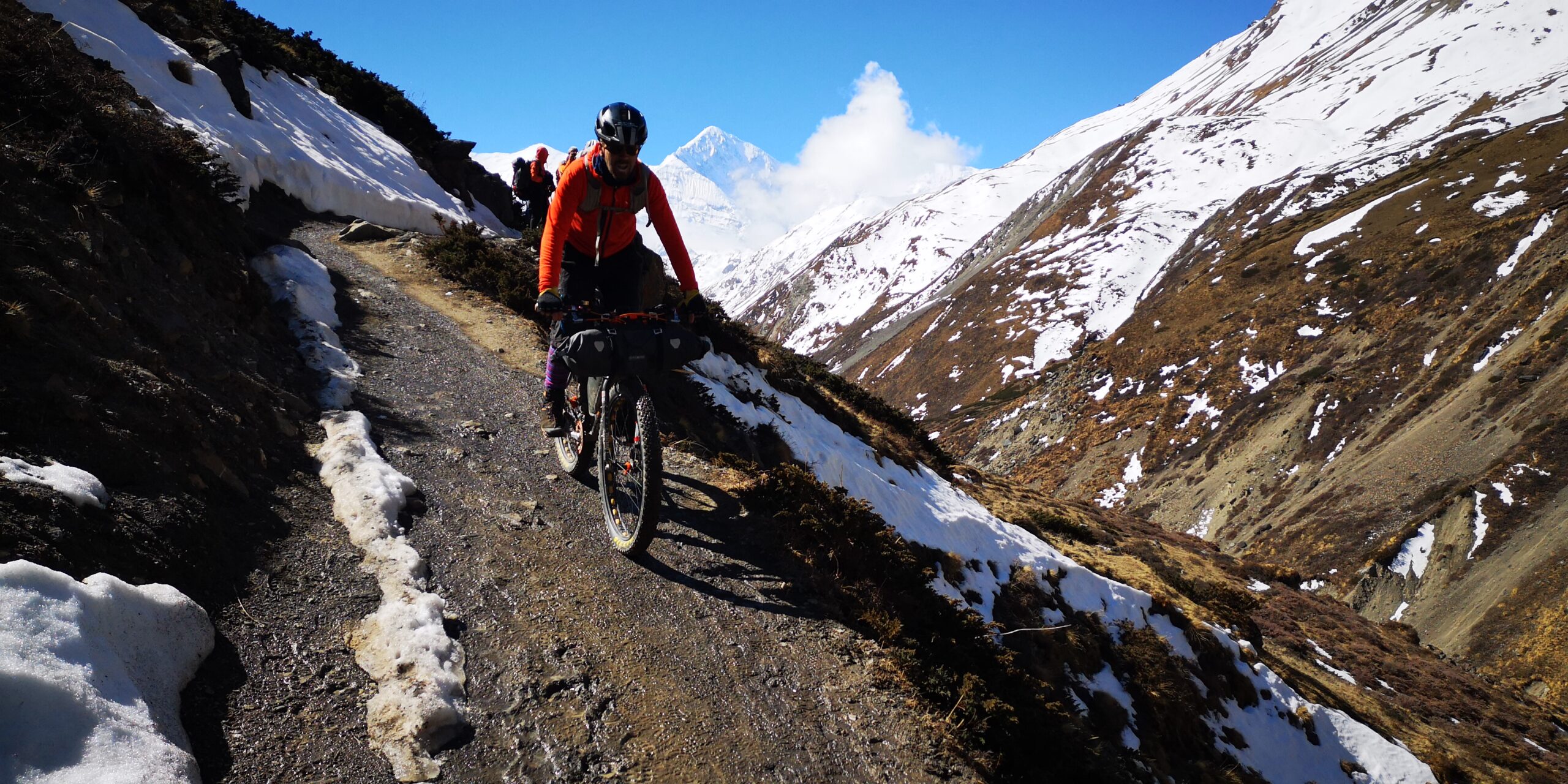
On the day of ascending the pass I start at 3.30am in Muktinath. In the pitch black the world has shrunk to the reaches of my head torch. An hour after dawn I arrive at the foot of the pass, where the snow starts. I have tried to carry my bike on my back, but it proves rather uncomfortable, so from here it’s dragging and pushing the Surly for the next 10km. Somehow this seems much more exhausting than on my training rides at home.

From my previous walks around Annapurna I know that the first leg is the steepest. There is a hut at about 4,400m, and this will be my point of no return. When I get there, the sun has made its way over the ridges and is bathing everything around me in a golden light. I enjoy a snack, take in the wide view into the valley below and across to Dhaulagiri and make the decision to continue further. The snow is still frozen, which makes pushing and dragging the bike a tad less strenuous. But my mind is focused, and I am confident I will make it to the top of the pass. Shortly afterwards I meet the first Nepalese guy descending from the pass. He’s a bit surprised to see me walking up with the bike.
My confidence grows the higher I climb. Soon the first trekkers descending from the pass come into sight, and their enthusiasm fires up my spirit. Higher up the gradient eases, but there is still no chance to ride. I push the bike for about 50m, rest, and push on. The altitude is taking its toll.
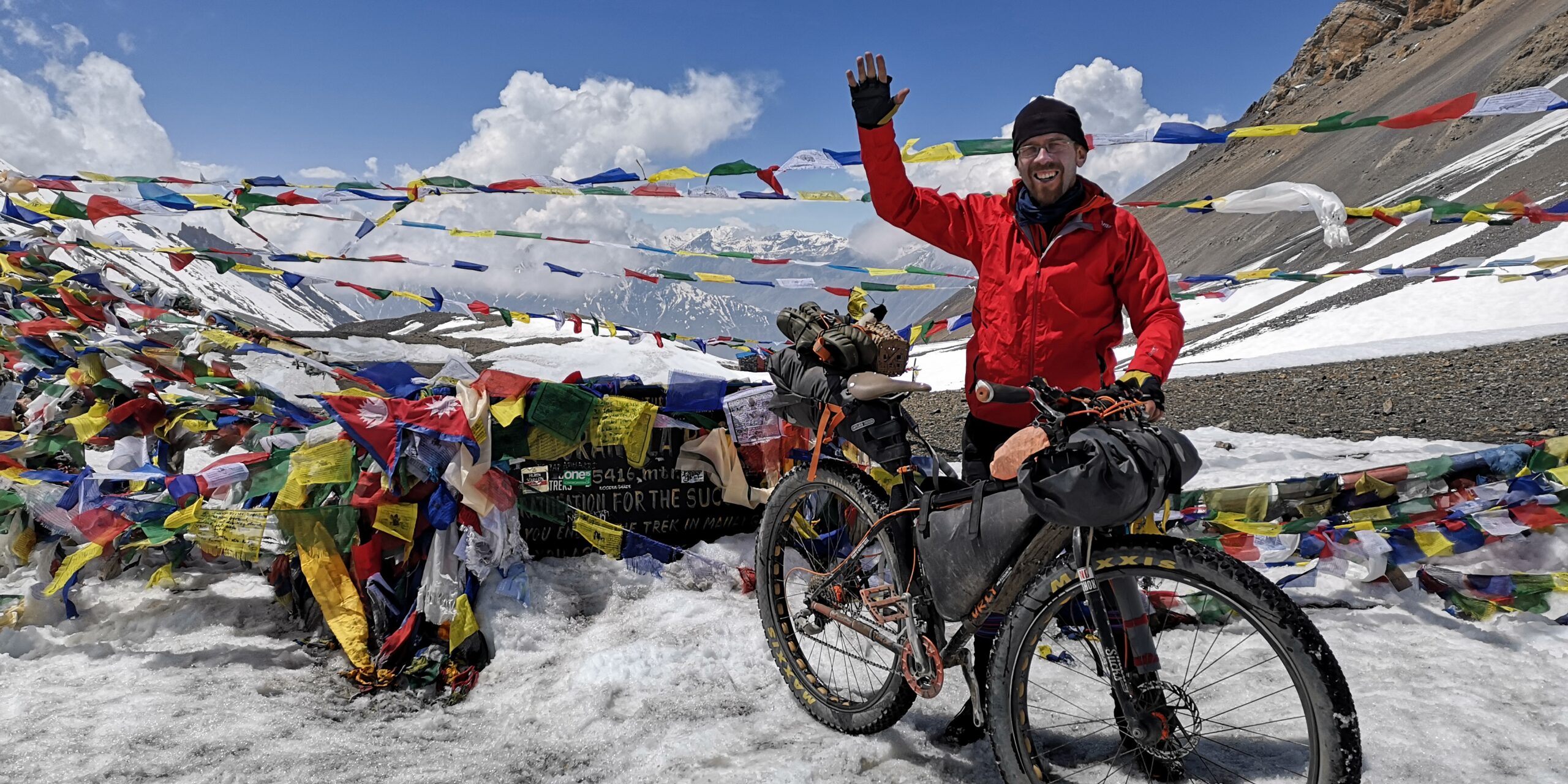
The prayer flags and the stone hut on top of the pass are already in sight, but it takes another hour before I finally reach the top at 5,416m. I’m the last one to arrive at the top today, but the first one from Muktinath. All other trekkers have left already. I treat myself to a noodle soup and a tea from the teahouse, sitting in the sun and enjoying this precious moment.
Fortunately, the wind is as forecast, and there’s just a light breeze. After I have my summit picture taken I descend to High Camp. There’s still no riding down. The snow is deep and the sun makes it soft – too soft even for plus tyres. Pushing my bike down the mountain is hard work, and I have another tea break at the teahouse at 5,000m. Some pheasants are rummaging around the little hut in search of food left by the trekkers. I think about staying here for the night, but decide to descend the additional 200m to High Camp instead.

Arriving there I catch the last free bed, order a Dal Bhat and apple crumble and not only enjoy the company of the people who will tackle the pass the next morning, but also the feeling of accomplishment.
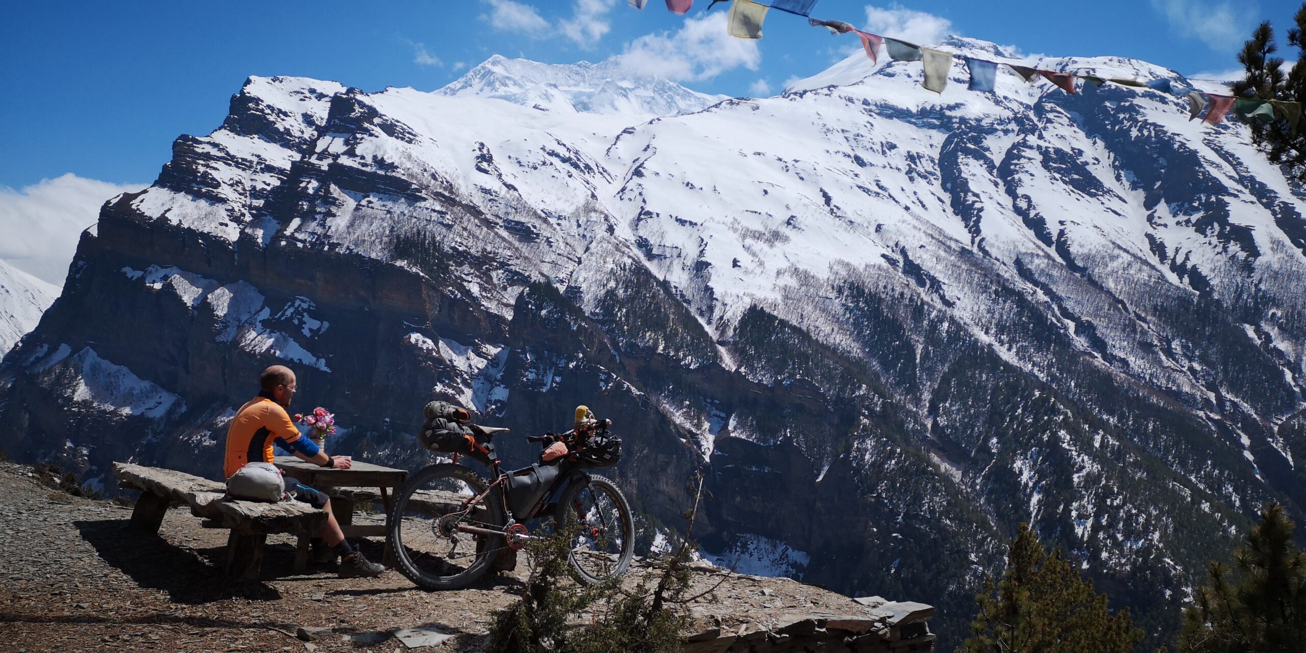
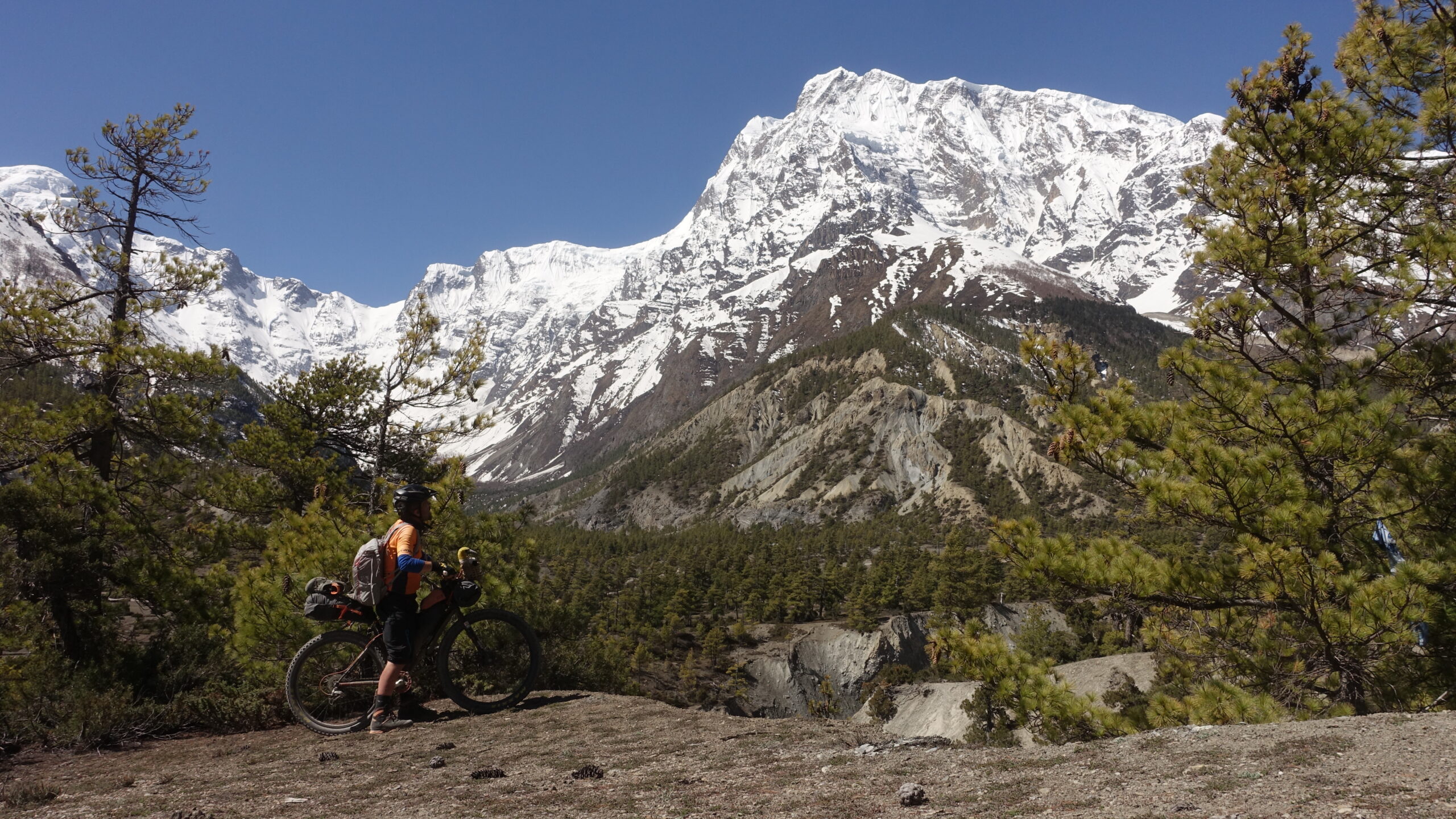
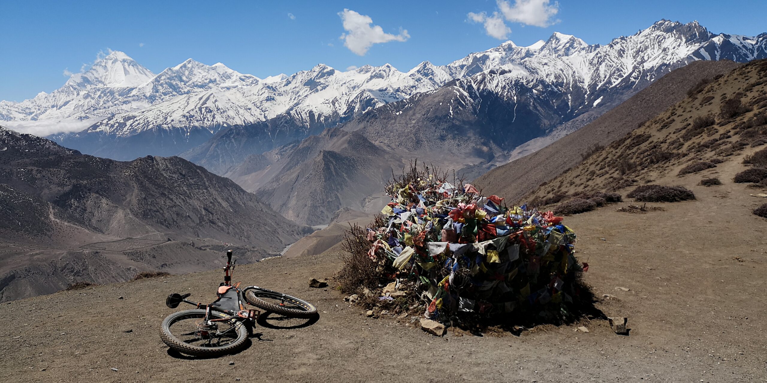
While savouring a fantastic sunrise at Gangapurna the next morning I watch a caravan of trekkers on their way to the pass. The remaining 400m of descent to Thorong Base Camp requires crampons before the path becomes rideable. It’s a fantastic day, and I enjoy a long downhill facing high snow-capped mountains and blue skies. I get cheered by trekkers on their way up. The trail is a dream to ride, almost a flow trail. Cycling down here I am glad to have tackled the route in the opposite direction and arrive in Manang, the main village in the upper valley, to enjoy a cafetiere of coffee and fresh baked goods.

Easy rider
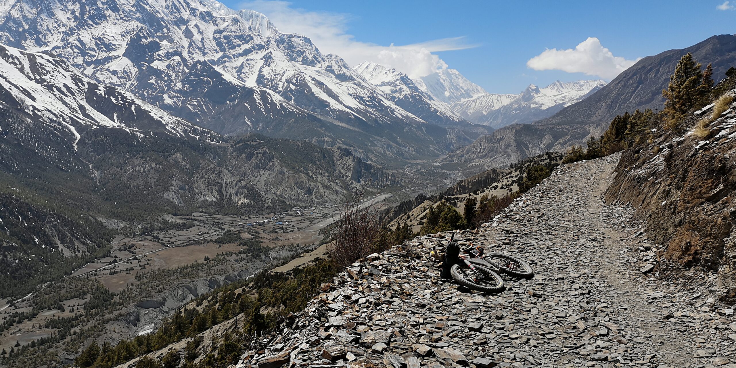
The journey further down the valley of the Marsyangdi river is a heaven for cyclists. Cycling close to high mountains, Annapurna II and III dominate the skyline. Jeep and gravel trails are easy to ride on, with the odd bit of pushing required. I take the high road via Ngawal and Ghyaru that resembles a balcony high above the valley floor. Timang, lined by rhododendron flowers in spring and tall Himalayan cedars, provides a good stop for the night in a small clearing in the woods, with splendid views towards the summit of the 8,163m high Manaslu.
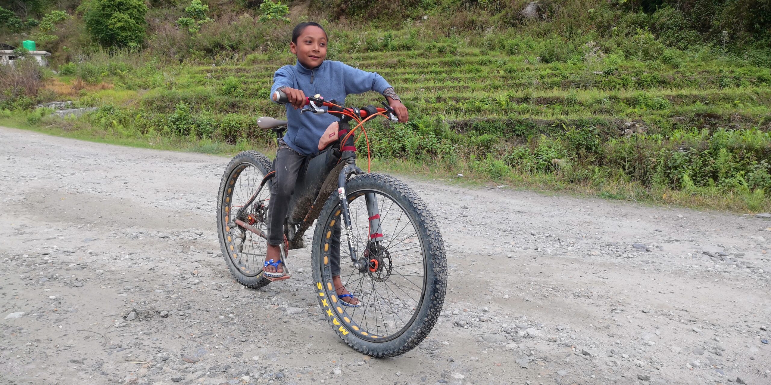
The next morning starts with a sudden drop in altitude through a dense and beautiful rhododendron forest. At Dharapani, the Manaslu Circuit joins the road and the valley becomes very narrow. I stop in the beautiful village of Tal to meet friends for lunch at a lodge. People from an Australian trekking group examine my bike and ask me where all my baggage is. Further down the road a surprise is waiting for me. As I start looking for a place to stay, I remember the little boy I met last autumn who proudly presented his new bike to me. In the lodge, I show the owner a picture of him. She tells me that the boy is her nephew and that he’s right behind the house. Moments later I meet Rohid for the second time in my life. His bicycle is still there, although the front wheel has a puncture, and the brake shoes are dislocated. Rohid is all eyes on my bike, and after unloading my bags I make him very happy by letting him ride it. While he’s riding, proud and excited, I fix his puncture and adjust the brake shoes.


Striking it lucky
I start with a heartfelt farewell to Rohid and his family the next morning and hit the road. I wonder why the traffic on the road is non-existent. Some locals tell me that there is a bandh, a countrywide strike, today. I take this as a blessing for the last day of my journey and have the road almost to myself, riding through the countryside in an area I’ve never been before. The lack of traffic makes it an enjoyable, albeit tough, ride through the foothills, a rollercoaster ride through green hills and lots of villages decorated with an abundance of flowers. I can’t believe how lucky I am. I stop by local food stalls, enjoy chatting to the locals and savour the moment.

As I begin the last climb to Manakamana, I am left with 500m of ascent in the dark. I buy some water at a local shop and ask about safety in the area. I’m told there’s nothing to fear. I look at my bike, think of what bikepacking is all about and find myself a place to sleep under the stars. Soon afterwards I lie down, savouring the views into the wide valley lit by the moon.
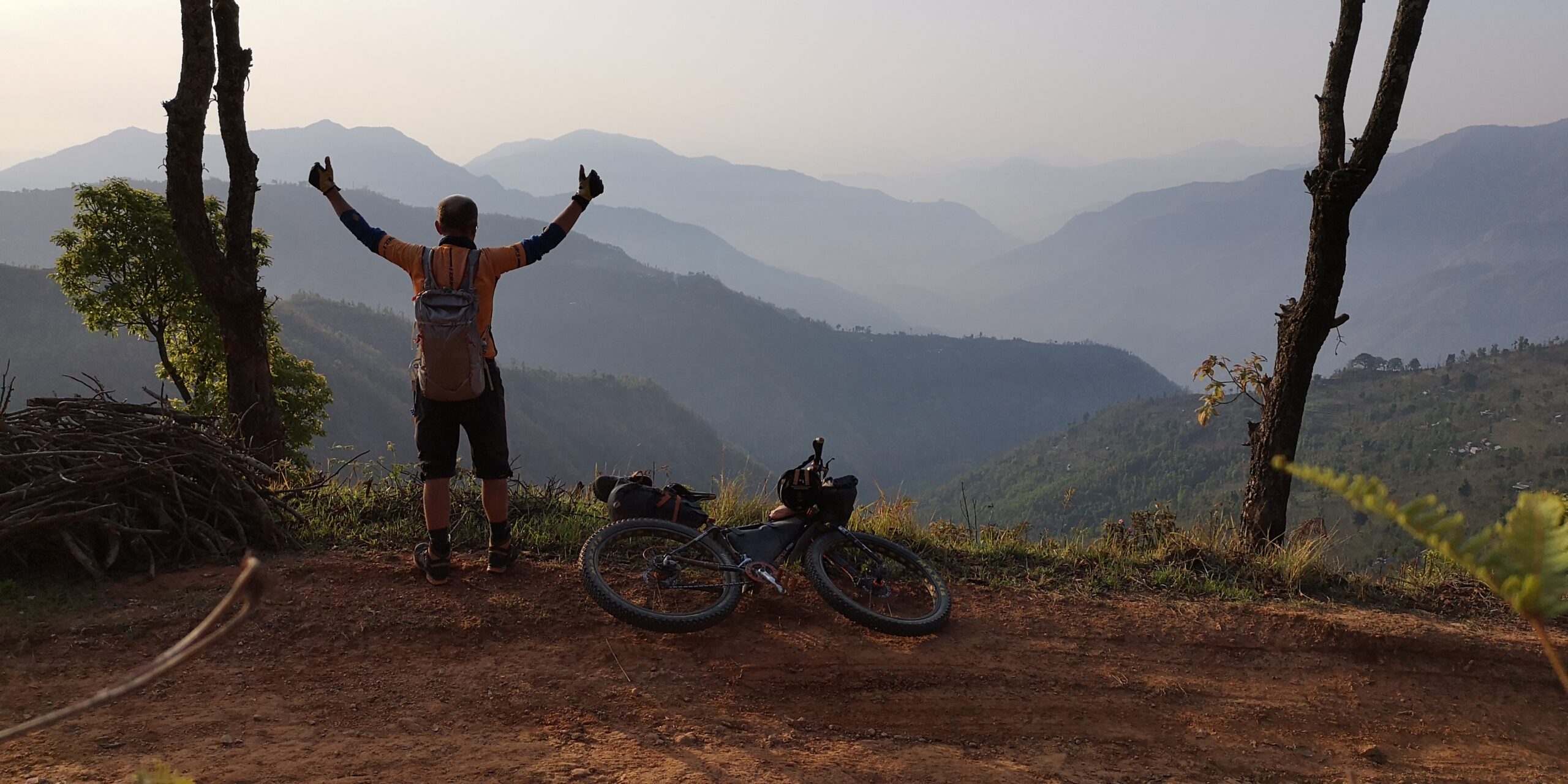
I get up at 3am the next morning, with the aim of arriving at Manakamana for the sunrise. After an initial hikeabike the track levels and I ride into the dawn. I arrive in Manakamana in time for the sunrise, drop my bicycle and watch a red sun rising over the foothills of Nepal. This is the perfect moment to end a journey on two wheels through this wonderful country. While the trip comes to an end, the memories will last for much longer.
A note for potential visitors: From April 2023 the Nepalese government has made it mandatory for international visitors to hire a licensed guide for this route and many others in Nepal. To have experienced this solo trip now feels like an even greater privilege!